
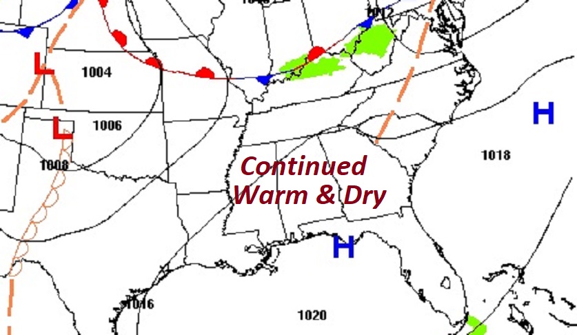
Good Morning! Our warm & dry string of November days continues. (Normal hi 73, low 46) We’ll be in the low to mid 80’s through Thursday. Lows at nights in the 50’s. Dry weather will persist, as the drought continues to expand. But, as high pressure breaks down, the risk of showers will return to the forecast as a series of disturbances drift though the area Friday through Sunday. Mostly light rainfall amounts are expected. But, it will turn quite a bit cooler over the Veteran’s Day weekend. No freezing temperatures are expected in the next 10 days. Looking deep into the month, the global models continue to hint at a more substantial storm system as Thanksgiving week begins. We’ll see. Here’s my brief forecast discussion.
TODAY: Abundant Sunshine. Warming trend continues. High near 83. West wind at 5 to 10 mph. Mainly Clear tonight. Not quite as cool. Low near 52.
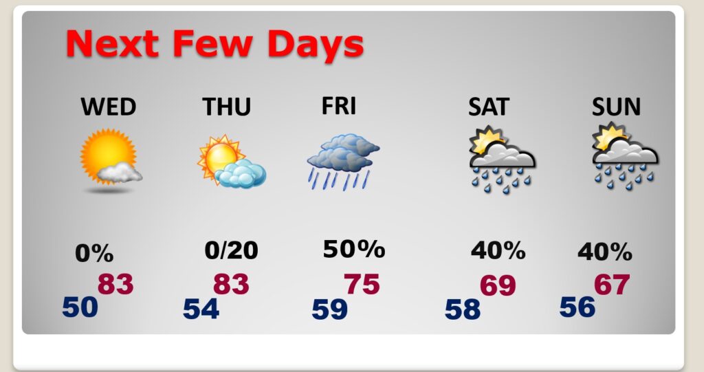
NEXT FEW DAYS: We’ll be above normal through Thursday. Highs in the low to mid 80’s. Lows in the 50’s. Risk of showers returns Friday through Sunday. It’ll be much cooler over the Veterans Day weekend. Scattered showers.
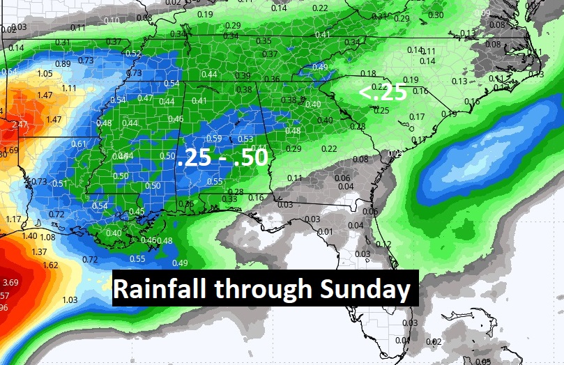
Here’s the expected rainfall through Sunday. Mostly light rainfall amounts are expected. Generally less than a 1/2 inch. In a drought, every rain drop is appreciated.
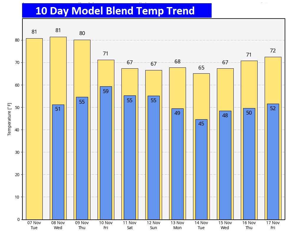
Here’s the 10 Day Model Blend temperature trend. No freezing temperatures are expected.
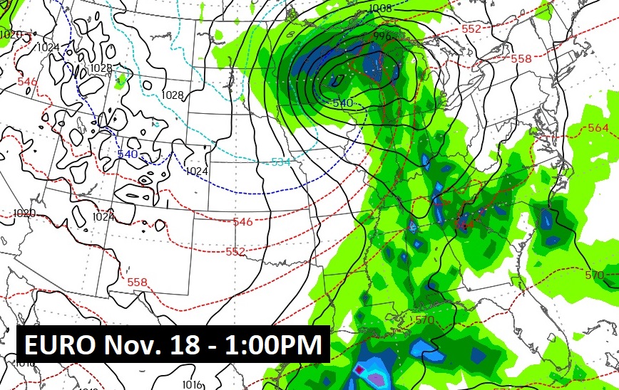
DISTANT: Both the GFS and EURO are advertising the potential for a substantial storm system as Thanksgiving Week begins. We’ve got a long time to watch this.
Thanks for reading this Blog this morning! This morning we are LIVE on the radio from 6 to 9 on NewsTalk 93.1. I’ll have another update for you in the morning. Have a nice day!