
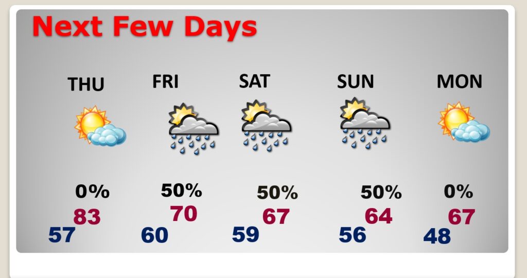
Good Morning! We’ve been stuck in a pretty nice pattern for an extended string of days. Today will be warm again. We’ll be above normal through Thursday. We desperately need raindrops. The Risk of showers returns Friday through Sunday, as a series of disturbances drift through the state. It’ll be much cooler over the Veterans Day weekend with highs only in the 60’s. Way out on the horizon – there could be another storm system in the middle of next week, and another one as Thanksgiving week begins. So, our quiet pattern will be getting much more active. Here’s my brief forecast discussion.
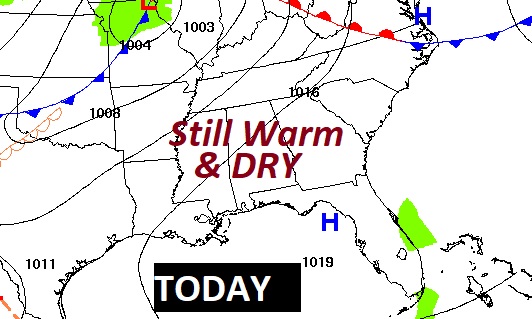
TODAY: DENSE FOG ADVISORY until 8:00 AM. Then…Mostly Sunny. Warm for November again. High near 83. South wind at 5 to 10 mph. Partly Cloudy tonight. Not quite as cool. Low near 57. (Normal hi low 73/45) (Record high 87 from one year ago today in 2022)
NEXT FEW DAYS: We’ll be above normal through Thursday. Highs in the lower 80’s. Low near 60. The Risk of showers returns Friday through Sunday. It’ll be much cooler over the Veterans Day weekend. 70’s on Friday and only 60’s over the weekend. Fingers crossed. We desperately need raindrops.
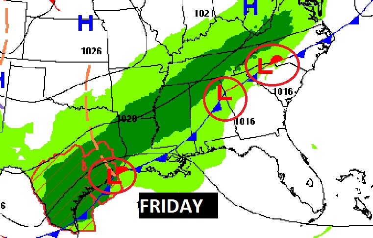
A series of disturbances, riding along a front will keep us wet at times Friday through Sunday.
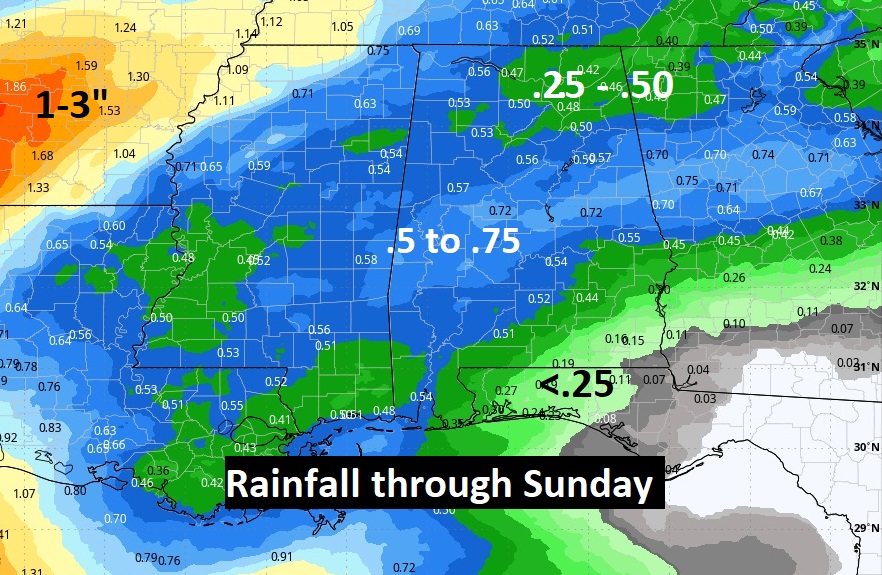
Here’s the expected rainfall through Sunday. Encouraging. Fingers crossed.
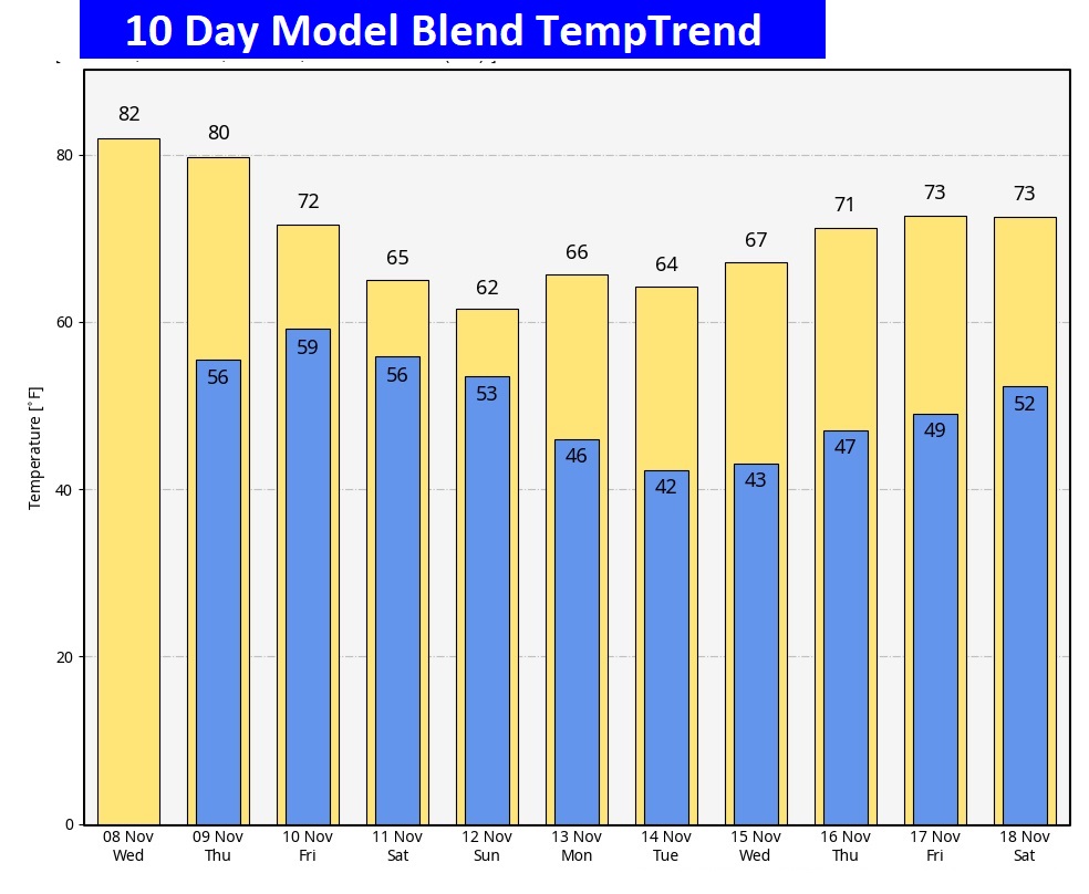
Here’s the 10 Day Model Blend temperature trend. No freezing temperatures are expected.
Thanks for reading this Blog this morning! This morning we are LIVE on the radio from 6 to 9 on NewsTalk 93.1. I’ll have another update for you in the morning. Have a nice day!
–Rich