
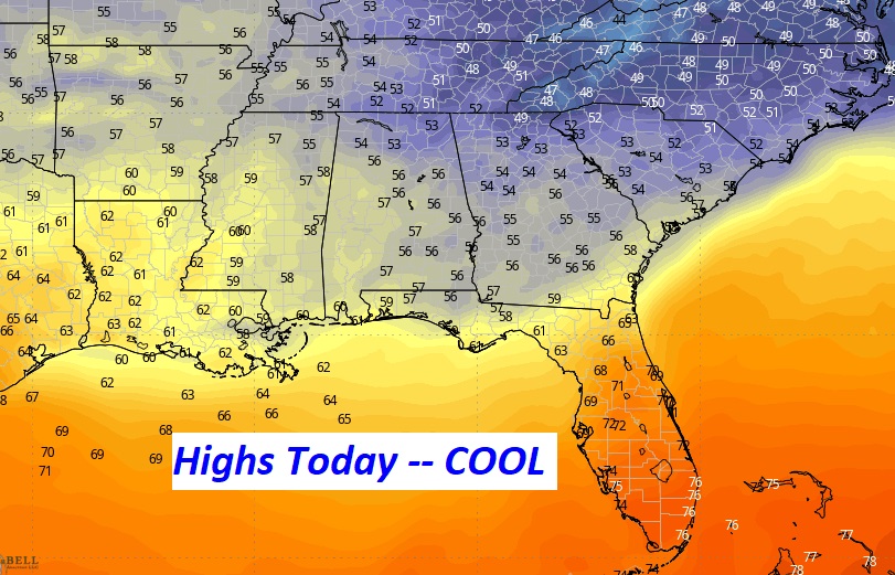
Good Morning! Our below normal temperatures will continue through the end of the week and into the weekend. We’ll be at or below freezing by Dawn this morning. The high today will not make it out of the 50’s. But, we are in a quiet and dry weather pattern through Friday. The risk of showers will return to the forecast by late Friday night and into the weekend. The better rain chance will be across the southern half of the state as a Gulf low pressure system brushes by the area Saturday & Sunday. On the current track, no severe weather is expected. Here’s my brief forecast discussion.
TODAY: Mostly sunny and cool. High 58. Northeast wind 5 to 10. Cloudy at times tonight. Chilly. Low 34.
NEXT FEW DAYS: Temperatures will stay below normal for the next few days. We’ll be dry through Friday. A Gulf storm system will brush by the area Friday night/Saturday into Sunday, which will bring a risk of showers in our forecast.
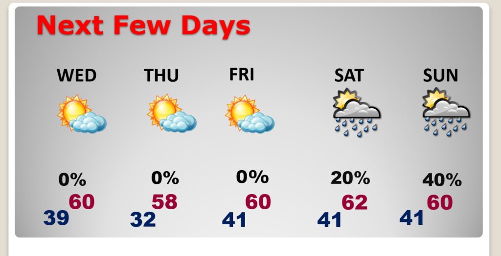
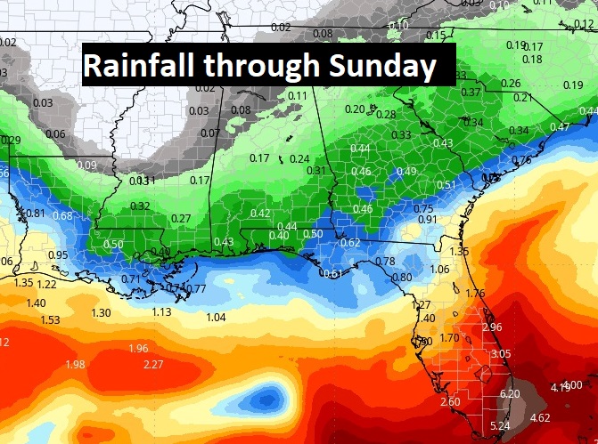
Most of the heaviest rainfall associated with that weekend Gulf Storm System will stay south.

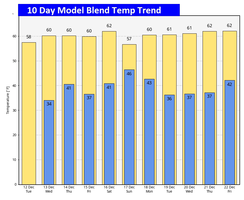
Here’s the 10 Day Model Temp Blend. Temperatures will generally be below normal this week. I don’t see any Arctic air in this forecast that takes us up to December 22nd.
Thanks for reading this Blog this morning! This morning we are LIVE on the radio from 6 to 9 on NewsTalk 93.1. I’ll have another update for you in the morning. Have a nice day!
–Rich