
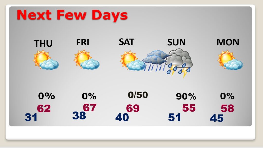
Good Morning! Welcome to February. It should be a great start to the new month, not only today, but Friday & Saturday look great. Today will be slightly milder than yesterday’s chill. In fact, lower 60’s are close to normal. We’ll be in the upper 60’s on Friday & Saturday. The dry, storm-free pattern continues through Saturday. The next chance of rain will be on arriving late Saturday night, after Midnight. Showers and thunderstorms are likely Sunday. Nothing severe. There could be a few leftover showers Monday. Here’s my brief forecast discussion.
TODAY: Sunshine today. Not as cool as yesterday. High in the lower 60’s. That’s actually normal. Southwest wind 6 to 12 mph. Mostly cloudy, chilly tonight. Low 40
NEXT FEW DAYS: Nice, warmer weather Friday and Saturday, with lots of sun, as the mercury recovers to the upper 60’s. The dry, storm-free pattern continues through Saturday. The next chance of rain will be on arriving late Saturday night, after Midnight. Showers and thunderstorms are likely Sunday. Some leftover showers are possible Monday.
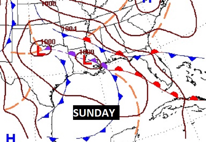
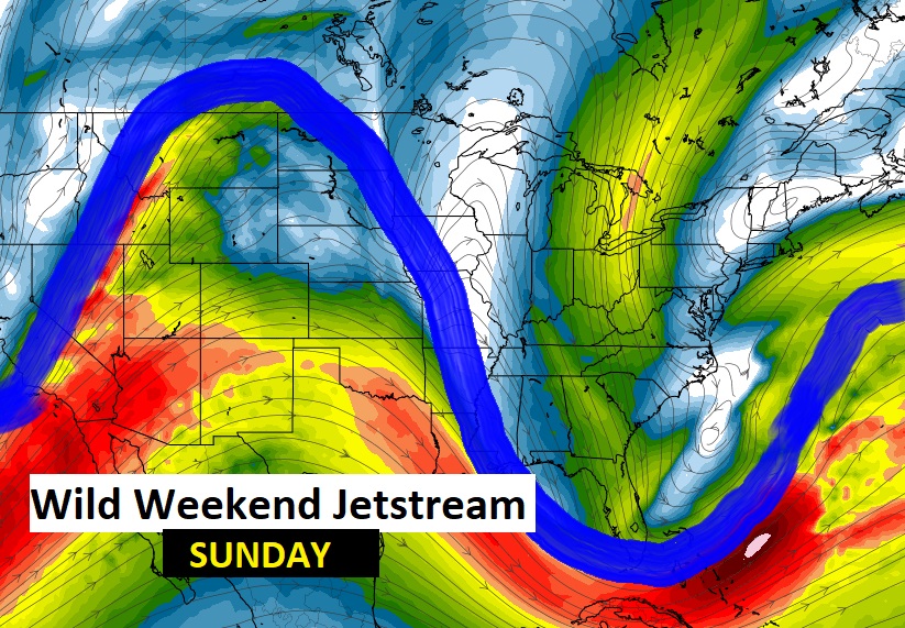
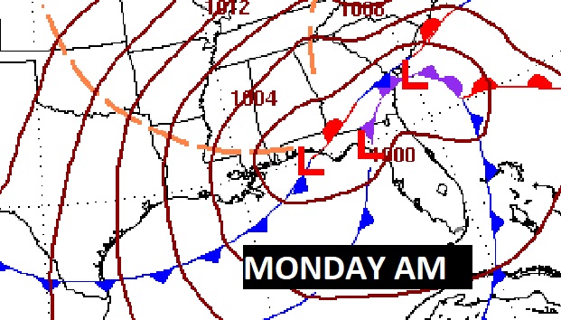
Risk of rain and storms arrive Saturday night. Sunday and Monday looks quite wet across the Gulf South. WILD mp set-up at thew surface and alonft.
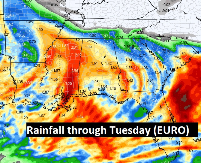
Here’s the expected rainfall through Tuesday from the EURO model. Looks like yet another southern soaker.
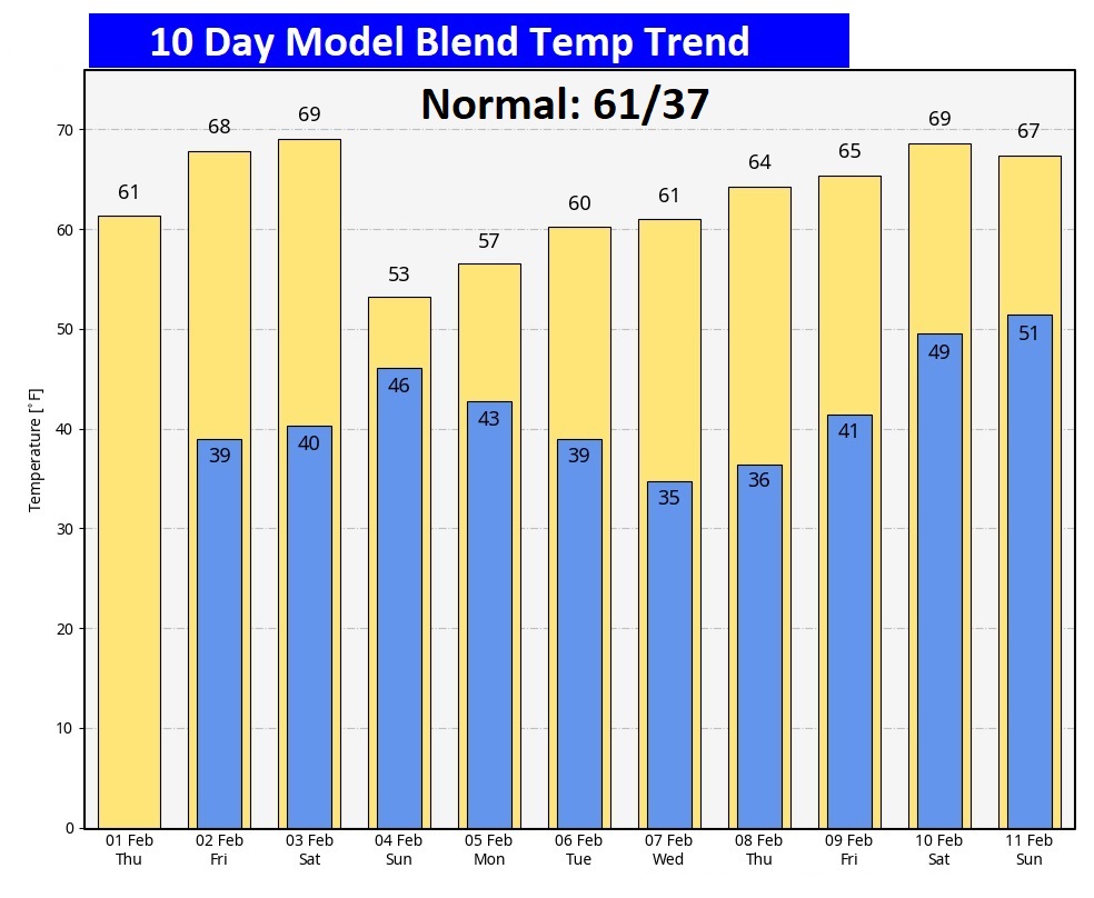
Here’s the 10 day Model Blend Temperature trend. The Arctic Flood gates are still closed for now. So far the global models don’t “see” any arctic air through February 15th. Stand by. That could change.
This morning everything is normal including Live on the radio 6 to 9AM on NewsTalk 93.1 WACV. There will be another Blog update in the morning.
–Rich