
Good Morning! Our storm-free, dry pattern continues for now. Our mini warming trend continues today and tomorrow. Upper 60’s will feel Spring-like. The next chance of rain will be on arriving late Saturday night, after Midnight. A cold rain is likely Sunday. There could be a few leftover showers are possible Monday morning. Much of next week will be dry. Here’s my brief forecast discussion.
TODAY: Sunshine today. A little warmer. High in the upper 60’s. Northwest wind 5 to 10 mph. Mostly clear, not as cool tonight. Low 42.
NEXT FEW DAYS: The nice, warmer weather continues Saturday. Normal High 62. Saturday’s high 69. The dry, storm-free pattern continues through Saturday. The next chance of rain will be on arriving late Saturday night, after Midnight. A cold rain is likely Sunday. Some leftover showers are possible Monday morning. Much of next week looks dry.

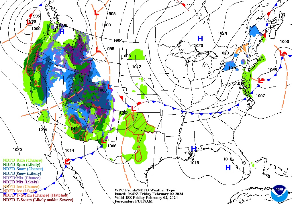
Herre’s the complex set-up for the Sunday storm system.

Here’s the expected rainfall through Tuesday from the EURO model. Looks like yet another southern soaker.

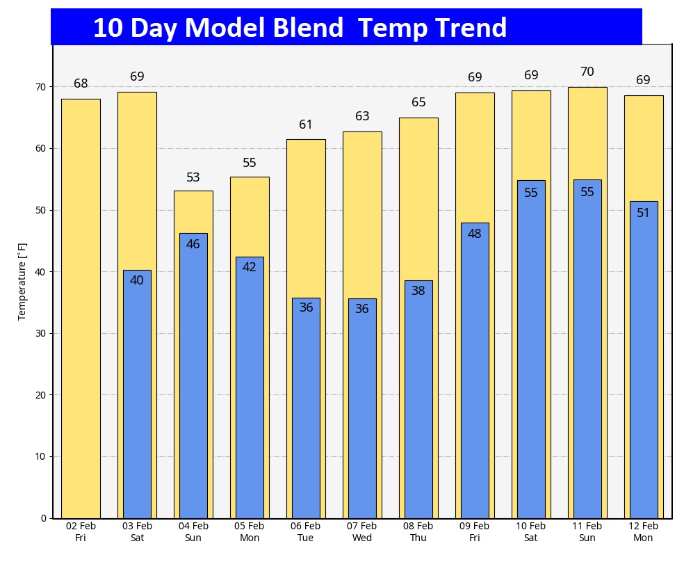
Here’s the 10 day Model Blend Temperature trend. No Arctic Air in at least the next 10 days.
This morning everything is normal including Live on the radio 6 to 9AM on NewsTalk 93.1 WACV. There will be another Blog update in the morning.
–Rich
This morning everything is normal including Live on the radio 6 to 9AM on NewsTalk 93.1 WACV. There will be another Blog update in the morning.
–Rich