
Good Morning! Our storm-free, dry pattern continues today. Today will be very Spring-like. Friday’s high was 71. Today will be near 70 again. Weather changes are on the way. This evening will be dry, but rain will arrive in the overnight hours tonight. A cold rain is likely Sunday. It will be breezy, and cold. Rainfall in many towns will be at least 1-2”. Some spots could see more. There could be a few leftover showers are possible Monday morning. Most of next week will be dry. We’ll be back in the 60’s Tuesday and beyond. More rain arrives by next Saturday.
TODAY: Sunshine today. It should be a beautiful day. High near 70. Northeast wind 5 to 10 mph. Mostly cloudy tonight. Becoming breezy. Winds could gust 25+ mph overnight. Rain arrives in the overnight hours. Low 47.
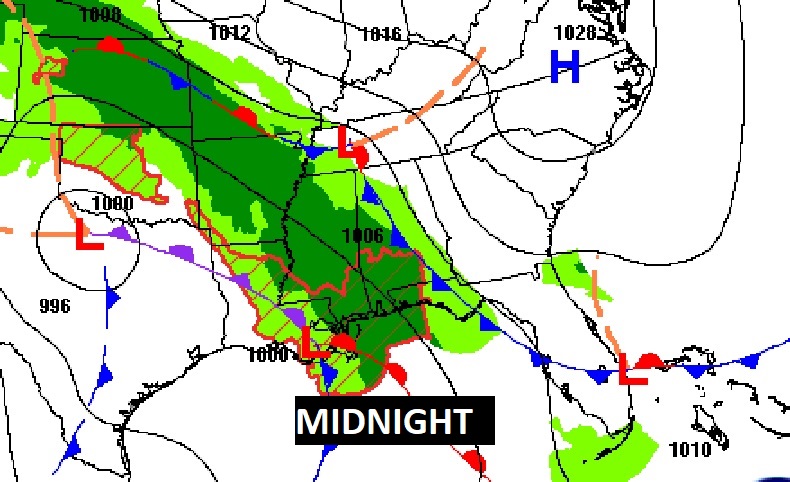
Here’s the set-up at Midnight, as the storm system approaches.
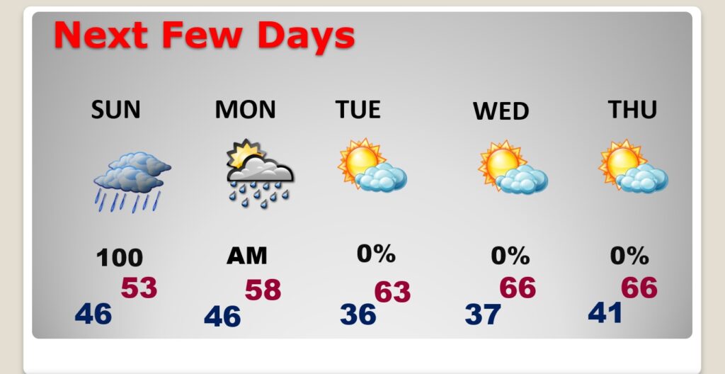
NEXT FEW DAYS: The nice, warmer weather is about to end. A cold rain is likely Sunday. It will be breezy, and cold. Rainfall in many towns will be at least 1-2”. Some spots could see more. There could be a few leftover showers are possible Monday morning. Most of next week will be dry. We’ll be back in the 60’s Tuesday and beyond. More rain arrives by next Saturday.
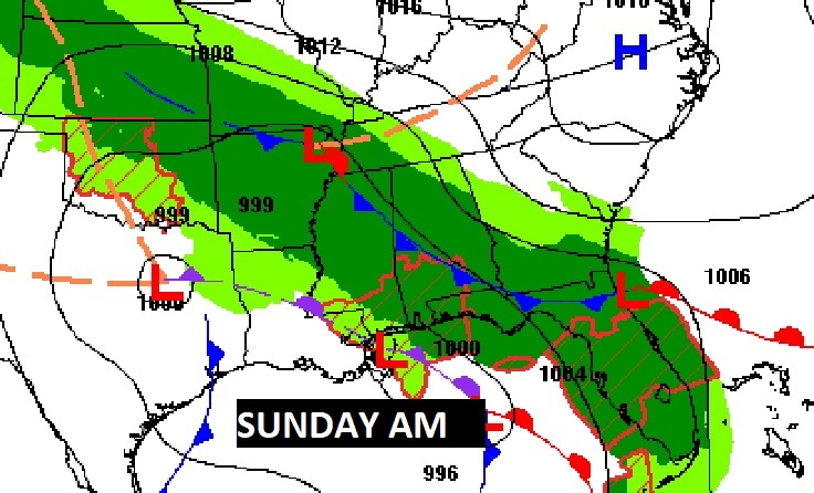
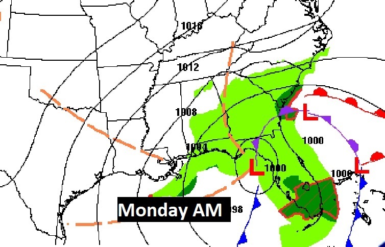
Herre’s the complex set-up for the Sunday storm system. There could be a few left over showers for Monday morning.
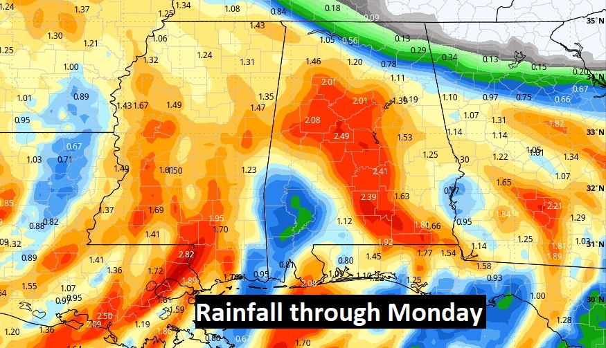
Here’s the expected rainfall through Tuesday. Some spots could be 2”+. Most places will see at least 1-2”.
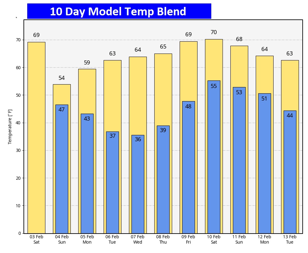
Here’s the 10 day Model Blend Temperature trend. No Arctic Air in at least the next 10 days.
Thanks for reading the blog. The next scheduled blog will be Monday morning. Have a nice weekend!
–Rich