
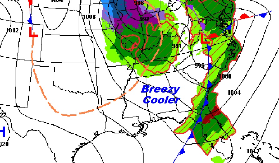
Good morning! The cold front that brought strong/severe storms, and a few tornado touchdowns last night, has ushered in some much cooler air. It will be a windy/brisk day today with clouds early and sun later. Highs will only be in the 60’s through Friday. We’ll fall to the upper 30’s by Thursday and Friday night. Several dry/storm-free days will follow through the weekend. Risk of showers, perhaps, on Monday. (Eclipse Day)
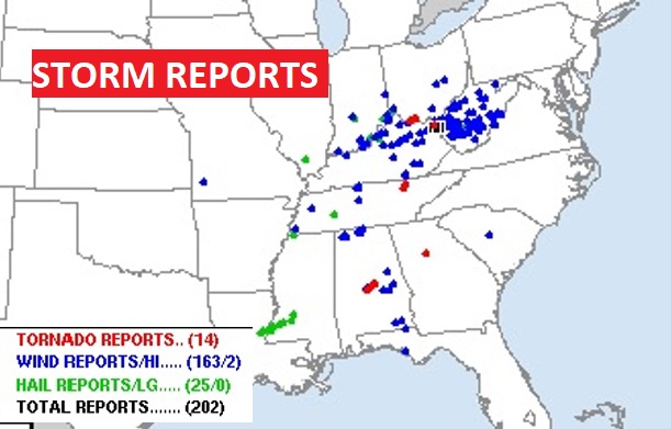
OVERNIGHT TORNADO TOUCHDOWNS: There was a Supercell thunderstorm that produced multiple tornado touchdowns from about 10:30 PM to 12:45 AM, roughly. It tracked from Perry to extreme northern Dallas into Autauga to Chilton to Coosa. It touched down several times causing damage and there were multiple tornadoes. This is interesting. NWS says: Since it looks like we’ve had our first tornadoes of the year, for our 39 counties (BMX CWA), this is the longest into the year (April 2) we’ve gone without a tornado in our area since 2004 (May 31), 2002 (April 30), and 1998 (April 8). This is going back through 1988. All other years since 1988 have featured at least one tornado in our CWA by the end of March.
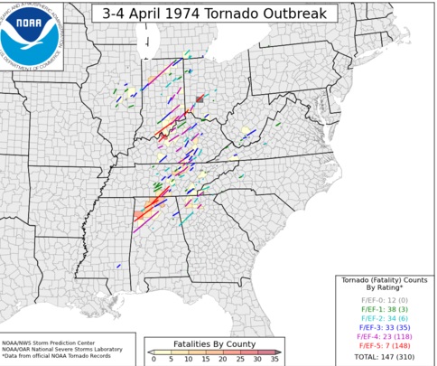
50th Anniversary of one of the biggest tornado Super Tornado Outbreaks in US History, including 7 F-5s and 23 F4’s! Xenia, Ohio. Brandenburg, KY. Guinn, AL. 148 tornadoes. 330 deaths. Stunning. Only April 27, 2011 compares.
TODAY: Brisk. Clouds early…then mostly sunny, windy and much cooler. High 68. Wind: North 12 to 22 gusting to 30 mph. Clear and colder tonight. Low 43.
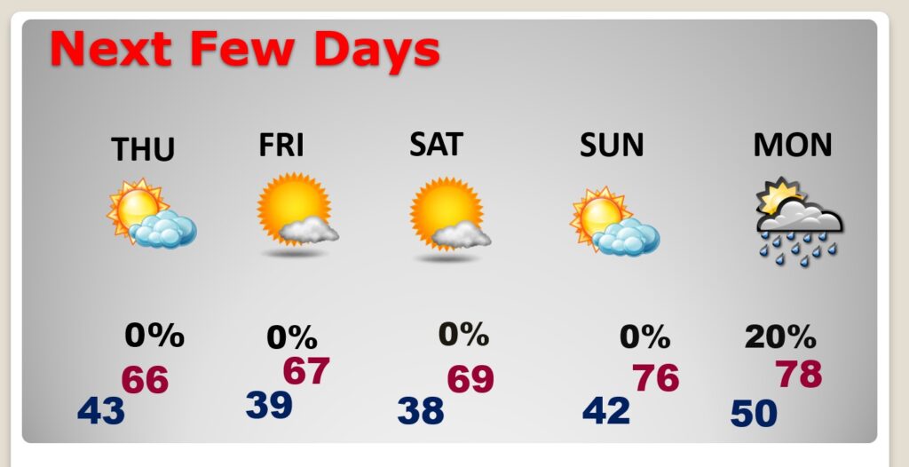
NEXT FEW DAYS: Expect a period of cool days and cold nights. Highs will only be in the 60’s Wednesday through Friday. We’ll fall to the upper 30’s by Thursday and Friday night. We’ll be back to near 70 Saturday and mid 70’s Sunday. Risk of widely scattered showers will return Monday.
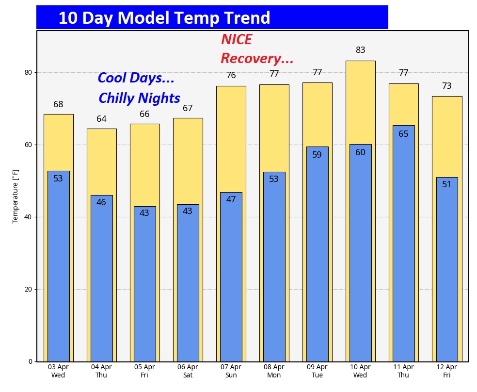
Here’s the 10 day temperature trend. Expect a series of cool days and cold nights through Friday night. A warm-up begins this weekend.
Who will see the #SolarEclipse2024 and who won’t? Due to clouds, looks viewing will be less than ideal especially across the South and mid-section. Better in the Northeast. Fingers crossed.
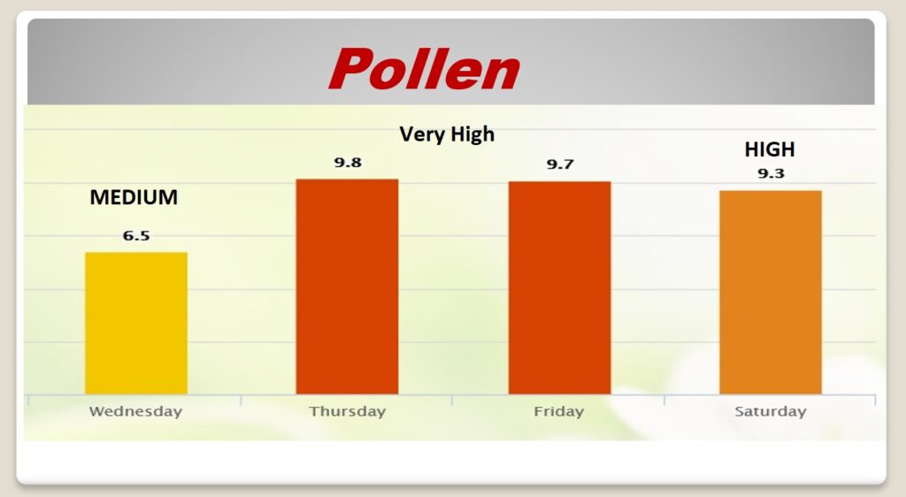
POLLEN: Hang on… A few more weeks of this, then it will ease.
Thanks for reading the Blog this morning. I’m still on the road this week at the National Tropical Weather Conference, South Padre Island, Texas. There will be a very abbreviated blogs each morning, and perhaps just a little later than normal.
We may be in for quite an active hurricane season this year. The first seasonal forecast comes out Thursday from Colorado State university. Have a nice day!
–Rich