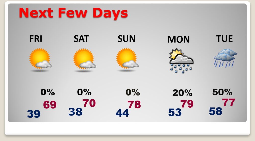
Good morning! We’ve got a nice string of days storm-free, sunny, dry days. Today will be quite cool for this late in the season. We’ll struggle to reach the upper 60’s with gusty NW winds 20+ mph. Tonight will be chilly. Upper 30’s by dawn Friday morning. (Normal: 76/50) Sunshine will dominate each day through Sunday. By Saturday we’ll be near 70. The warming continues on Sunday and Monday with upper 70’s expected. Risk of widely scattered showers arrives on Eclipse Monday, unfortunately. I’m not very optimistic about eclipse viewing locally. On the other hand, it will be nearly ideal weather for the Maxwell Air show this weekend. The probability of showers and thunderstorms increases Tuesday and Wednesday.
TODAY: Cool sunshine will dominate. Still well below normal for April. Breezy. West wind gusting to 20+ mph. Clear and cold tonight. Low 38 by Dawn . (Normal: 50). RED FLAG WARNING today highlights the wild fire danger due to gusty winds and low humidity.
.
NEXT FEW DAYS: Sunshine will dominate each day through Sunday. By Saturday we’ll be near 70. The warming continues on Sunday and Monday with upper 70’s expected. Risk of widely scattered showers begins on Eclipse Monday. I’m not very optimistic about eclipse viewing locally. The probability of showers and thunderstorms increases Tuesday and Wednesday.
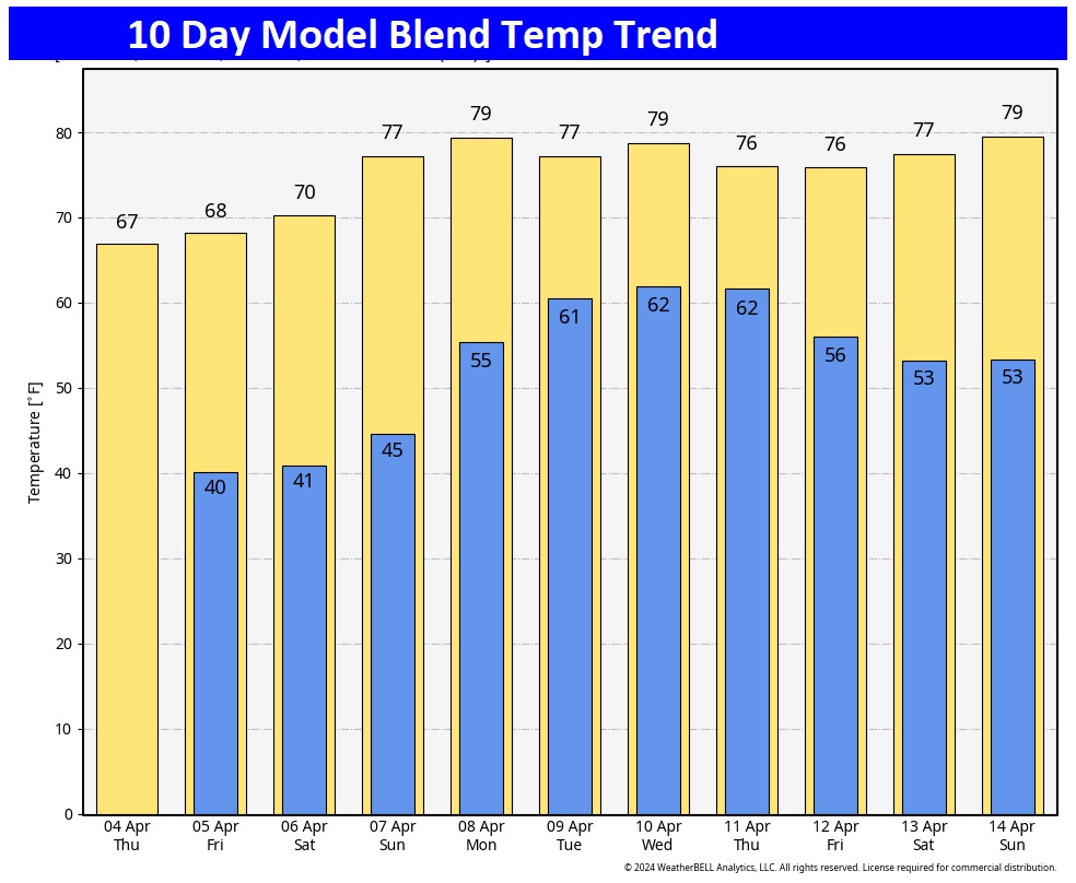
Here’s the 10 day temperature trend. . A nice warm-up begins this weekend.
Who will see the #SolarEclipse2024 and who won’t? Due to clouds, looks viewing will be less than ideal especially across the South and mid-section. Better in the Northeast. Fingers crossed
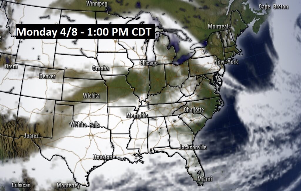
In Montgomery the eclipse begins at 12:40 and ends at 3:17 PM. It reaches peak coverage of 86% at 1:59 PM. More details on the weekend Blog Saturday.
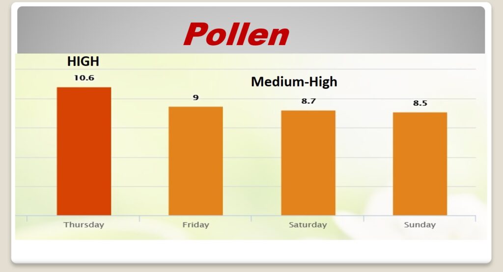
POLLEN: Slight improvement over the weekend, but not much.
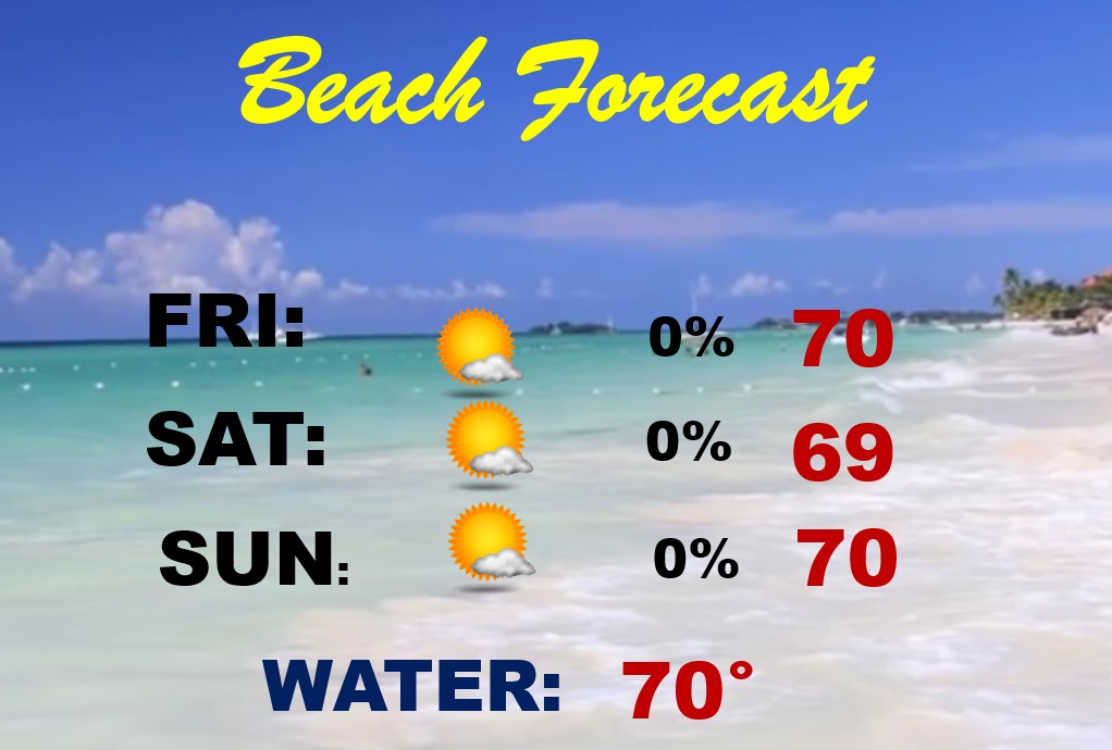
BEACH FORECAST: Temperatures will be below normal, otherwise, it’s a really nice Beach Forecast this weekend. Gulf water is still quite cool. HIGH Rip current risk today. Moderate Saturday and Sunday.
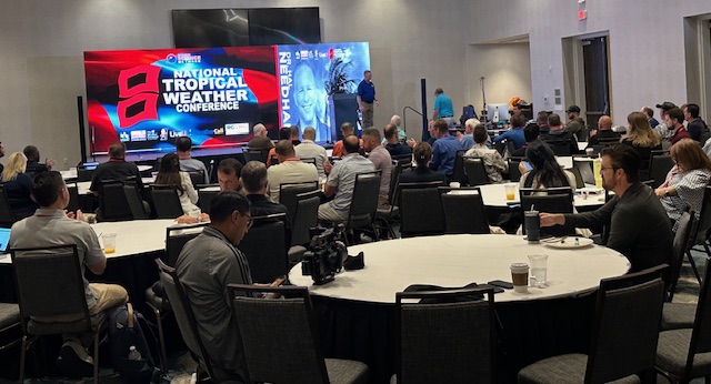
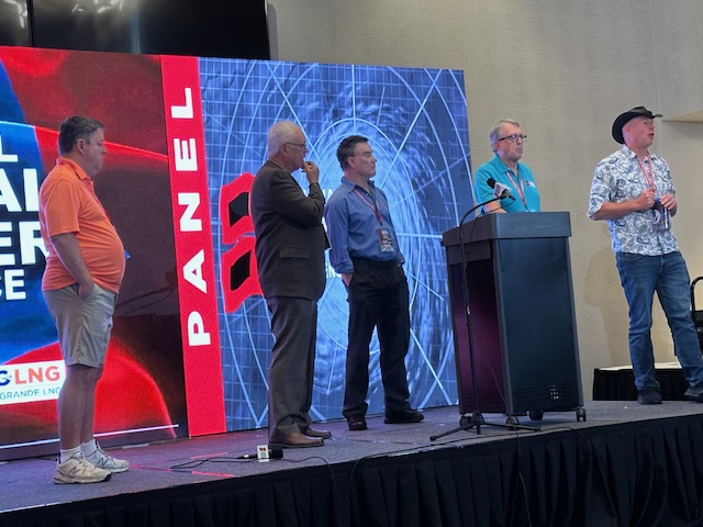
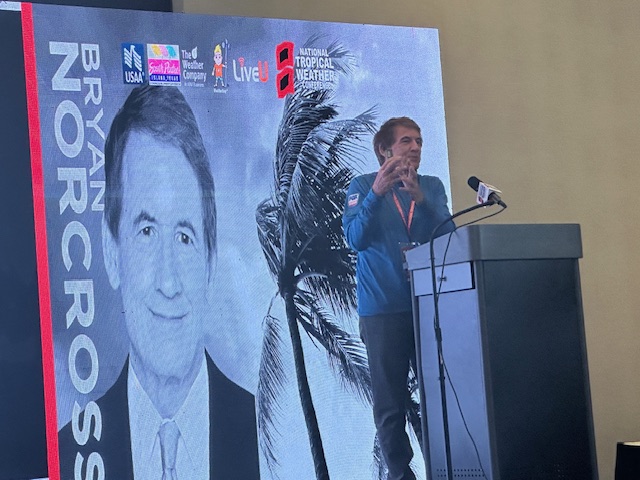
Thanks for reading the Blog this morning. I’m on the road this week at the National Tropical Weather Conference, South Padre Island, Texas. Listening and learning….
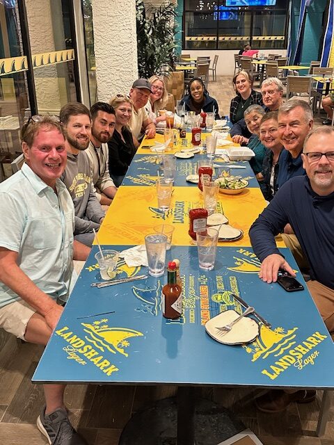
Our Conference dinner outing last night at the Landshark Bar/Restaurant, part of the brand new Margaritaville Resort.
The first seasonal forecast comes out This morning from the experts at Colorado State university. Have a nice day!
–Rich
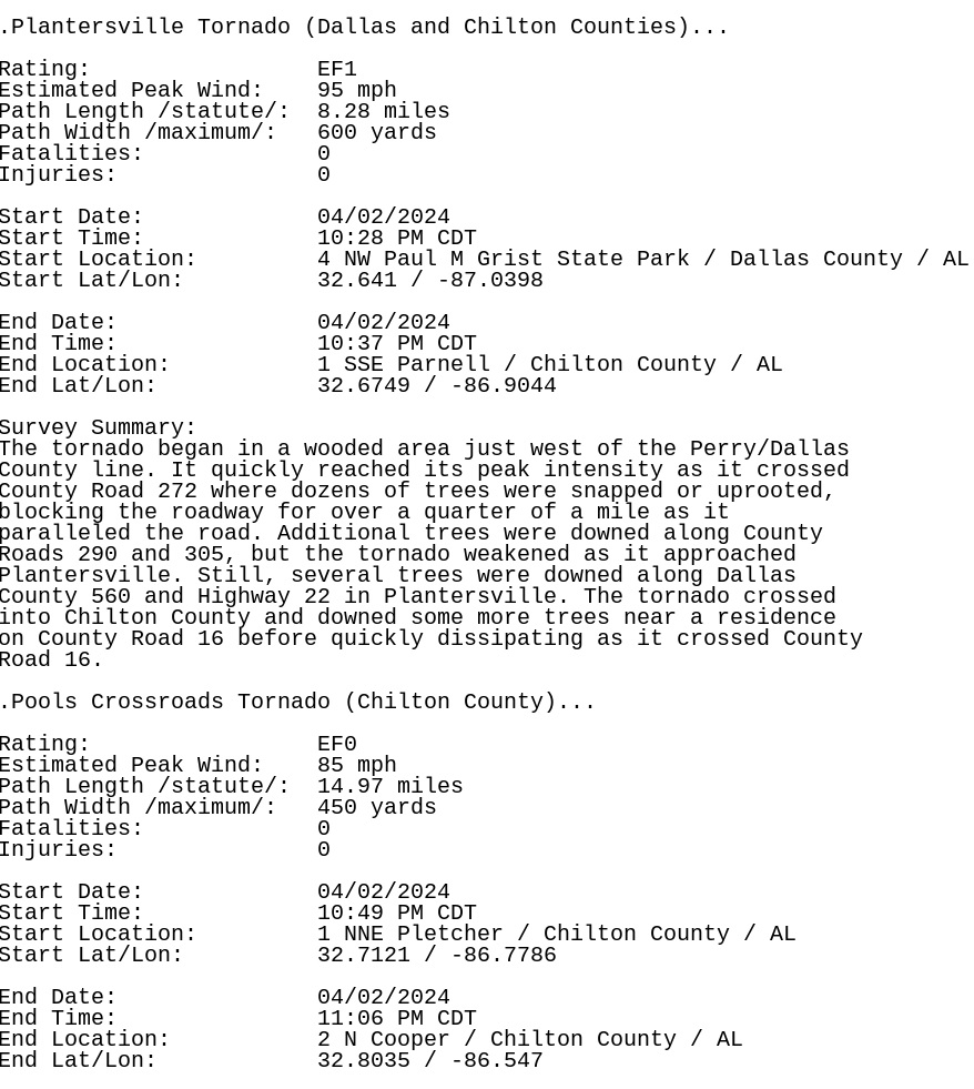
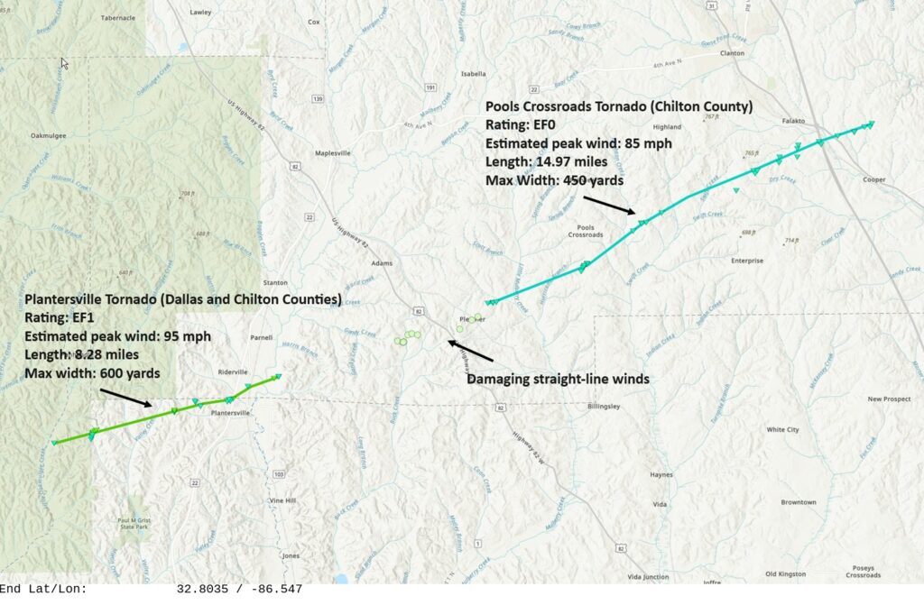
TWO tornadoes Monday night. An EF-1 and EF-0: