
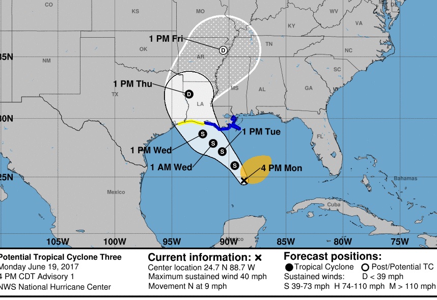
It’s not a Tropical Storm yet, but it’s called Potential Tropical Cyclone 3 (a new designation this year).
Here’s some excerpts from the Hurricane Center:
A Tropical Storm Warning is in effect for…
* Intracoastal City to the Mouth of the Pearl River
A Tropical Storm Watch is in effect for…
* West of Intracoastal City to High Island
At 400 PM CDT, the disturbance was centered near latitude
24.7 North, longitude 88.7 West. The system is moving toward the
north near 9 mph (15 km/h). A turn toward the north-northwest is
expected tonight, followed by a slower motion toward the northwest
on Tuesday and Tuesday night. On the forecast track, the
disturbance will move toward the Louisiana coast on Tuesday and
Wednesday.
Maximum sustained winds are near 40 mph (65 km/h) with higher gusts.
Some slight strengthening is possible before the system reaches
the coast.
Upper-level winds are expected to be marginally conducive for some
additional development of this system during the next day or two,
and a tropical or subtropical cyclone is likely to form during that
time.
* Formation chance through 48 hours…high…80 percent
* Formation chance through 5 days…high…80 percent
RAINFALL POTENTIAL: It doesn’t matter exactly where this system comes ashore. It is a lopsided system, with most of the heavy rains on the west and northwest side. The models are advertising possibly prolific future rainfall totals through the end of the week. The GFS shows 4-6″ amounts in central Alabama, and maybe a foot or more on the coast.
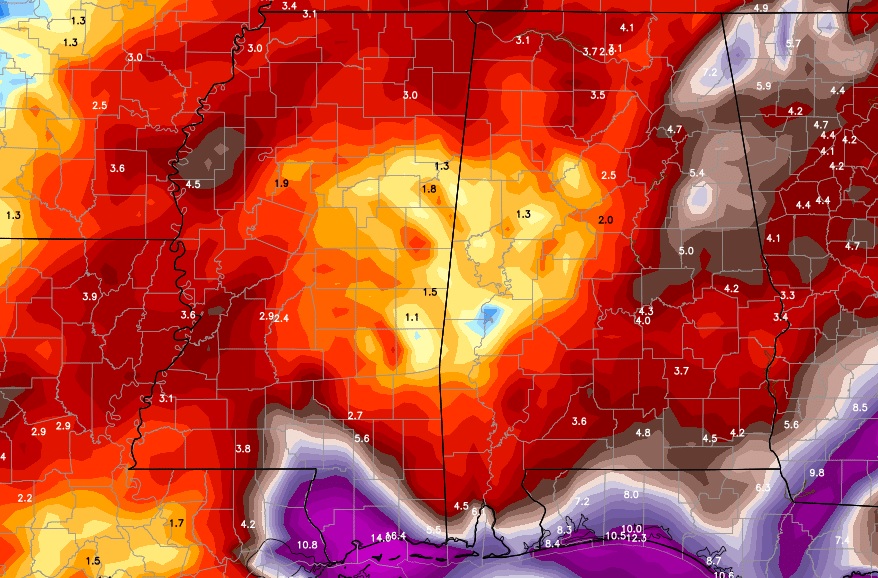
The Euro suggests maybe as much at 6 – 8″ inches in parts of central Alabama and maybe more than a foot in spots near the coast. 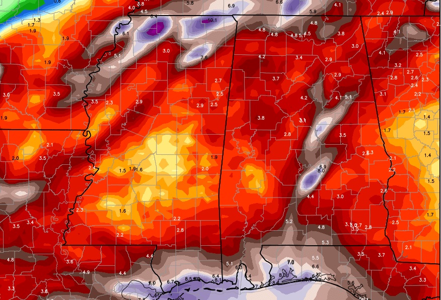
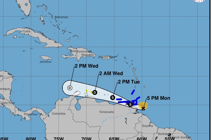
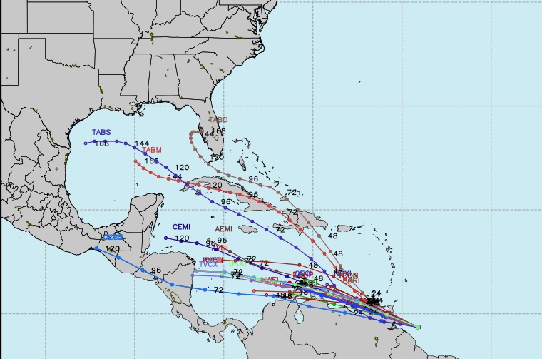
Elsewhere in the tropics, the system in the tropical Atlantic has been promoted to Tropical Storm Bret. It could have future implications for the United States in a few days.
Stay tuned! I’ll have a lot more on this system and its potential impact on us on your next video which will be online by tomorrow morning at 4:45.