
Good Morning! We have settled into a more typical summer pattern. That’s good news as we get ready to celebrate the 4th of July. Random storms will still be roaming around, but the coverage won’t be a dense as recently, following weekend flooding in spots. On this video, we’ll check the numbers on the rain chance and hotter temps. I’ll have future radar, the beach forecast and new tropical developments, too. Here’s your Monday special holiday edition video.
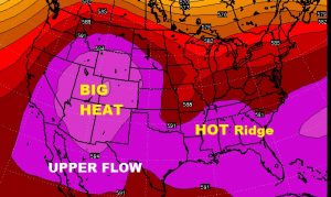
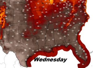
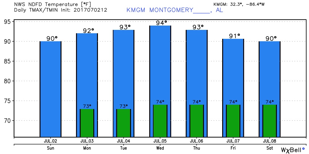
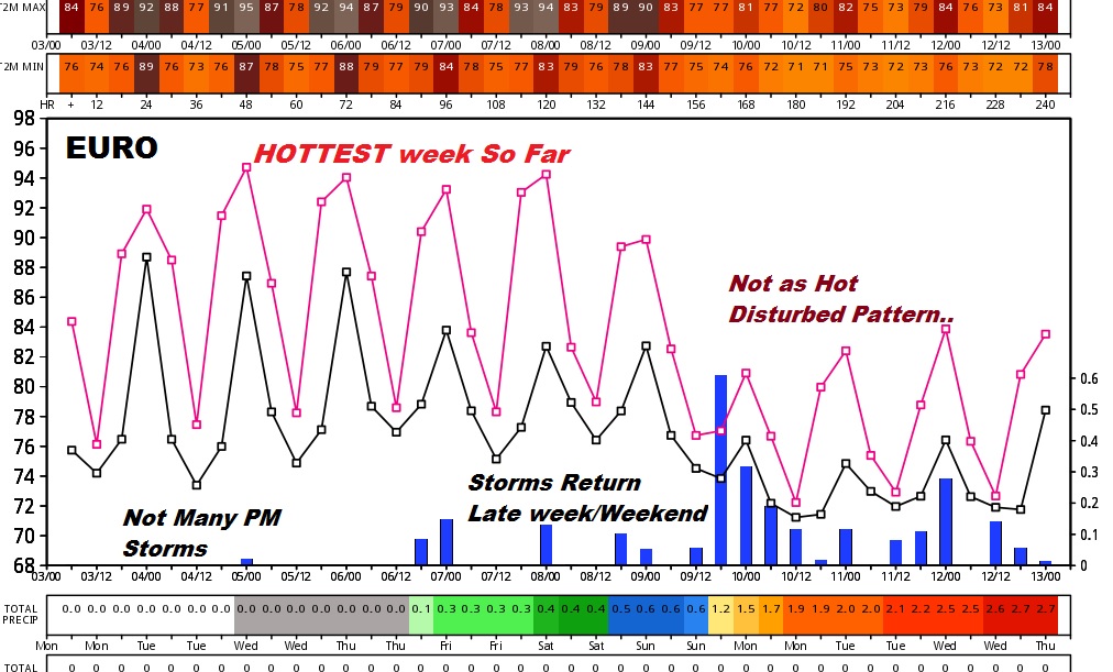
Something we haven’t seen all summer YET, a building ride of high pressure in the upper atmosphere will be responsible for hotter temps. this week. Hottest day could be Wednesday. Mid 90’s.
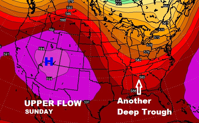
BUT, by the weekend, we may fall backwards into another dreaded trough of low pressure, which means more “disturbed” wet/stormy pattern…..again. Here’s a peak at the Euro model.
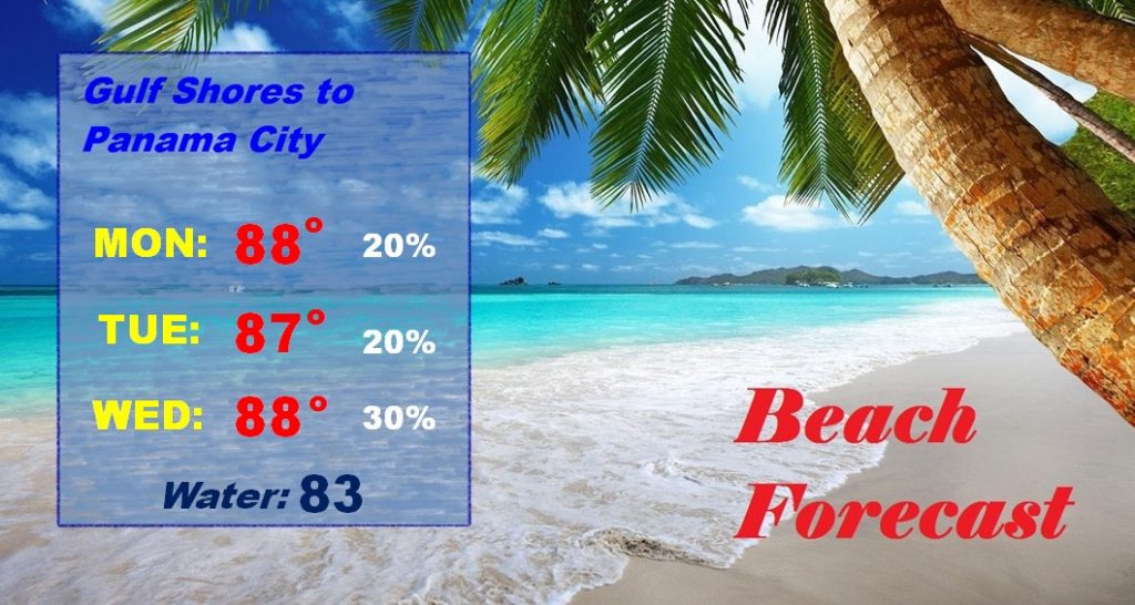
Better beach forecast through mid week. Then, stormier again Friday through Sunday and beyond.
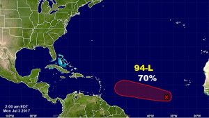
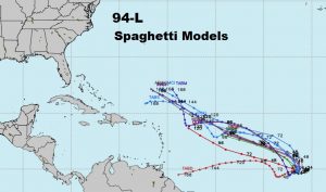
In the Tropical Atlantic, NHC is monitoring Invest 94-L, which would eventually get the name Don.
Hope the rest of your extended 4th of July weekend is a good one! No video tomorrow, but there will be a Blog Post. Next video Wednesday morning, online by about 4:45AM.
-Rich