Good Morning! Dangerous Heat Indices are back.. I have updated the rain chances right on through the weekend. Storms will be around, but not plentiful. I have updated the projected cloud forecast for Monday’s eclipse. I have the latest from the busy tropics, where we may see a new Depression or Tropical storm perhaps by tomorrow. I lot of good information for you on your Thursday morning personal weather briefing.
TODAY: High in the mid 90’s Heat index 103-105. Partly sunny. Scattered PM Storms.
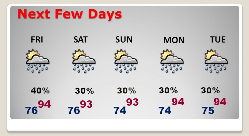
Next few days…
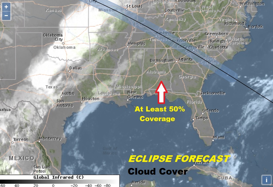
Monday looks like a pretty typical summer day as far as clouds. Those puffy white cumulus clouds will be hide the sun from time to time. At least 50% Coverage. The eclipse begins at 12:02 PM and ends around 3PM. Peak of 90% coverage of the sun at about 1:34PM
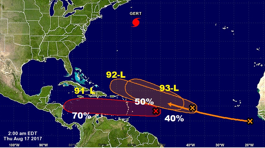
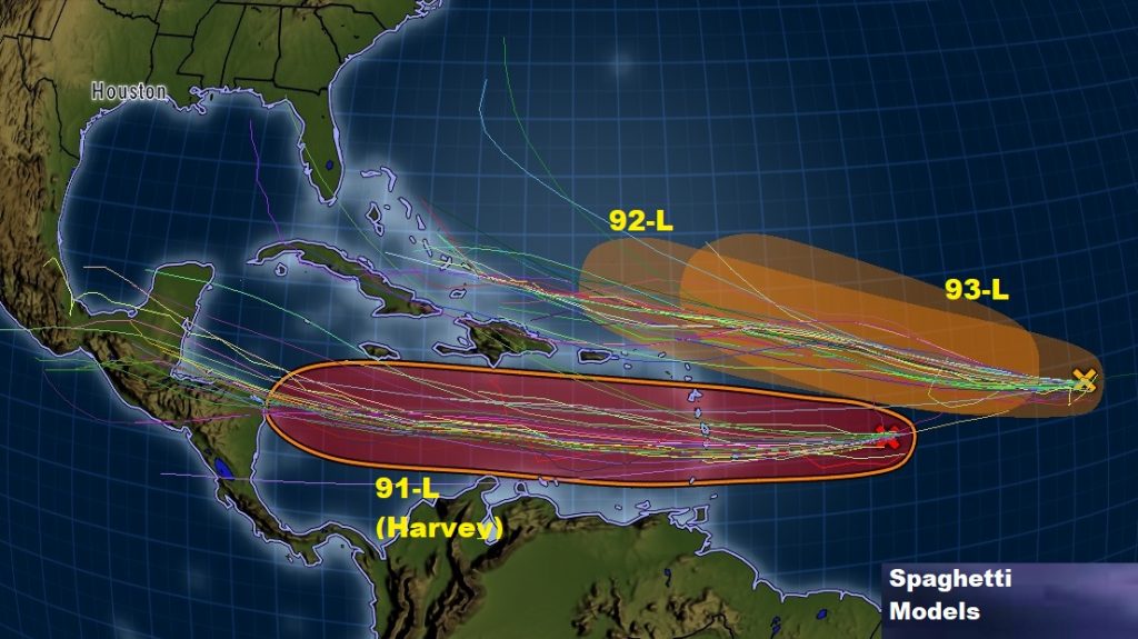
Very busy in the Tropics besides Cat 2 Hurricane Gert. Three Invests are being tracked by NHC. The lead disturbance, 91-L, could become a Depression or Tropical Storm by Friday. 92-L could have future possible implications for the US and/or Gulf.