
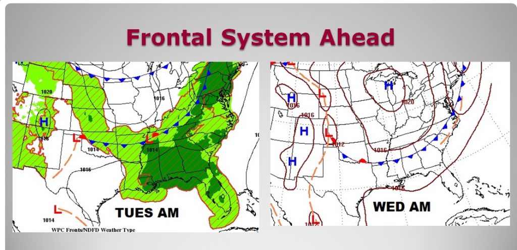
We are stuck in a pattern which features, excessive heat & humidity, which leads to a wealth of random storms in the afternoon & evening. No big changes are expected today & Monday. However, a frontal system will approach the state Tuesday, causing rain chances to increase. That front will try to move southward in the state Wednesday before stalling. So, we’re expecting little or no relief in our part of the state front this front.
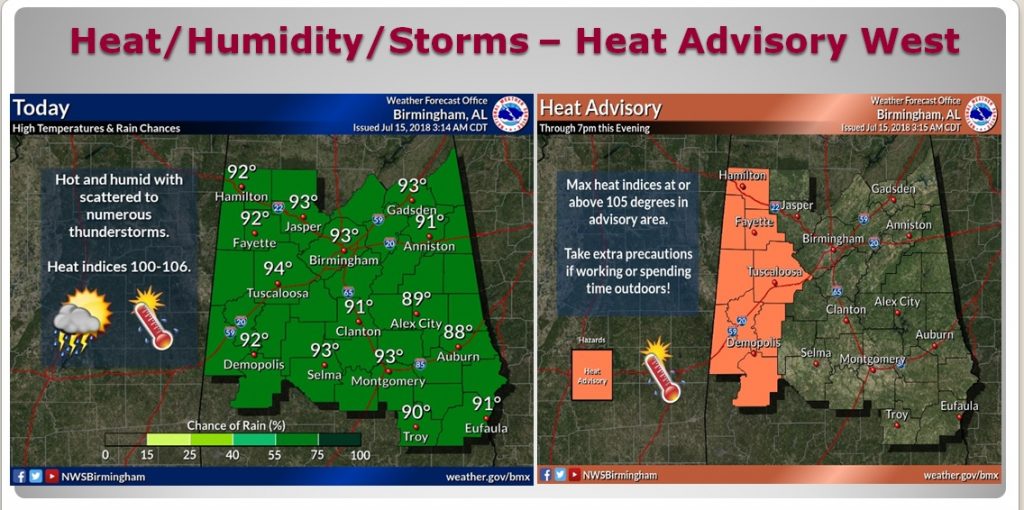
TODAY: You know the drill. Partial sunshine. Very humid. High around 93 (we had 94 yesterday). Heat index 101-106. Storms will fire-up in the daytime heat and become most numerous from mid afternoon into early evening, before fading out tonight. Low tonight 75. Have you heard this before?
By the way the western strip of counties are under a Heat Advisory again, where the heat index is likely to be 105 or higher.
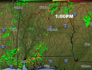
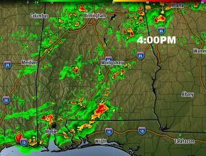
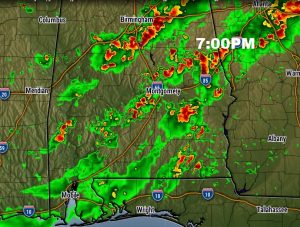
FUTURE RADAR: Here’s the hi-res NAM model. It shows storms getting a good start after lunch. But, this model shows quite a peak in storm-coverage in the 4 to 7PM hours today. That’s just what this model shows. We’ll see if it plays out that way..
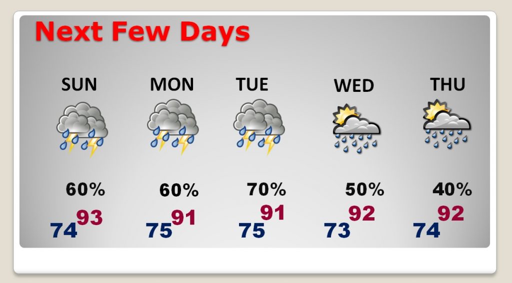
NEXT FEW DAYS: Better than normal rain chances continue. The storms reach a peak on Tuesday & Tuesday night with that front approaching. Storms may thin out a little bit by late week.
Here’s a peek at the frontal system’s approach and movement through Wednesday. It will probably stall in the central counties Wednesday/Thursday.
TRACKING THE TROPICS: If you care, Sub-tropical Storm Beryl continues to crawl northeast in the Atlantic, well off the US coastline. Meanwhile, the rest of the tropics are quiet and boring, for now.

—
Have a great Sunday! I’ll have a complete video will be Monday morning by 4:45AM.
Rich