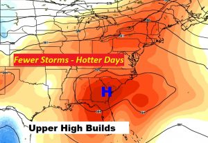
Today’s Blog Update is relatively short and sweet. We are easing into a quieter, more routine early August pattern, at least for a few days. An upper level high pressure ridge is building over the Southeast. That spells fewer storms and hotter days, at least for the next 4 days or so, until the pattern changes again.

TODAY: We are back to the lower 90’s today, which is normal for August. Random, “hit or miss” storms will be few and far between. Most towns will stay dry. Low tonight around 74.
FUTURE RADAR: I selected this hi-res model to show you, through 7PM tonight. It shows very widely storms dotting the radar screen. There won’t be many to go around. Good luck! Maybe your town will get lucky. Although some towns got too much rain this week. Some folks are looking for a break.
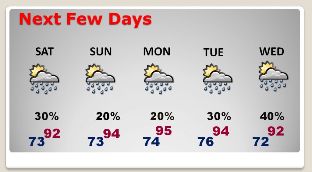
NEXT FEW DAYS: This hotter pattern, with only widely scattered storms should be with us through at least Tuesday. Starting in the mid to late week, showers and storms will start to increase in number again by mid to late week.

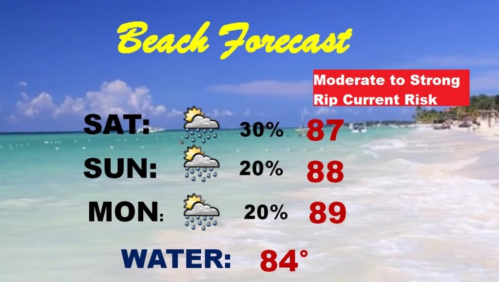
BEACH FORECAST: After a truly awful week of beach weather, things are finally getting better, and just in time. A lot of families are making their last Beach visit before school begins. Be careful. A moderate to rip current risk is expected through the weekend. Monitor the flags at each beach.

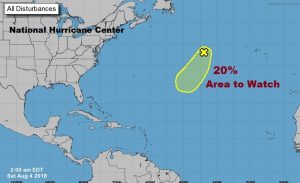
THE TROPICS: Still very quiet. NHC is highlighting one non-tropical system, way out in the central Atlantic, which has a 20% chance of acquiring tropical characteristics. Otherwise, nothing for the next 5+ days. Three factors are contributing to this quiet pattern… 1) too much dust from the Sahara 2) too much wind shear 3) well below normal sea surface temperatures through much of the Atlantgic basin. This is far different from the set-up last year.

—
Have a nice weekend! I’m planning another Blog update first thing Sunday morning. Stay hydrated. Enjoy!
Rich
