Good Morning! As the effects from Gordon fade away, we are easing back to a more typical summertime pattern. I’ll show you the trend to “fewer” storms for a couple of days days at least, until an approaching front escalates the rain chances by early next week. And, don’t look now…but things are really starting to get interesting in the tropics, with possible serious implications for the US.
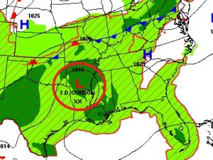
As the remnants of Gordon cross over the Mississippi river today into Arkansas, the affects from Gordon will fade away in Alabama as we start to edge back to a more routine summer forecast.

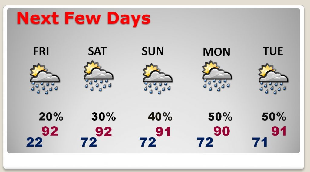
Storms will be few and far between on Friday and Saturday. Then the rain chances will start to rise again, especially by late Sunday through Tuesday as a frontal system approaches the state.
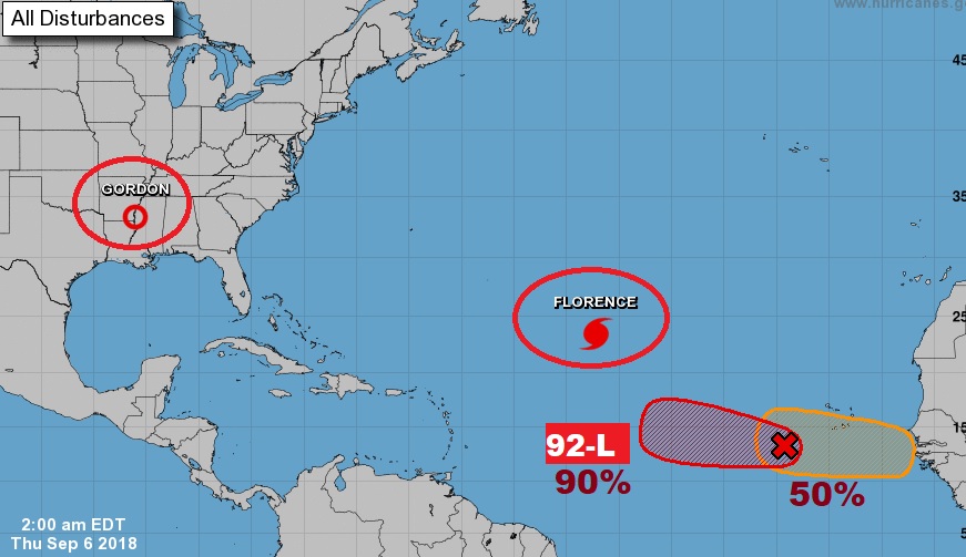
Busy in the tropics now. Florence is a major hurricane in the central Atlantic with possible US implications next week. Behind it 92-L is likely to be the future Helene. And, there’s another system forecast to develop off Africa, too.
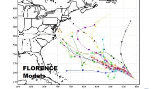
Now, too many of the spaghetti models track Florence closer to the US next week. Not many models show it curving into the Atlantic.
While the American GFS keeps Florence barely off shore in the middle of next week, it is too close for comfort. Look at that pressure! 928 Mbs.
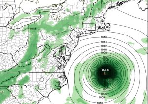
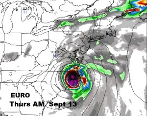
The very reliable Euro model (ECMWF) paints a particularly ugly scenario for the Carolinas next week. This is Thursday morning 7AM. A potential disastrous situation.
