
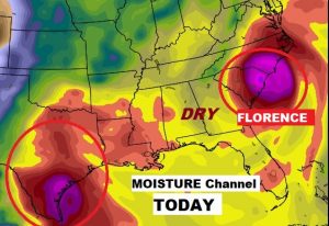
The heart wrenching catastrophic flood threat from Florence continues, just over 400 miles east of us. Over two feet of rain has fallen in spots. Perhaps another foot and a half more will fall, as the slow pounds the Carolina coastal zone for another couple of days. It’s very interesting, what Florence in the Carolinas, in concert with that tropical system in Texas is doing to our weather. We are in a “dry zone”, in between, and that pattern will continue for a few days. Our heat and humidity continues, but storms will be non-existent. More on Florence below.
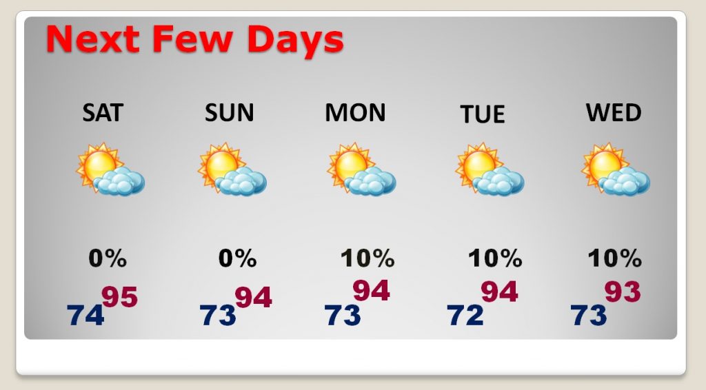
TODAY: Wednesday and Thursday’s high was 94. Yesterday Montgomery had 95, with a heat index of 105. We will be in the same neighborhood day, with few if any showers. If you are going to any of the big games in the state today, including the big one in Auburn, please stay hydrated and wear sunscreen. Tonight’s low 74. Not many clouds.
NEXT FEW DAYS: Not much change day to day. A lot of sun. Very hot and humid. Mid 90’s Heat index triple digits. Rain chances as close to zero as it gets around here, on a summer day. Rain chances will get a little better by Thursday and Friday. Friday is the first official day of Fall.
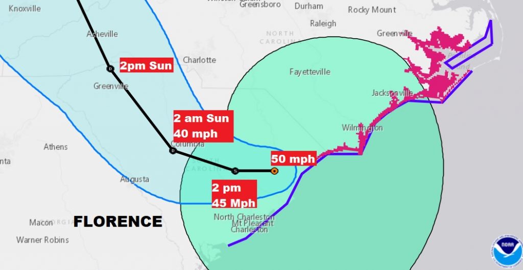
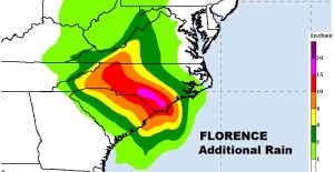
LATEST ON FLORENCE: Tropical Storm Florence with 50 mph winds, is centered not too far from Myrtle Beach, only moving WSW at 5 mph. As you look at the forecast cone below, notice that, as the storm continues to weaken some, but it sure doesn’t move much through mid-day Sunday. That means the coastal zone is in for more prolific rainfall totals, on top of what has already fallen. They can’t handle any more rain. This is a catastrophic, life threatening situation. Unfortunately, for the Carolinas the Florence threat is far from over. A storm on a lifetime. Heart breaking. Deadly. New Bern, NC. Has had 23.75” so far. The North Carolina record from a tropical system is 24.06” in Floyd in 1999.
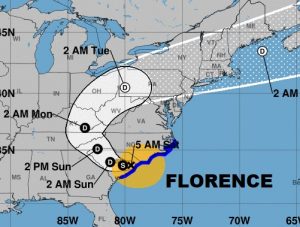
After Florence leaves the Carolinas, the heavy rain threat will spread through much of the eastern US, along the forecast path.
Additional rainfall could easily exceed 15 to 20” more.
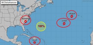
ELSEWHERE IN THE TROPICS: Good news. The rest of the tropics are quieting down. Joyce and Helene are way out there. Isaac was just downgraded and is no longer a Depression. It is a remnant low.
—
There will be another Blog update first thing Sunday morning. I‘ll have the latest unfolding news on the Florence tragedy . Have a nice weekend!
Rich