Good Morning! What a week ahead. It will be very active and very wet. Locally heavy rainfall amounts are the big story. In fact, the farther north you go in the state, the potential for excessive rain grows. Today will be the best day of the week, but on this video, I’ll walk you through details, as we face several days of rain and some thunderstorms, too. Could there be any severe weather? I’ll run it all down for you in a couple of minutes on your Monday personal weather briefing.
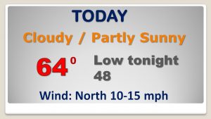
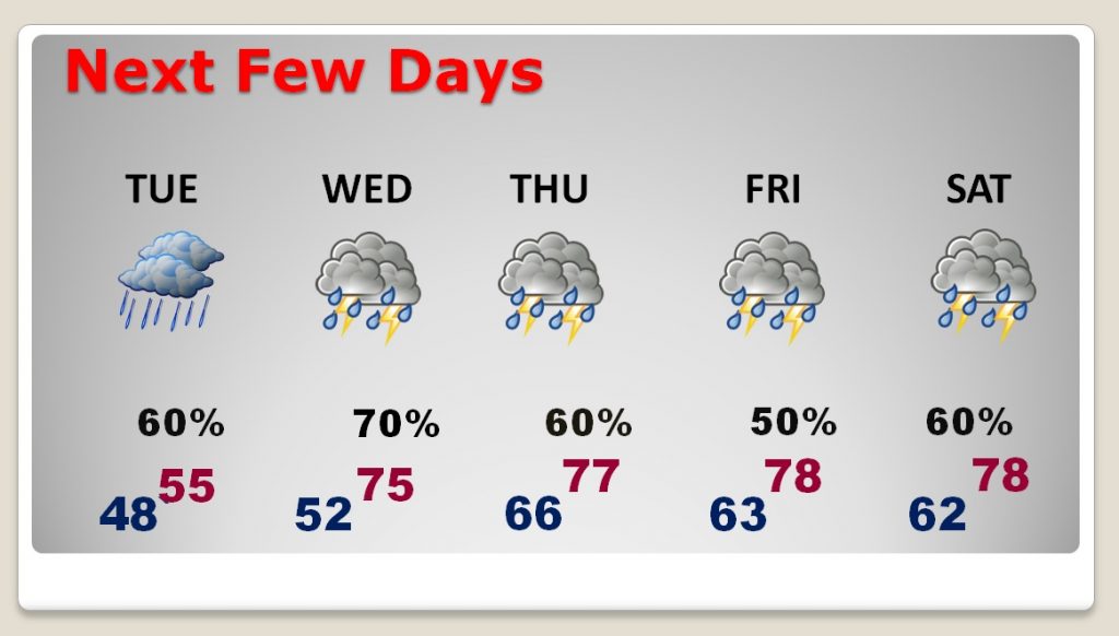
Today will be the “pick of the litter” as far as this week’s weather. Quiet. Partly sunny. Maybe some showers overnight tonight.
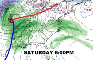
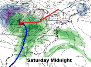
Waves of rain and thunderstorms will roll through this week. Locally heavy rainfall totals. A few stronger storms can’t be ruled out Wednesday through Friday. But, a more important front approaches Saturday.
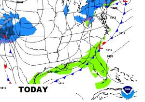
Serious, excessive rainfall amounts are expected from Louisiana through parts of Mississippi, Georgia and Tennessee in the week ahead.
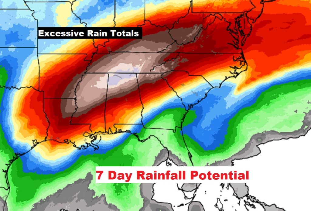
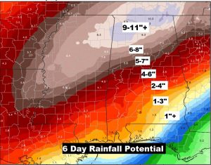
Many of us could see 2 to 4″ this week, but just north of I-85 amounts ramp up quickly. Birmingham could see 5 to 7″ and 9-11″+ are a possible in the Tennessee valley.
A powerful frontal system will be approaching Saturday evening and night. It’s too early to say if we’ll be dealing with a severe weather threat. It’s not out of the question. Stay tuned.