
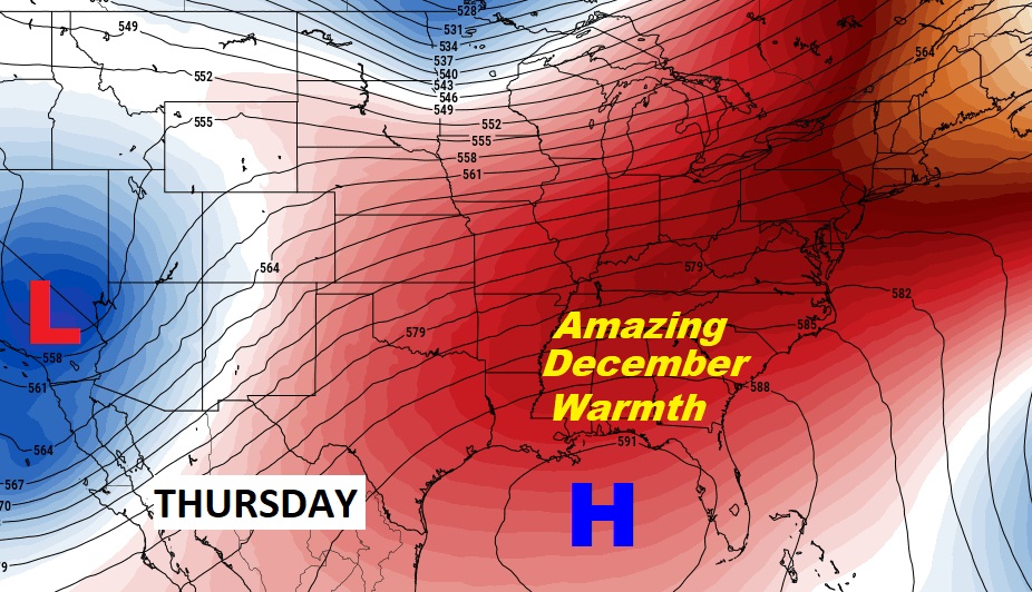
Good Morning! Get ready for some Spring-time warmth in December. Temperatures will be running nearly 20 degrees above normal by Thursday. Fortunately, the arctic flood gates are closed for the foreseeable future. The pattern looks relatively quiet. A weak front could bring spotty showers Friday. But, no “big ticket” weather through Sunday. A little cooler over the weekend, but still mild.
TODAY: Clouds will dominate. Unusually warm for December. An isolated shower can’t be ruled out today. High today 78. South winds 5 10. Cloudy tonight, Low 64.
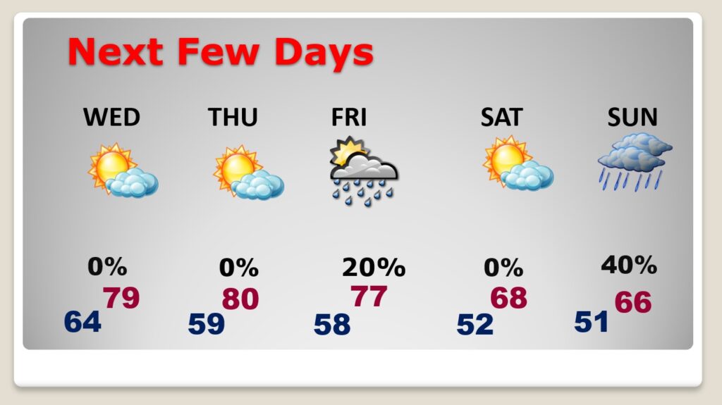
NEXT FEW DAYS: Very warm for December. Near 80 Wednesday & Thursday. A weak front brings a small risk of a shower or two Friday. A little cooler over the weekend. More showers Sunday.
A huge upper level high will be responsible for the unusual December warmth.
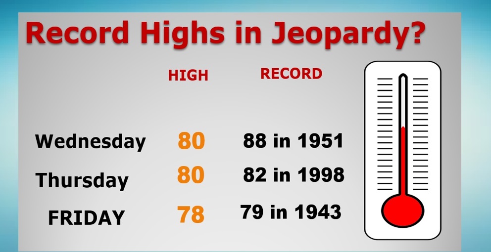
Record Highs appear to be safe… But, we won’t be too far off on Thursday and Friday…
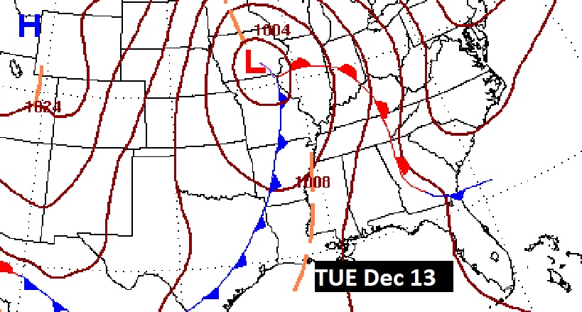
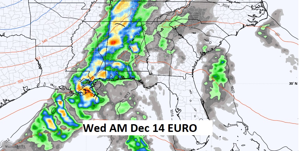
The next big deal storm system is roughly a week away..
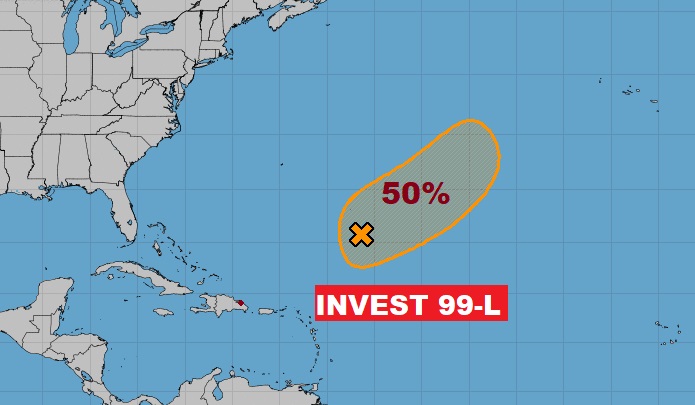
TROPICAL AREA TO WATCH: Yes, the hurricane season ended a week ago today. But, NHC is tracking a post-season disturbance in the central Atlantic. Invest 99-L has a 50% chance of development in the next 5 days.
Thanks for reading this Blog this morning! This morning we are LIVE on the radio from 6 to 9 on NewsTalk 93.1. Watch us on TV on CBS 8 and ABC 32. I’ll have another update for you in the morning. Have a nice day!
–Rich