
Good Morning! A cold, miserable rain will dominate much of our day today. Wednesday is the first day of Winter. We get a brief break. The Calm before the drama. More rain by Thursday and Thursday night ahead of an Arctic Cold Front. Late Thursday night there will be a shocking temperature plunge. We have a Bitterly Cold Arctic Blast Shocker on the way for Christmas Weekend. For instance, Friday’s High near 26 would be a record. It will be very windy. Wind chill by Saturday morning could reach ZERO. Saturday’s high will struggle to reach freezing. Christmas Day will be quite cold. The updated numbers are below. Here’s my brief forecast discussion.
TODAY: A cold, miserable rain will dominate much of our day today. COLD. High 48. Showers taper off early this evening. Low tonight 39.
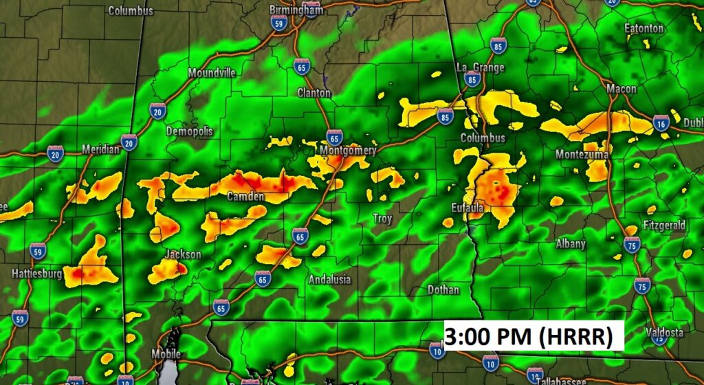
Future Radar snapshot at 3PM. A Cold Rain Soaker….
WINTER SOLTICE WEDNESDAY: Today is the last full day of Fall. Winter Officially begins at 3:48 PM CST. After tomorrow, the days slowly start to get longer.
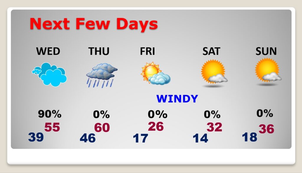
NEXT FEW DAYS: Tomorrow, on the First Day of Winter we get a little break. Wednesday’s high of 55 will seem like a heatwave. Rain returns late Wednesday night into Thursday and a STRONG Arctic Cold Front Approaches. Rain at times Thursday and especially Thursday night. Windy and COLD late Thursday night. Shocking temperature plunge overnight. Friday’s forecast is FRIGID. High of 26. VERY WINDY. Low Mid-teens by Dawn Saturday. Wind chill by Saturday morning, perhaps near ZERO for many of us. Saturday’s high not too far from freezing. A COLD Christmas day. Roughly 30 degrees colder than last year.
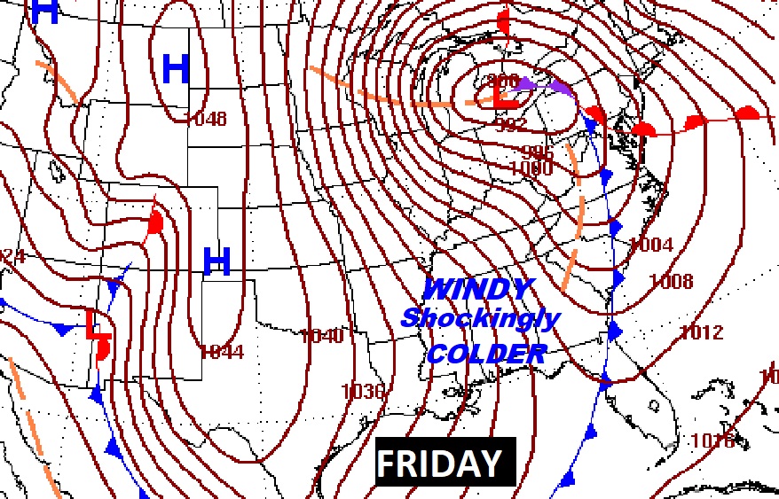
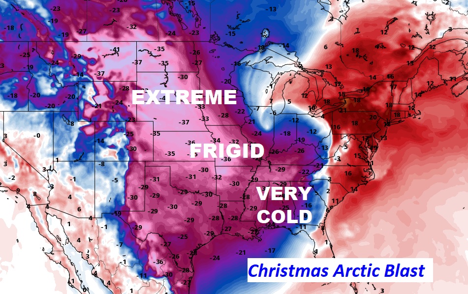
This Friday Map shows the extent of the Arctic Blast Covering much of America. All those lines are called ISOBARS. The More isobars, the stronger the wind.
As Cold as it will be HERE, some states to the north of us will experience ridiculous cold numbers.
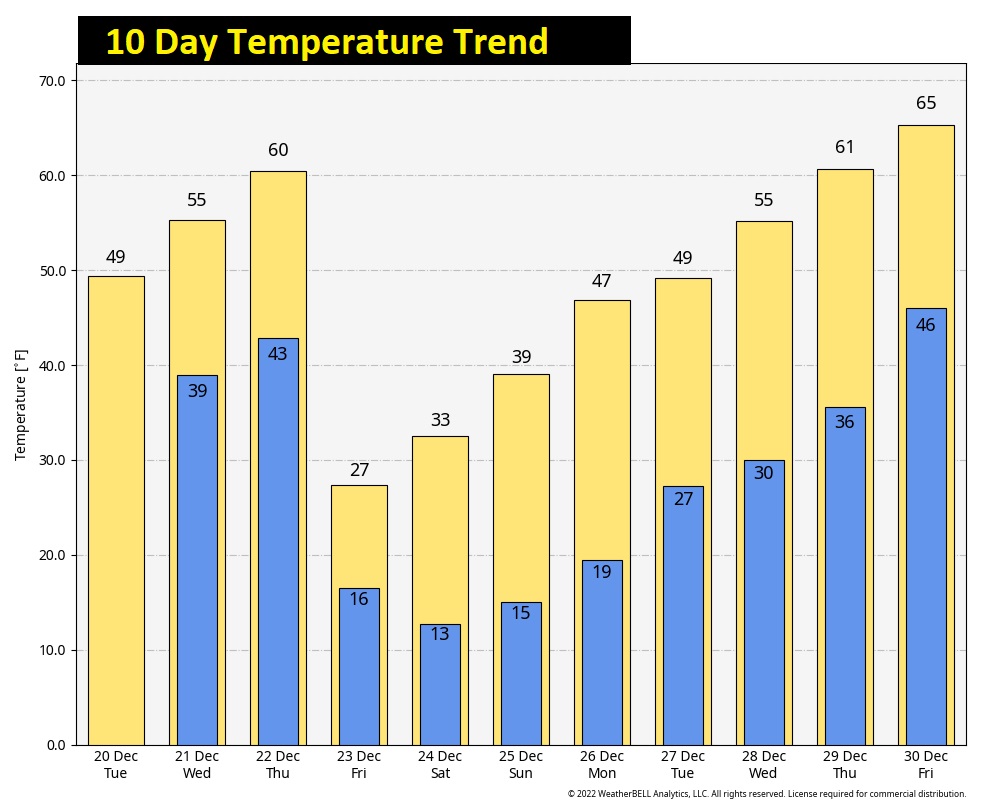
Here’s your updated Christmas Weekend Forecast. At least we won’t have to deal with any snow or ice to worry about.. That’s the best news. No travel issues.
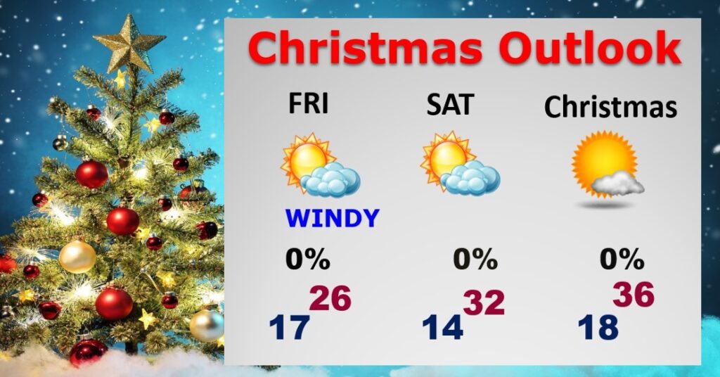
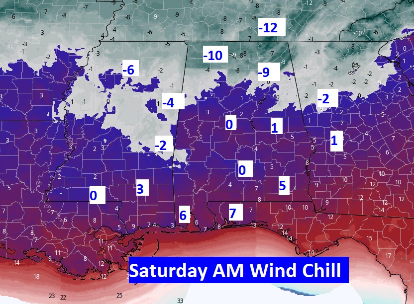
It will be VERY WINDY Friday and Friday night, especially. The potential wind chill numbers by Dawn Saturday cold easily be near ZERO for many of us. Below ZERO wind chill for much of north Alabama. This is serious, dangerous Arctic COLD. Get ready.
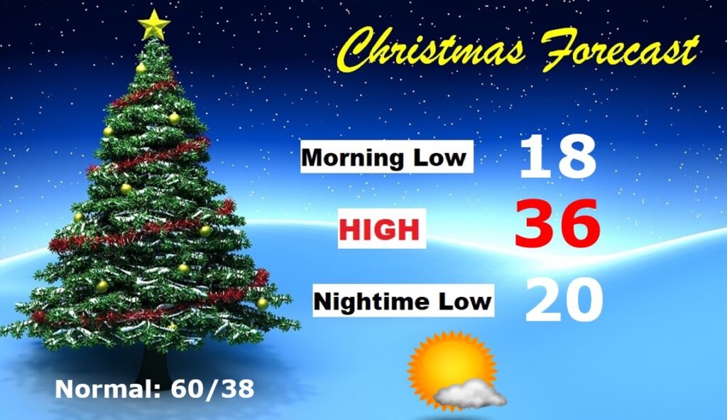
CHRISTMAS OUTLOOK: Last Christmas we had a high of 77 degrees. This Christmas will be Arctic COLD, compared to the Normal of 60, and last year’s 77! Morning low in the upper teens. AM. Wind Chill near 10. Daytime high perhaps mid 30’s. Mostly sunny. Nighttime low near 20. No snow or ice to worry about, though, so travel will not be a problem.
It’ll take several days to climb out of the arctic cellar …BUT….Look at that projected High 10 days from now. YES!!
Thanks for reading this Blog this morning! This morning we are LIVE on the radio from 6 to 9 on NewsTalk 93.1. Watch us on TV on CBS 8 and ABC 32. I’ll have another update for you in the morning. Have a nice day!
–Rich