
Good Morning! Yesterday was awful, as expected. This morning, rain departs early. Cloudy for at least the first half of today. but we should improvement by this afternoon. Although today will be chilly, compared to normal, tomorrow recovery will begin as we head for the mid 60’s. On Valentine’s Day we’ll in the low 70’s. Showers return Tuesday night & Wednesday. Thursday still looks like a potentially big severe weather, including the threat for tornadoes. Concern for Thursday is increasing.
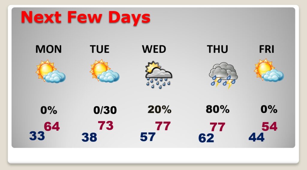
TODAY: Today, rain clears out early in the morning. Cloudy for the first half of the day, but we should at least some sun by this afternoon. Breezy & cool. Northwest wind 15 to 20 mph. High 56. Clear and quite cold tonight. Low 33.
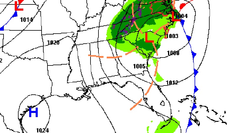
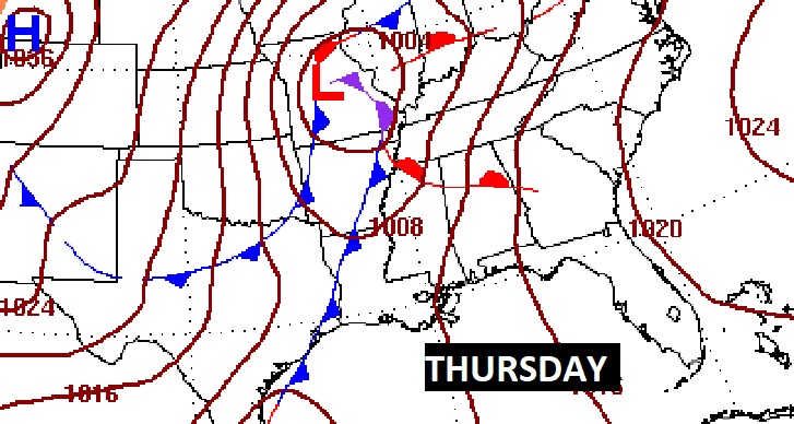
NEXT FEW DAYS: On Monday, recovery will begin, as we head for the low to mid 60’s. On Valentine’s Day we’ll reach the lower 70’s. Next week will be very active. Showers return Tuesday night & Wednesday, as the first disturbance brushes by the area. Thursday could be a big severe weather day. Concern for Thursday is increasing. See below for more.
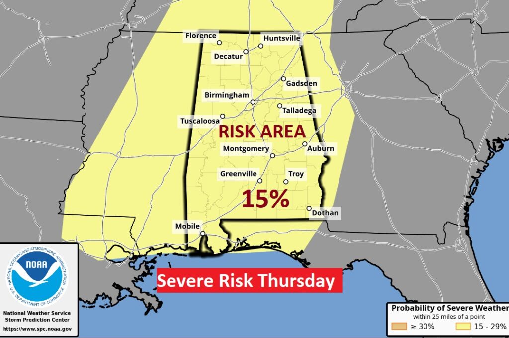
THURSDAY SEVERE THREAT: It’s always a big deal when the Storm Prediction Center issues a Severe Weather Threat beyond Day 3. But, when SPC issues an outlook 7 days out (like they did as early as last Friday), it’s very concerning. All modes of severe weather are possible including tornadoes. The Severe threat begins Wednesday in the lower Mississippi valley and spreads east to Alabama Thursday. It’s simply too early to get into details, but the action could begin Thursday morning and continue well into Thursday evening. It certainly could be a significant severe weather event, of course including the threat for tornadoes. Will there be a pre-stage of discrete Super Cells in the warm air sector, ahead of the main body of thunderstorms? Not out of the question. That could be quite dangerous. Stay tuned. It’s way to early to know how this day could unfold. It certainly has my attention. Start the planning mode for you and your family for Thursday.
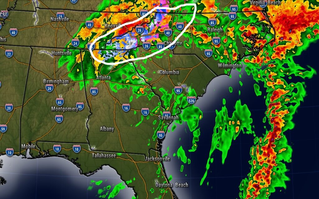
Models continue to suggest there could be an accumulating snow event from north Georgia through east Tennessee and the western Carolinas today.
TORNADO ANNIVERSARY: A powerful F3 tornado devastated a large part of Montgomery, killing 26 and injuring at least 300. It‘s Montgomery’s biggest weather disaster. It was a Monday afternoon, February 12, 1945, 5:18pm, about 10 minutes before sunset. 73 degrees. The storm struck without warning. There were no warnings in 1945. Damage was extensive. Several neighborhoods were affected, from the western part of the city, from around Day and Bell St., and skirting across the northern part of Montgomery. The epicenter of the worst damage was the Chisolm community, where 35 homes were destroyed, at least a couple of dozen more heavily damaged. The greatest loss of life was here. It was one of 7 significant tornadoes in Alabama that day, killing close to 4 dozen people. Here’s more in this article I wrote back in 2017.
Thanks for reading this Blog this morning! I’ll have another update for you in the morning. Have a great Super Bowl Sunday!
–Rich