
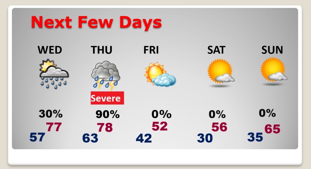
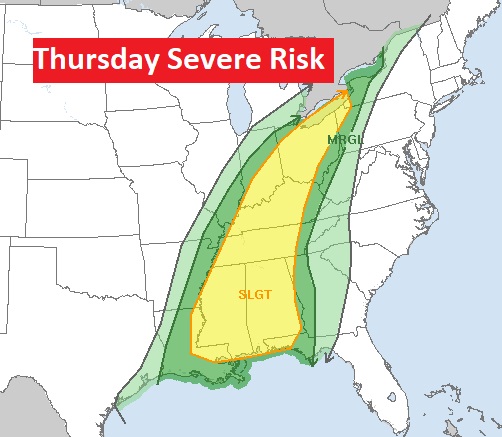
Good Morning! Today, on Valentine’s Day, the warm-up continues. We’ll in the low to mid 70’s. Isolated Showers return late tonight (overnight) & Wednesday. Thursday still looks like a potentially “big deal” severe weather event, including the threat for tornadoes. SPC says there could be multiple storm modes. Cellular and linear. Could be a long, multi-hour event. Colder air follows the big storm. Here’s my brief forecast discussion.
TODAY: The warm-up continues. Good bit of sunshine. High 73. (Normal 64/40) South wind 10 to 15 gusts to 20 mph. Most cloudy tonight. Low 57. Isolated showers possible in the late night, overnight hours.
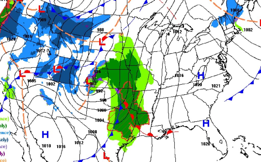
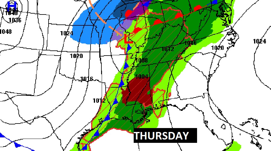
Look at the Parade of Storms lining up across the nation.
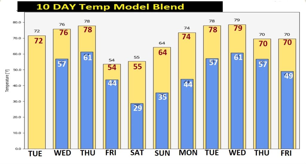
NEXT FEW DAYS: Isolated Showers are possible Wednesday, as the first disturbance brushes by the area. Thursday’s Severe Weather Event continues to take shape. Showers and storms begin Thursday afternoon and continue Thursday night. Some severe. Colder air follows the big storm. Friday will be chilly, with highs in the low 50’s. Upper 20’s are possible by Dawn Saturday. Saturday will be sunny and cool. Sunday will be a little warmer.
Lots of ups and downs. The weekend chill won’t last long. Look for another big warm-up next week.
THURSDAY SEVERE THREAT: There will be a multi-day Severe Weather Event starting tomorrow in the ArkLaTex and lower Mississippi valley, spreading eastward to Alabama Thursday. All modes of severe weather are possible including tornadoes. SPC says there could be multiple storm modes. Cellular and linear. Discrete individual super cells, way ahead of the main body of storms. “Several clusters of storms will likely cross the Gulf States before activity weakens. Could be a multi-hour event. We’ll continue to closely monitor the threat levels and future storm timeline. Early on, NWS is advertising a Noon to Midnight time line. That will be refined as we get closer.
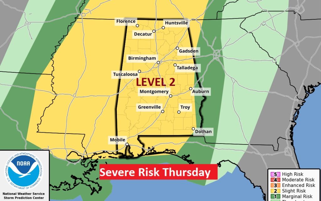
Thursday’s Severe Threat will extend from the Gulf Coast to Lake Erie.
Thanks for reading this Blog this morning! This morning we are LIVE on the radio from 6 to 9 on NewsTalk 93.1. Watch us on TV on CBS 8 and ABC 32. I’ll have another update for you in the morning. Have a nice day!
–Rich