
Good Morning! On this President’s Day, our big warm-up continues. What a nice start to the week! Look for highs in the middle 70’s. We’ll be near 80 Tuesday and well into the 80’s Wednesday and Thursday. There will be a small chance of rain at times, as disturbances brush by the area. But, the main action stays north & west of us. A huge upper level protective dome of high pressure centered over Cuba will keep us warm and divert storm systems away. The warmer than normal Spring-like pattern continues on Friday & Saturday. Here’s my brief forecast discussion.
TODAY: The big warm-up continues. Increasing clouds, but dry. High 75. (Normal 66/41) Breezy. Southwest wind 10 to 15, gusts to 20mph today. Mostly cloudy very mild tonight. Low near 60. Isolated showers possible before dawn Tuesday.
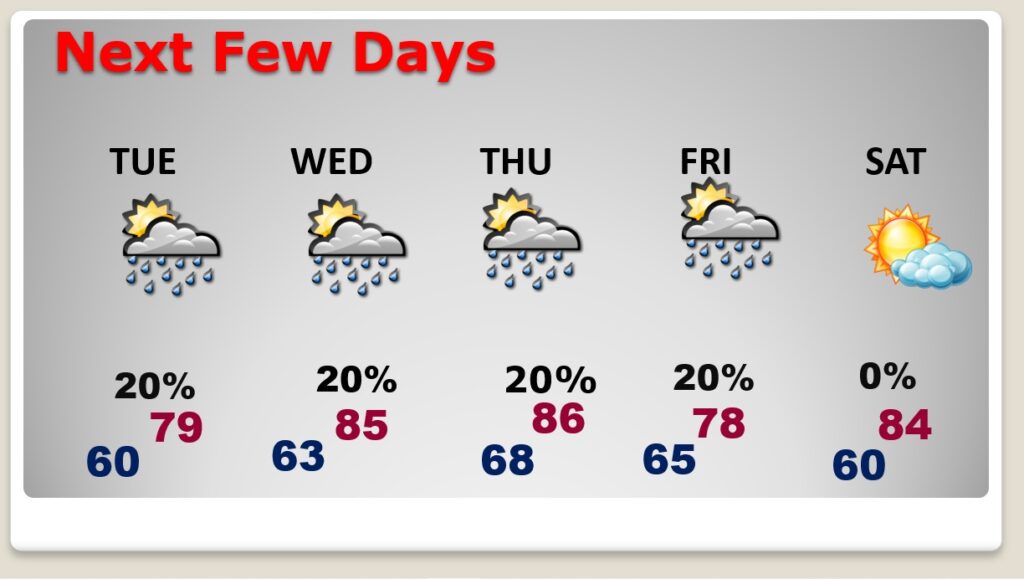
NEXT FEW DAYS: Spring preview will continue. We’ll be near 80 Tuesday. Expect highs well into the 80’s by Wednesday and Thursday. There will be a small chance of rain just about everyday through Friday as disturbances brush by the area. The warm pattern continues through Friday and Saturday, too.
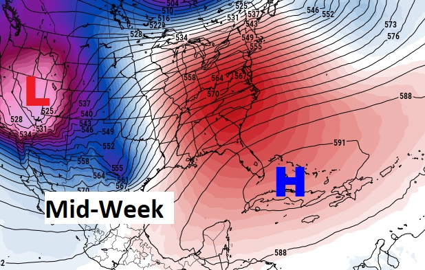
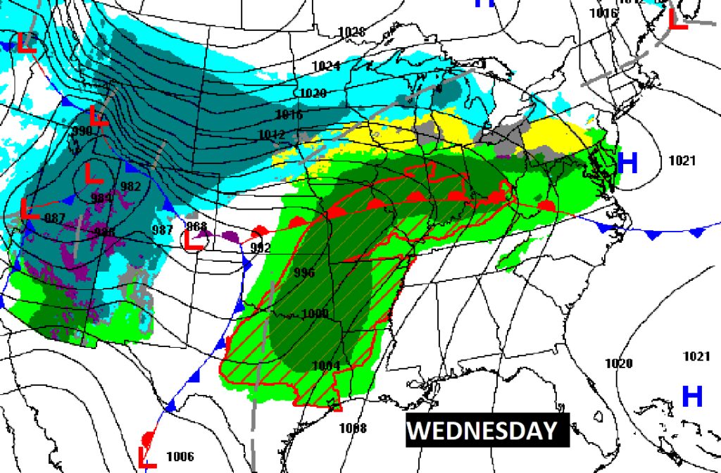
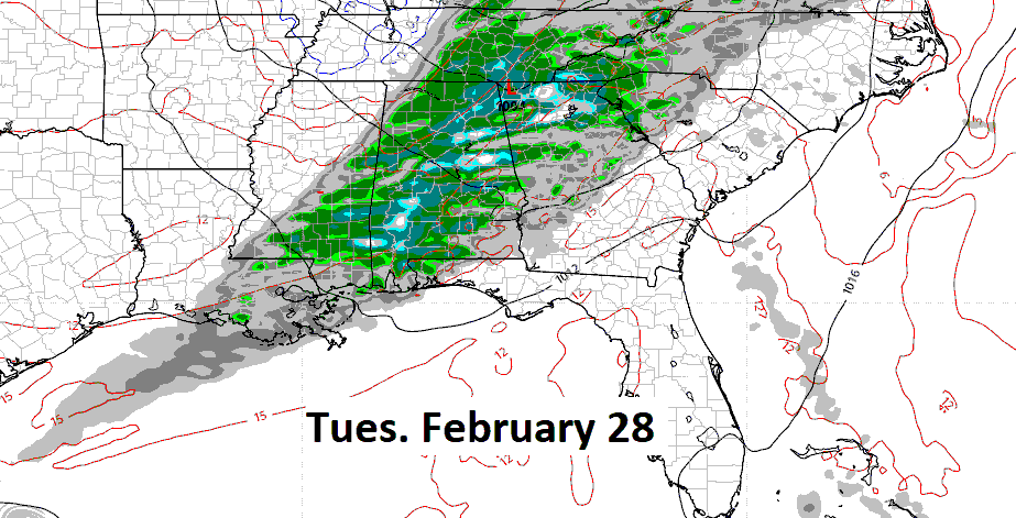
There will be a small chance of rain by mid-week as disturbances brush by the area. But, the main action stays north of us. A huge upper level dome of high pressure centered over Cuba will keep us warm and divert storm systems away.
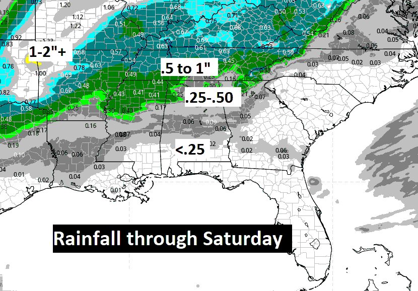
The Big High will keep the big storm systems away. Rainfall will be minimal through Saturday for the southern half of Alabama.
The Arctic Floodgates remain closed for the next 10 days. The Amazing February Thaw continues.
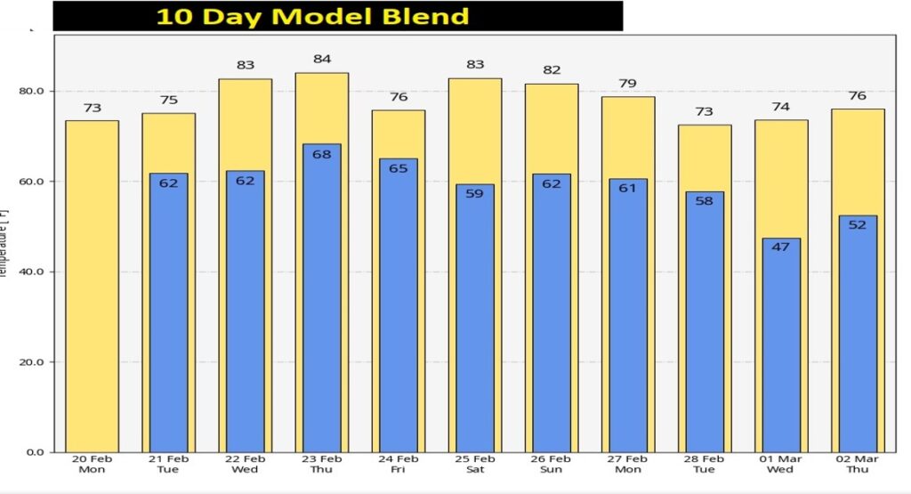
The next big deal storm system is about 8 days away, according to the Euro model.
Thanks for reading this Blog this morning! This morning we are LIVE on the radio from 6 to 9 on NewsTalk 93.1. Watch us on TV on CBS 8 and ABC 32. I’ll have another update for you in the morning. Enjoy this nice weather on this holiday!
–Rich