
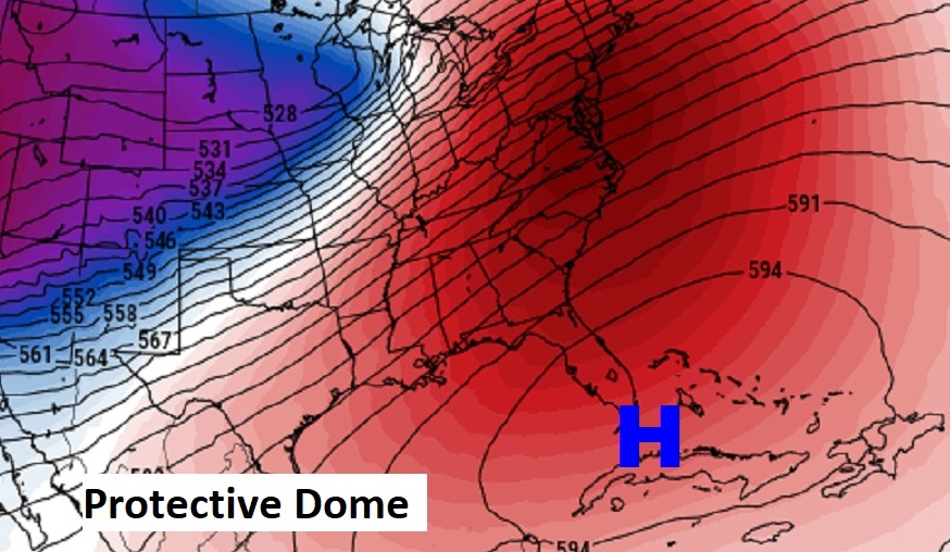
Good Morning! Happy Mardi Gras! Our big warm-up continues. Today’s high may tease 80. We will be into the 80’s Wednesday and Thursday. Rain chances today through Friday are not zero, but they are quite low. A huge protective dome of upper level high pressure over Cuba is still in control. This High will not only promote warmth, it will continue to divert storm systems around us for the next several days. Looks like the next storm system will hold off until early next week. Here’s my brief forecast discussion.
TODAY: The warm-up continues. Mostly cloudy, breezy & warm. High mid to upper 70’s. Isolated showers possible. (Normal 66/41) Southwest wind 10 to 15, gusts to 20mph today. Mostly cloudy very mild tonight. Low near 60. Isolated showers possible.
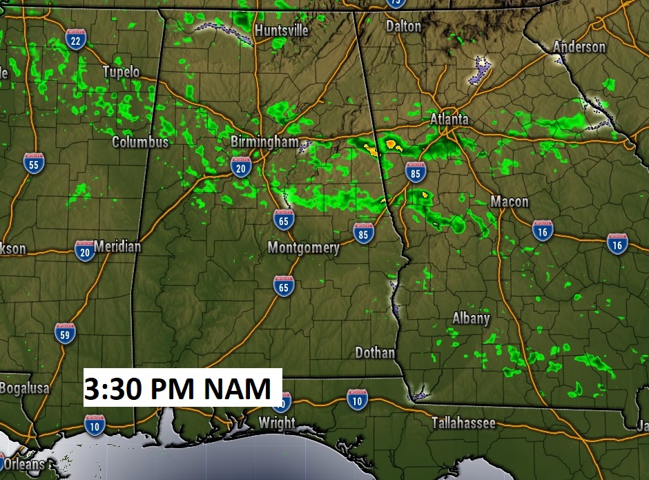
Future Radar this afternoon suggests the better rain chances will be located over the northern half of the state today.
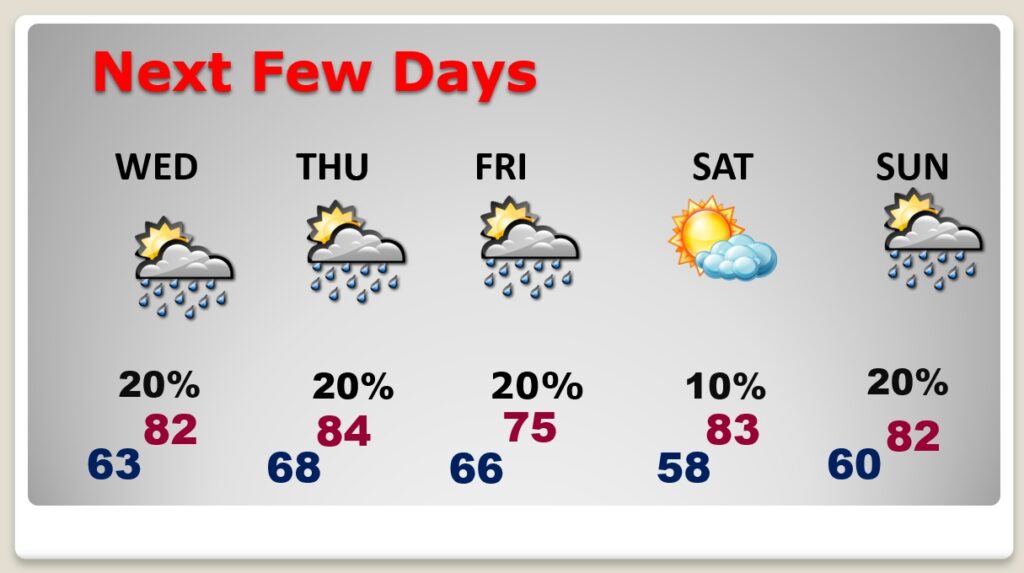
NEXT FEW DAYS: Spring preview will continue. Expect highs into the 80’s by Wednesday and Thursday. There will be a small chance of rain just about every day through Friday as disturbances brush by the area. Friday’s high will be in the mid 70’s. But we should be back in the 80’s over the weekend.
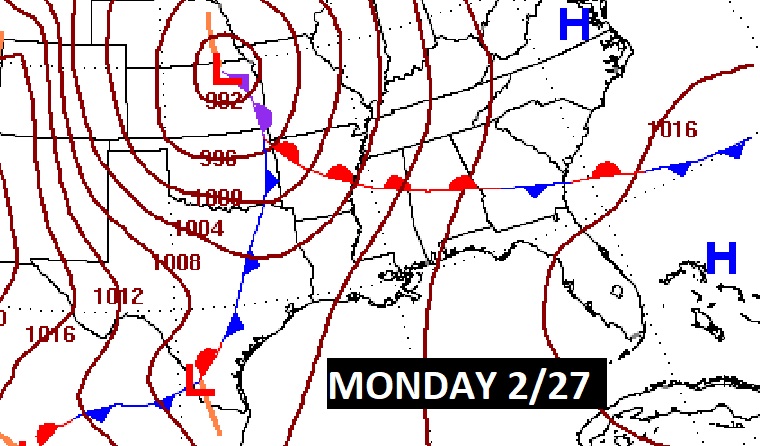
There will be a small chance of rain by mid-week as disturbances brush by the area. But, the main action stays north of us. A huge upper level dome of high pressure centered over Cuba will keep us warm and divert storm systems away.
The Arctic Floodgates remain closed for the next 10 days. The Amazing February Thaw continues.
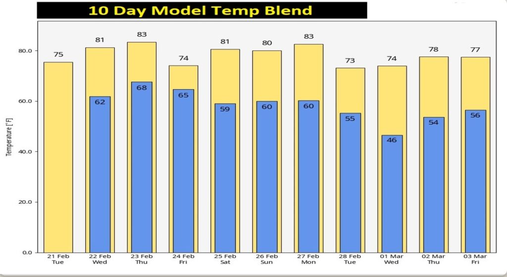
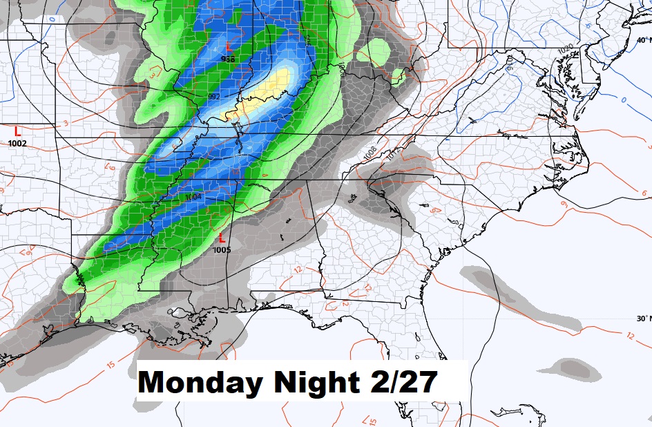
The next Storm System holds off until early next week.

Thanks for reading this Blog this morning! This morning we are LIVE on the radio from 6 to 9 on NewsTalk 93.1. Watch us on TV on CBS 8 and ABC 32. I’ll have another update for you in the morning. Enjoy this Fat Tuesday!
–Rich