
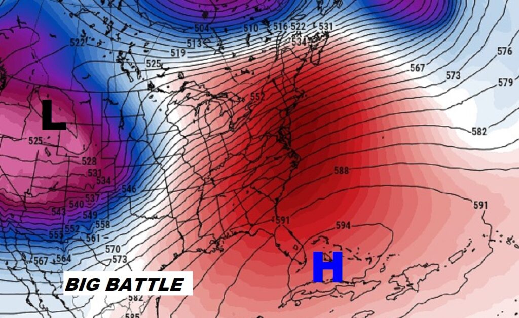
Good Morning! Our big warm-up continues. Every Day has been a bit warmer. Yesterday’s high was 80. We will be the low 80’s today, and we may tease a Record High on Thursday. While today should be dry, a small chance of some isolated pop up showers are in the forecast Thursday & Friday. A huge protective dome of upper level high pressure over Cuba is still in control. This High will not only promote warmth, it will continue to divert storm systems around us for the next several days. Right now, the weekend forecast looks dry and warm. Looks like the next storm system will hold off until early next week. Here’s my brief forecast discussion.
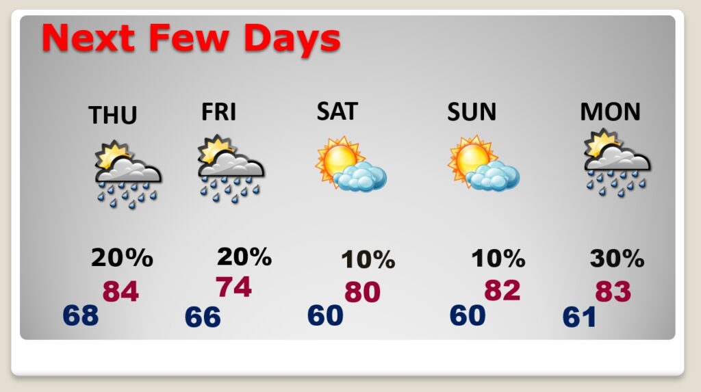
TODAY: Breezy and unusually warm again today. Mostly cloudy, with some sunbreaks later. High 82. (Normal 66/42) South wind 10 to 20, gusts to 30 mph today. Mostly cloudy very mild tonight. Low near 66.
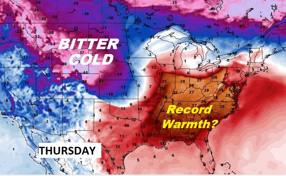
Meanwhile — there is some very, very ugly and severe winter weather in other parts of our country,

That HUGE Upper Level High north of Cuba continues to act as a protective dome, promoting warmth and diverting major storm systems around us.
NEXT FEW DAYS: Spring preview will continue. It’s possible we could at least tease the Record High of 85 Thursday. There will be a small chance of rain Thursday and Friday. Friday’s high will be in the mid 70’s. But, we should be back in the lower 80’s over the weekend, and it looks like we’ll be dry.
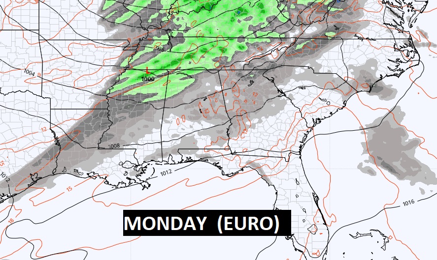
Here’s expected rainfall through Sunday. NOT MUCH across the southern half of Alabama.

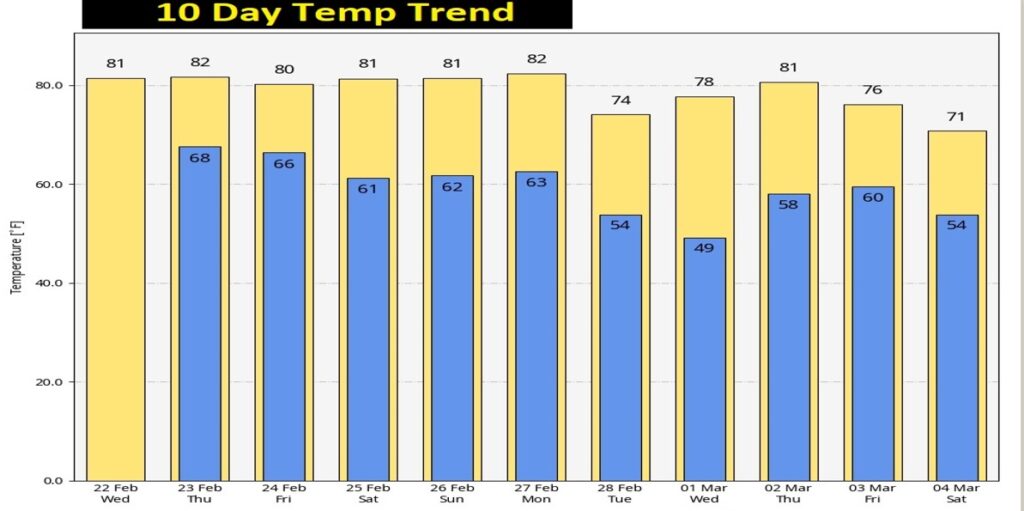
We’re living the dream, at least for now. The warmth continues for the rest of February and over the first few days of March.
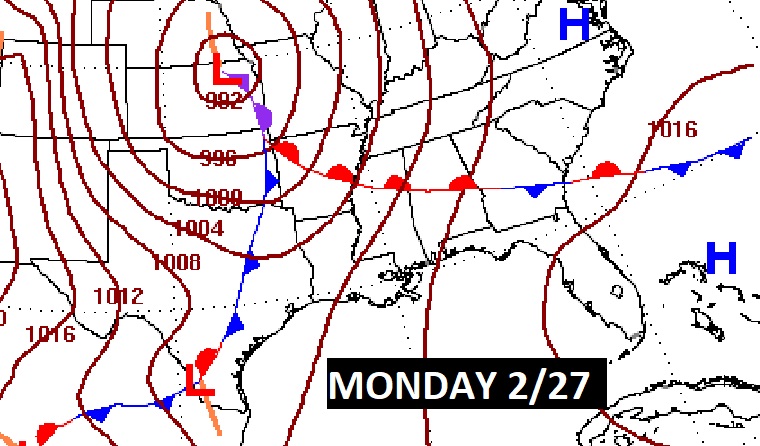
The next Storm System holds off until early next week.
Thanks for reading this Blog this morning! This morning we are LIVE on the radio from 6 to 9 on NewsTalk 93.1. Watch us on TV on CBS 8 and ABC 32. I’ll have another update for you in the morning. Enjoy this Fat Tuesday!
–Rich