
TRACKING SEVERE WEATHER THREAT
(11:00 AM 3/3/23)
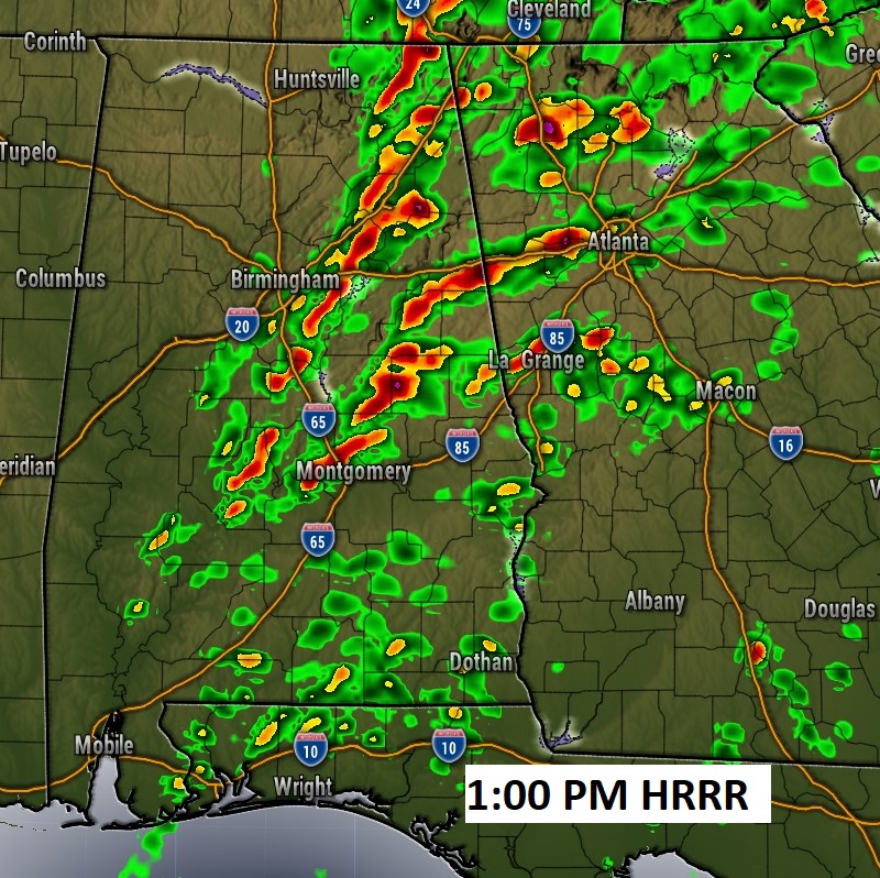
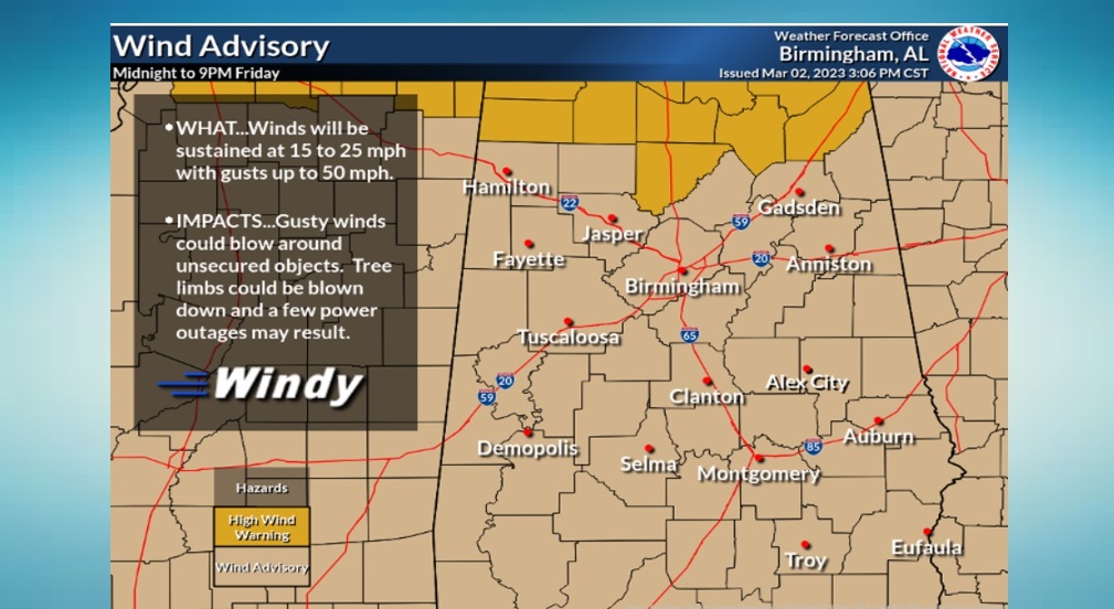
Tornado Watches now cover most of north Alabama. The watches are generally along and north of a LaGrange, GA, Clanton, Demopolis line. The farther east Watch goes until 4PM. Meanwhile, we continue to track a line of strong/severe storms moving eastward from west Alabama late this morning. Future Radar shows the line close to the I-65 corridor by about 1PM – 2PM. Damaging wind gusts will be the main threat for areas not included in the Tornado Watch. Elsewhere, all of the area is under a Wind Advisory. Non-thunderstorm wind gusts could easily reach 40 to 50 mph. Stay weather aware until the line of storms passes out of the state by about 3:30 or 4PM.

Wind Advisory remains in effect.
EARLY MORNING UPDATE:
Good Morning! An approaching storm system and cold front will usher in a band of strong, possibly severe storms into the state today, entering the western counties early this morning and exiting east Alabama by about mid-afternoon. Damaging wind gusts will be the main threat. A few tornadoes can’t be ruled out. A Wind Advisory is in effect. Non thunderstorm winds could gust as high as 40 mph. We should see the sun before this day is over. It will be noticeably much cooler tonight, Saturday and Saturday night. But, look for a nice recovery starting Sunday afternoon. Really, the weekend forecast looks pretty nice. Here’s my brief forecast discussion.
TODAY: Wind Advisory in effect. Risk of strong to severe storms mainly first half the day. High today 78. We should work our way into sunshine later in the afternoon. Northwest wind 15 to 25 gusting to 30 mph. TONIGHT: Clear, breezy & colder. Low 49.
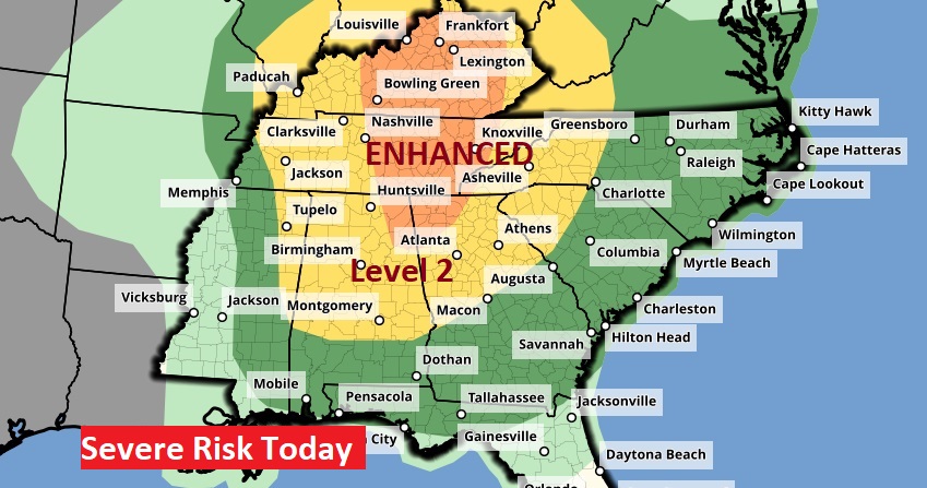
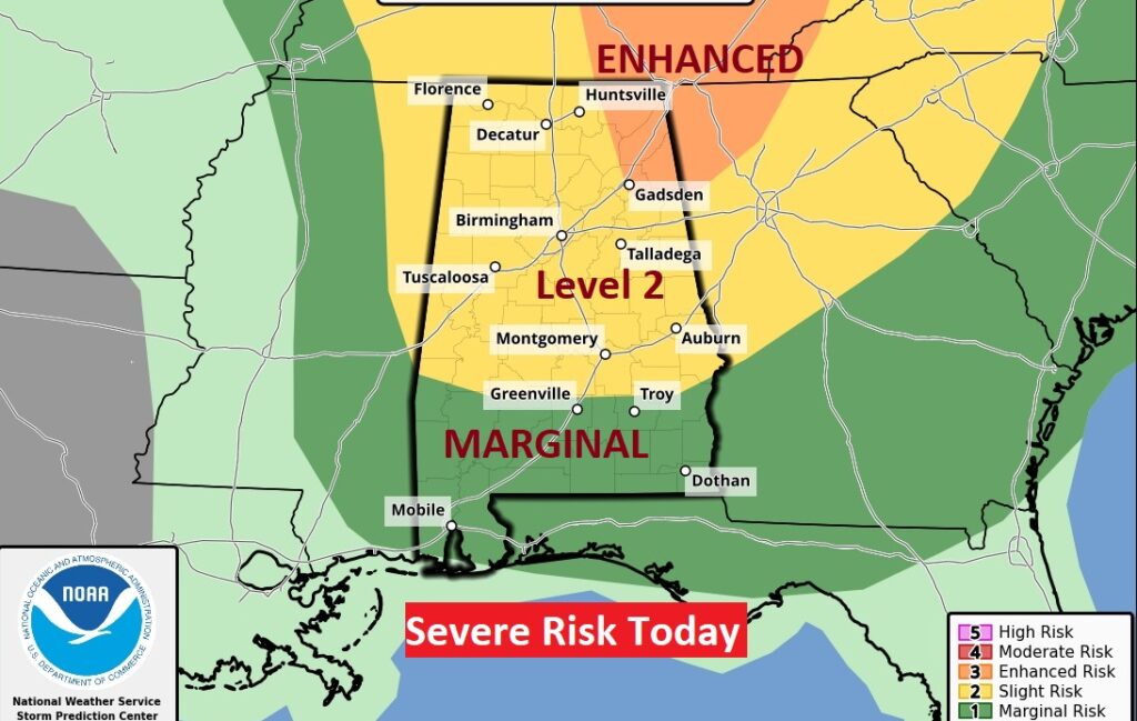
Here’s today’s Severe Threat from SPC. The Level 2 threat covers the northern 2/3 of the state, generally north of a Greenville/Troy line. South Alabama has a Level 1 Marginal Severe Risk. An enhanced Level 3 risk covers the northeast counties. All modes of severe weather are on the table including the risk of tornadoes.
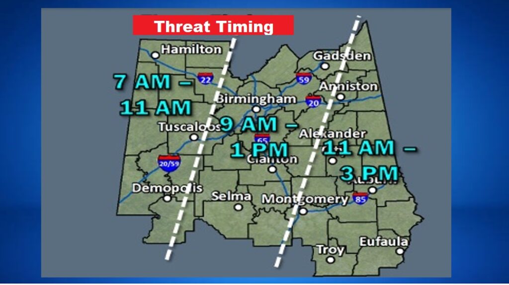
Today, timeline has shifted roughly three hours slower than we thought yesterday. The activity should enter west Alabama at about 7AM and depart extreme east Alabama by about 3PM.
.
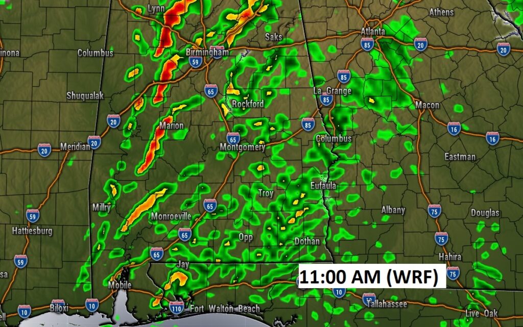
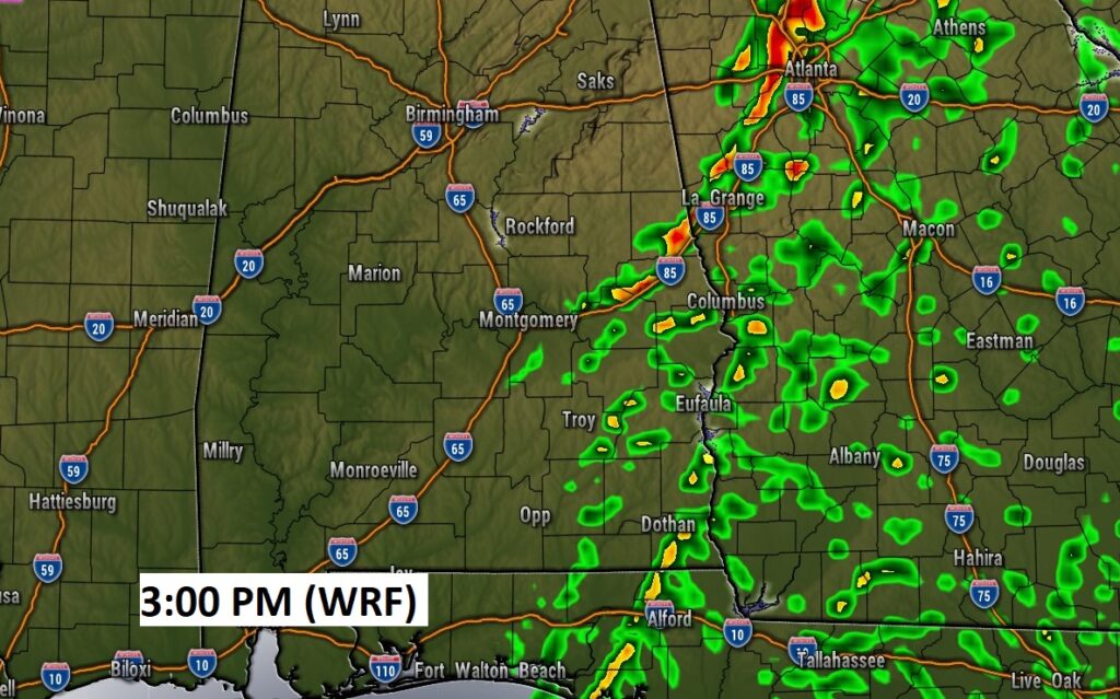
I’m using the WRF hi-Res Model to give you a “flavor” of the potential timing of that eastward moving line of thunderstorms. Notice the broken nature of the line of storms by late morning. Damaging wind gusts are certainly the main risk. But, tornadoes can’t be ruled out.
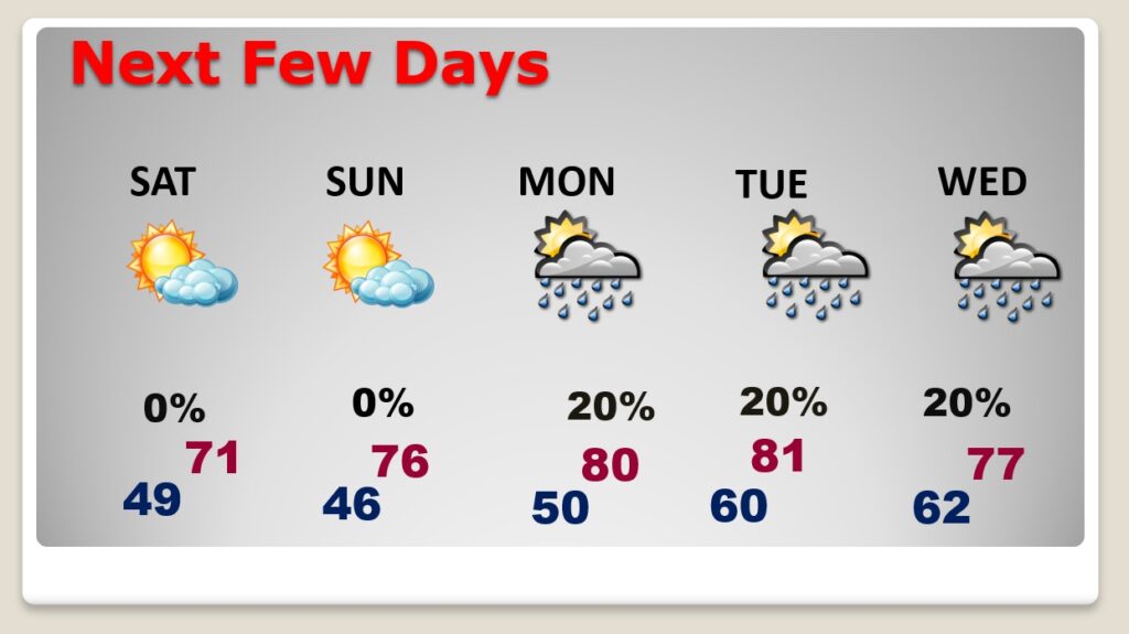
NEXT FEW DAYS: Sunshine and noticeably cooler Saturday. Saturday’s high 71. (Normal 69/44) Sunday looks nice. Chilly start, but a nice warm up. High in the mid 70’s. More sun… Back to the upper 70’s to near 80 Monday. Widely scattered showers Monday through Wednesday. Small chance of rain.
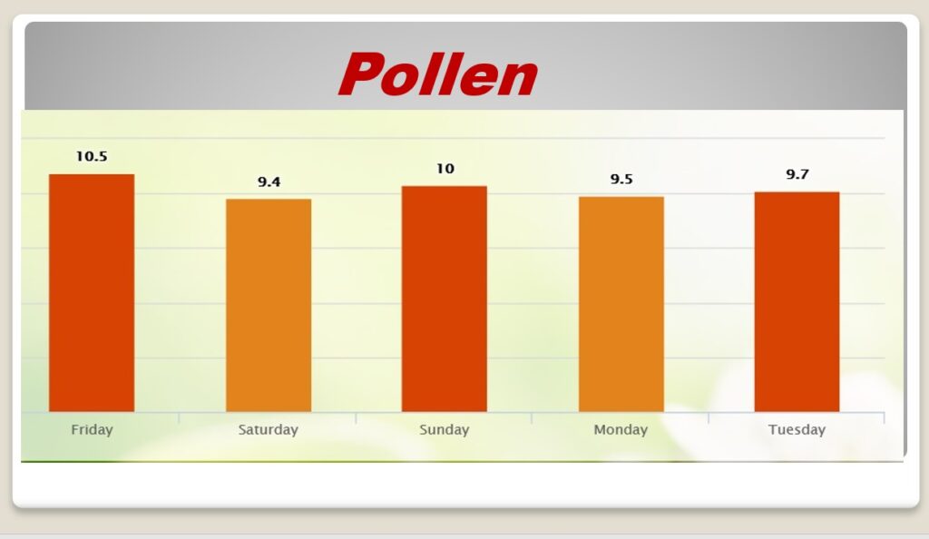
POLLEN: No relief in sight. Pollen will continue in the high range to moderate high for the next few days.
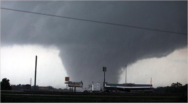
TORNADO ANNIVERSARY: The violent EF-4 Lee County tornado killed 23 and injured 90 others. Multiple tornadoes touched down across the state, including the violent EF-4 that ravaged southern Lee County before moving into Georgia.


Thanks for reading this Blog this morning! This morning we are LIVE on the radio from 6 to 9 on NewsTalk 93.1. Watch us on TV on CBS 8 and ABC 32. I’ll have another update for you in the morning. Have a nice day!
–Rich