
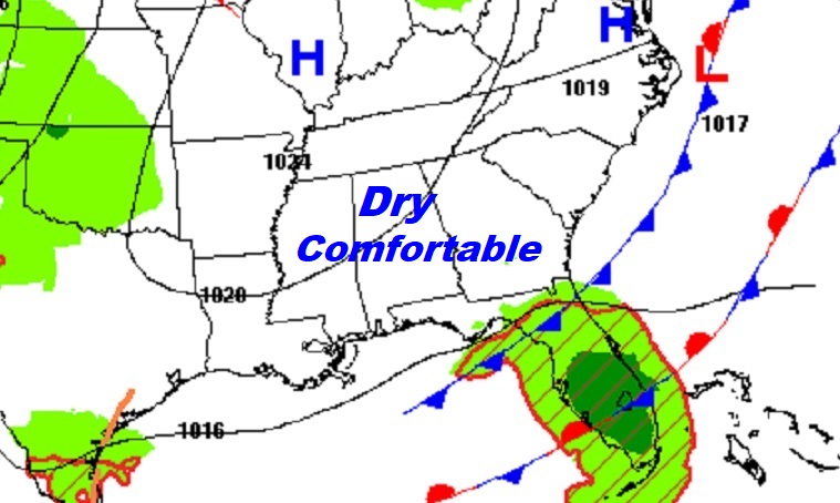
Good Morning! Today, will be quiet, dry and comfortable. But, the week ahead will be, active, unsettled and wet at times, as a series of disturbances relentlessly parade across the South. Right now, it appears the best chance of significant rainfall will be in the Wednesday/Thursday time frame. It looks like we’ll get a brief break in the action by Friday afternoon into Saturday, before the final front in this series delivers more showers and thunderstorms by Saturday night into Sunday. The pattern should quiet down after that. Here’s my brief forecast discussion.
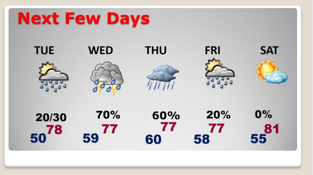
CLIMATE DATA: Yesterday we had morning low of 47, and a afternoon high of 77. (Normal 81/54) No rain.
TODAY: Risk of an isolated shower before 7AM. Mostly cloudy then gradually mostly sunny. High 73. North wind 5 to 10. Partly cloudy, chilly tonight. Low 49.
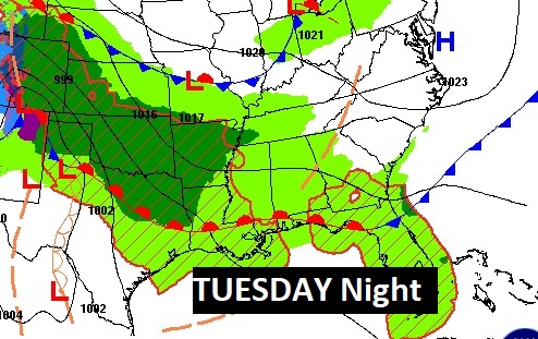
Dry today, tonight and most of the daytime hours Tuesday. Showers return Tuesday night.

NEXT FEW DAYS: The week ahead will be, active, unsettled and wet at times, as a series of disturbances relentlessly parade across the South. Right now, it appears the best chance of significant rainfall will be in the Wednesday/Thursday time frame. It looks like we’ll get a brief break in the action by Friday afternoon into Saturday, before the final front in this series delivers more showers and thunderstorms by Saturday night into Sunday. Highs will be in the 70’s. (Normal high 81, low 54)
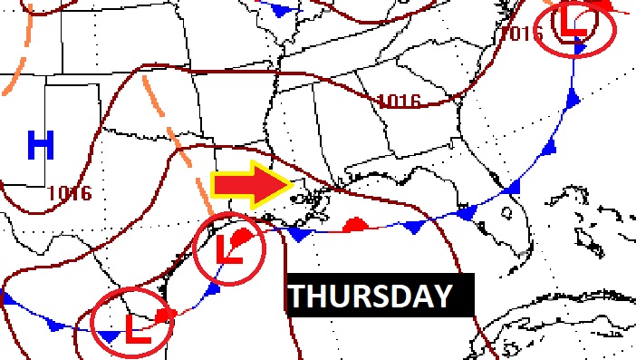
A series of storm systems will parade across the southern states, one after another after another.
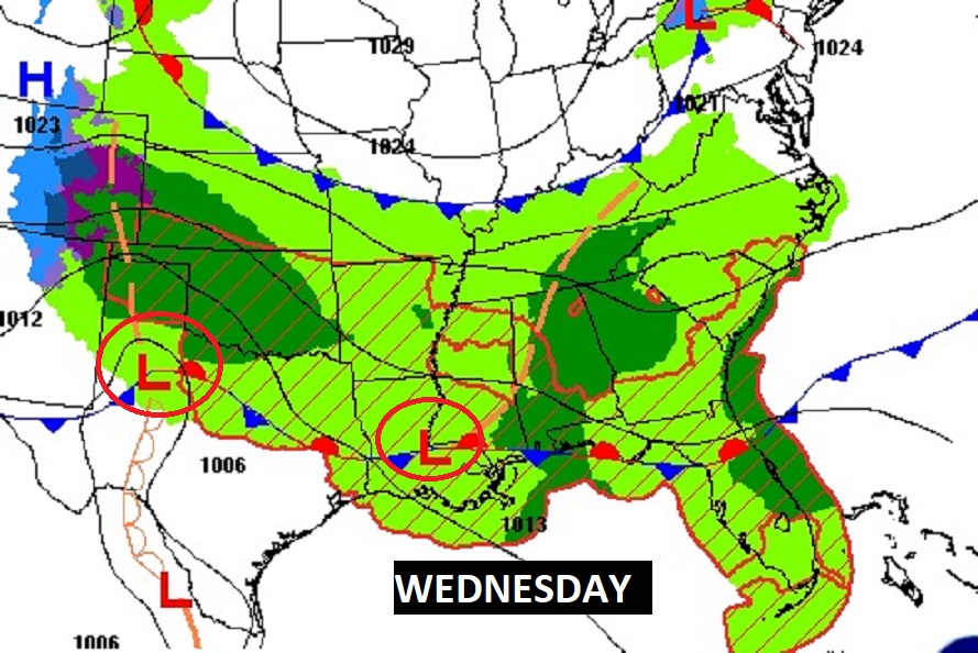
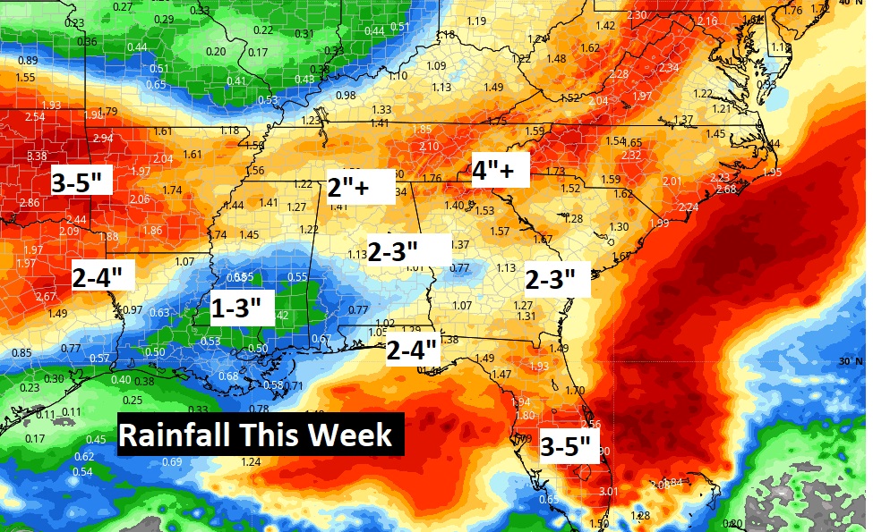
Expected rainfall through Saturday. Wet times across the South.
Thanks for reading this Blog this morning! I’ll have another update for you in the morning. Have a nice Sunday!
–Rich