
Good morning! No surprises in the forecast. More of the same today. Hot. Lower 90’s again. Humid enough, for sure, but not crazy yet. Radar will be more active today with random storms. Tomorrow, a southward moving front will spike the rain chances a notch higher. The front will probably make it too the coast Friday. So, we’ll take the rain chances much lower on Friday and Saturday. Scattered Random Hit or Miss storms return to the forecast on Sunday and Monday. The tropics are quiet. Here’s my brief forecast discussion.
CLIMATE DATA: Yesterday’s morning low was a cool 65 at MGM. Afternoon high was 02. Normal hi/lo: 90 and 67. No rain at the airport.
TODAY: Mostly sunny. Hot again. High 90-92. Scattered, random showers & storms, especially afternoon & evening, fading out at night. Southeast wind 5 to 10 mph. Partly cloudy tonight. Low 6i8.
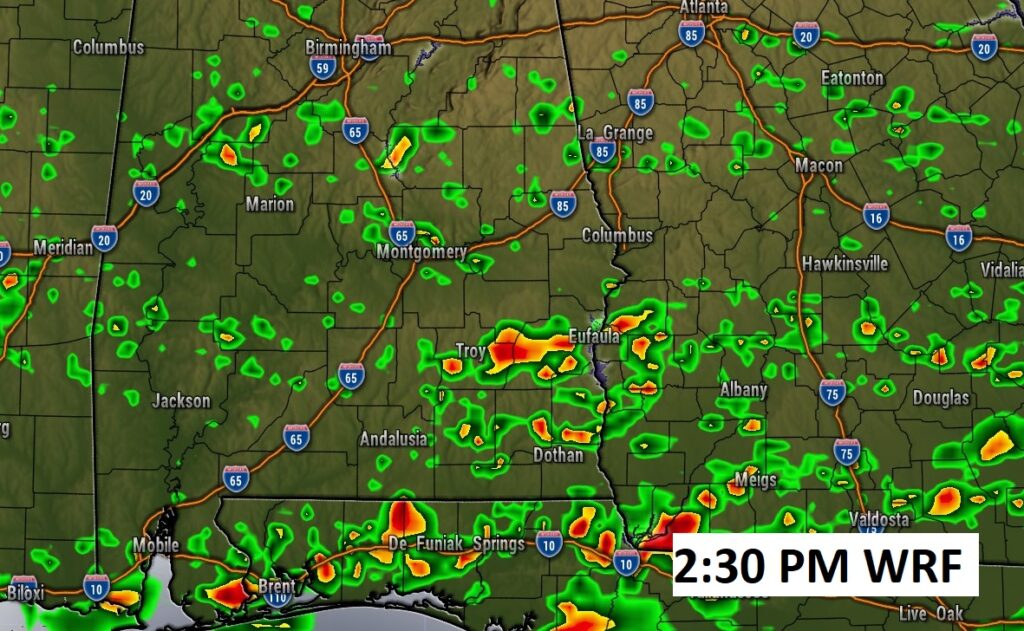
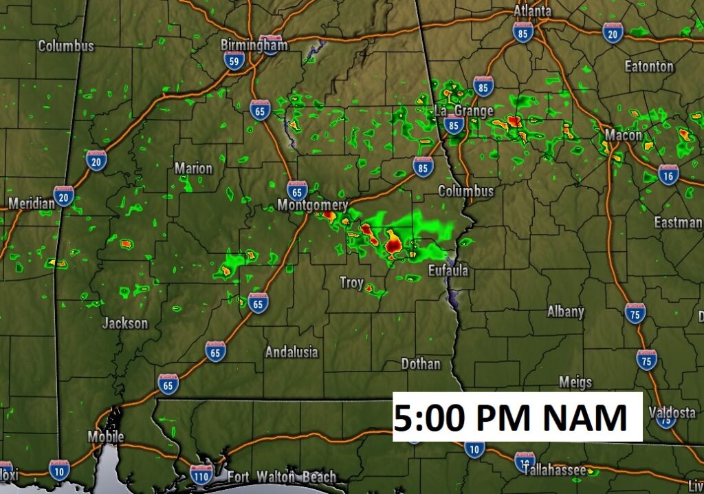
Here’s a couple of Future Radar snapshots. The models show that the radar is likely to be a little more active today. Scattered storms. But, many towns will stay dry.
TROPICAL UPDATE: There’s only one lonely Area to Watch near the Azores in the eastern Atlantic with a 10% chance of development.

.
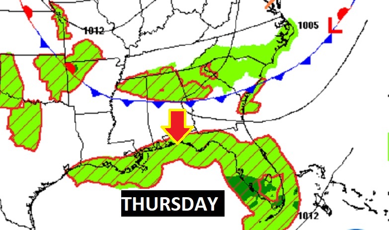
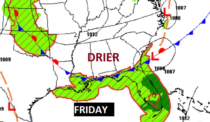
NEXT FEW DAYS: Tomorrow, a southward moving front will spike the rain chances a notch higher. The front will probably make it too the coast Friday. So, we’ll take the rain chances much lower on Friday and Saturday. Scattered Random Hit or Miss storms return to the forecast on Sunday and Monday.

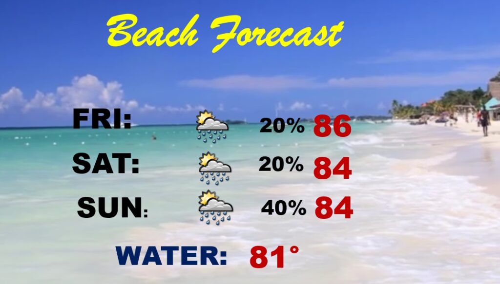
BEACH FORECAST: Not bad! Routine.
Thanks for reading this Blog this morning! This morning we are LIVE on the radio from 6 to 9 on NewsTalk 93.1. Watch us on TV on CBS 8 and ABC 32. I’ll have another update for you in the morning. Have a nice day!
–Rich