
Good morning! It looks more and more like we are in for a very active, potentially stormy pattern, beginning this afternoon and especially tonight. Strong to severe storms are a good bet. There are two severe weather windows. Scattered severe storms are possible this afternoon, with the main risks – damaging wind gusts and potentially large hail. A more organized band of strong/severe storms will move into central Alabama tonight. It looks like an active weather week ahead with better than normal rain chance each day. Stay weather aware.
CLIMATE DATA: Yesterday’s morning low was 63 at MGM. Afternoon high was 91. Normal hi/lo: 91 and 68. Airport rainfall….nice: .40”
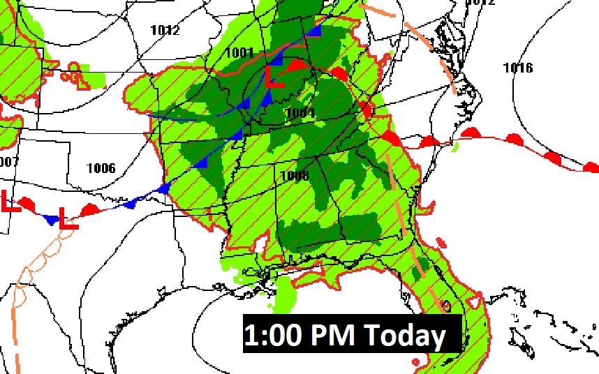
APPROACHING FRONT: An approaching frontal system will be the main player for our stormy forecast through tonight and into Monday.
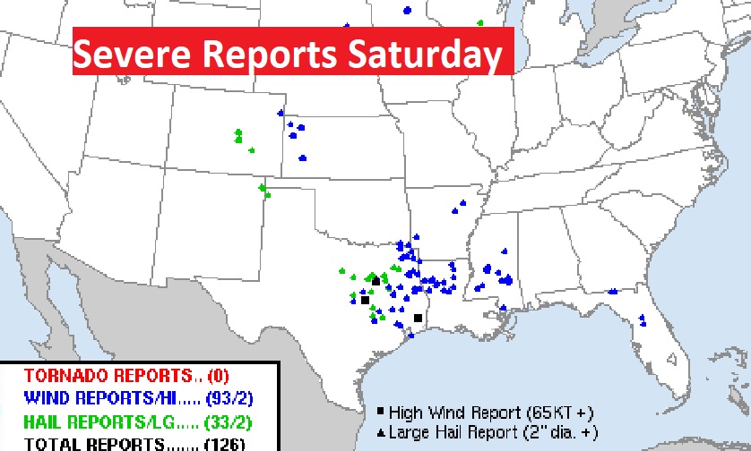
This front was responsible for over 100 severe weather reports Saturday. Large hail and damaging winds. Tennis ball size hail south of Dallas.
TODAY: More humid today. High in the upper 80’s to near 90. Scattered storms will develop this afternoon. Some storms could become strong to severe. Damaging wind gusts are possible, along with the risk of large hail. A more organized band of strong/severe storms will move into central Alabama tonight. Low tonight 70.
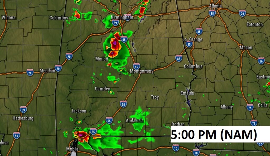
Future Radar: Two potential windows of severe weather. Scattered strong storms this afternoon. Then, a much more organized band of strong to severe storms across the area tonight. Here’s two model examples.

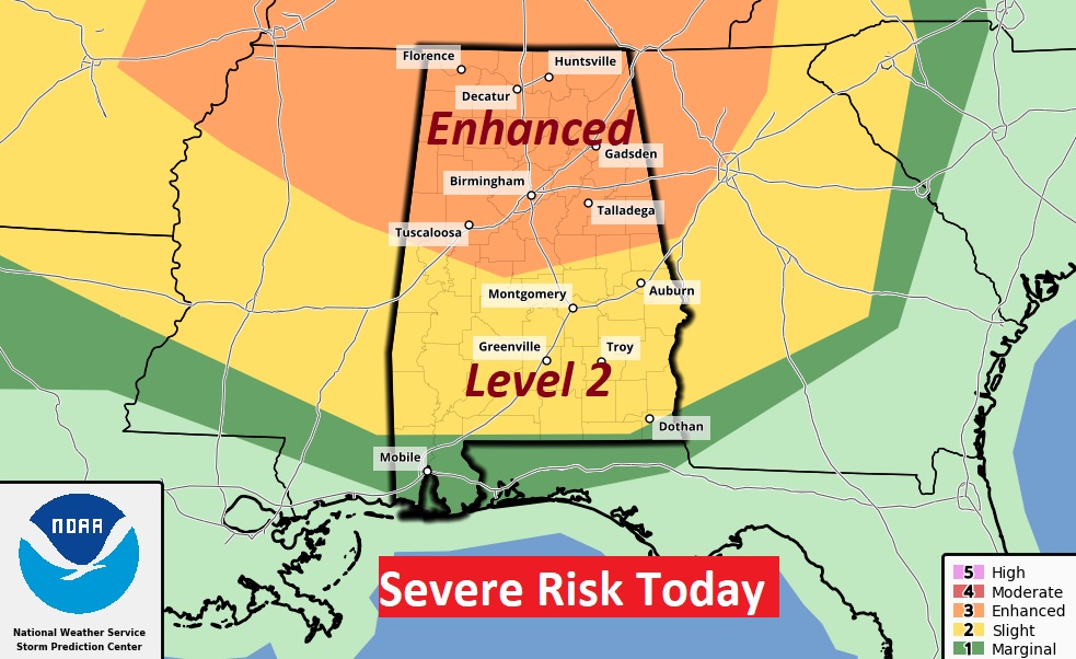
Significant ENHANCED severe risk today especially across north Alabama, and particularly along and north of I-20. . Damaging wind gusts are possible, along with the risk of large hail. Most of us are in a Level 2 “Slight” risk.
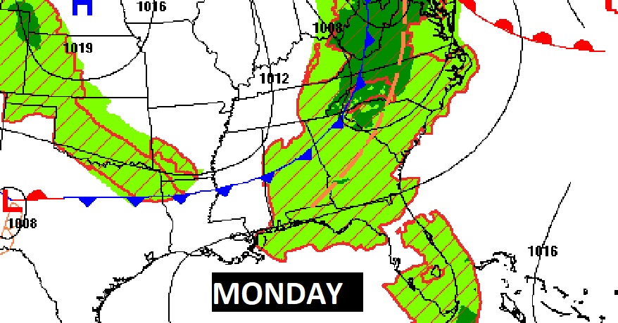
After 7AM Monday, the severe weather threat shifts across the southern half of the state along and ahead of the front.

.
NEXT FEW DAYS: It looks like an active weather week ahead with better than normal rain chance each day. Storms will be random but rather numerous, especially in the afternoon & evening hours. Highs will be mostly in the upper 80’s. Lows at night around 70.

Thanks for reading this Blog this morning! I’ll have another update for you in the morning. Stay weather aware!
–Rich