
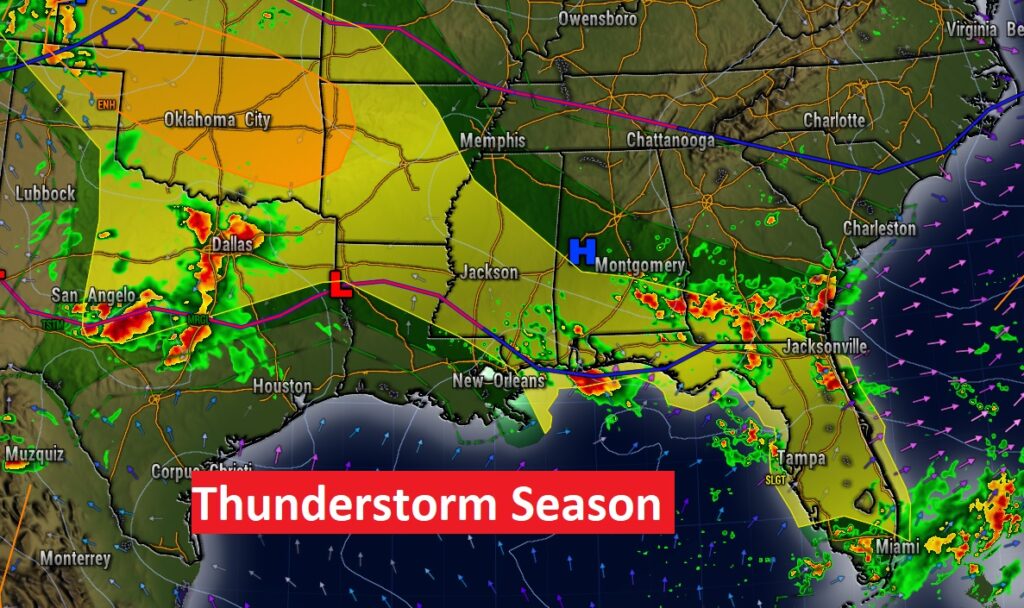
Good morning! Friday was another big thunderstorm day. There were several warnings. Our unusually stormy June series of days continues. The Storm Prediction Center has us in a Severe Weather Risk today, Sunday and Monday. That would be six days straight. Extremely unusual. Damaging wind gusts and large hail are the main threat. In between thunderstorm clusters, there will be limited sunshine. I really don’t see an end to this stormy pattern through mid-week. Stay Weather Aware.
TODAY: Once again today, a better than normal chance of showers and locally strong storms. Locally heavy downpours & intense lightning. In between thunderstorm clusters, there will be limited sunshine. The risk of storms continues this evening and overnight tonight. High today upper 80’s to near 90. Low tonight near 70.
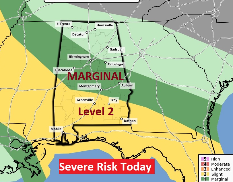
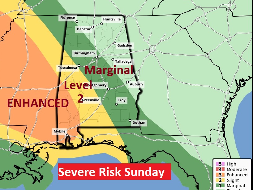
SPC has most of south Alabama in a Level 2 Severe Weather Risk again today. The rest of the area in a Marginal Risk. Damaging wind gusts and large hail are the main threat.
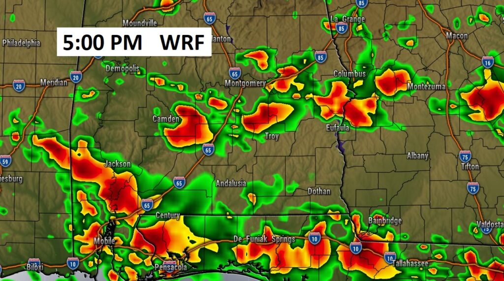
FUTURE RADAR: The most concentrated storms today will be close to the coast. But, all of us will run the risk of occasional thunderstorm clusters. Here’s a late afternoon example.
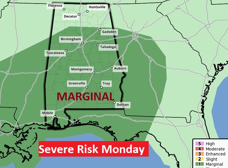
SEVERE WEATHER RISK: The multi-day Severe Weather Outbreak continues Sunday & Monday.
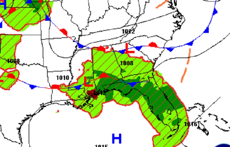
On Father’s Day Sunday, much of the area, again, is under a Level 1 Marginal Severe Risk. Southwest Alabama has a concerning Level 3 ENHANCED risk nosing into the state. Not a good weekend near the beach. Even Monday, SPC has the area in a Marginal Risk.
NEXT FEW DAYS: Scattered showers and locally strong storms through the next few days. Highs will be back in the upper 80’s next few days. Lows at night 70 to 73. Little Day to Day change.

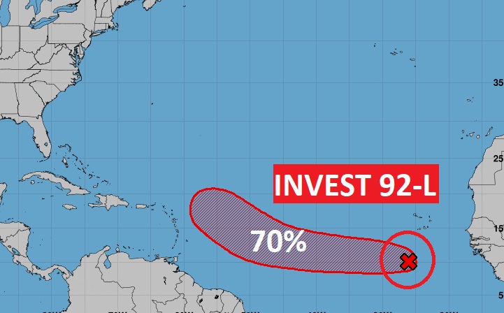
TROPICAL UPDATE: NHC is tracking invest 92-L in the eastern tropical Atlantic. This system now has a 70% chance of becoming a tropical cyclone. This is likely to become Tropical Storm Bret in the week ahead.
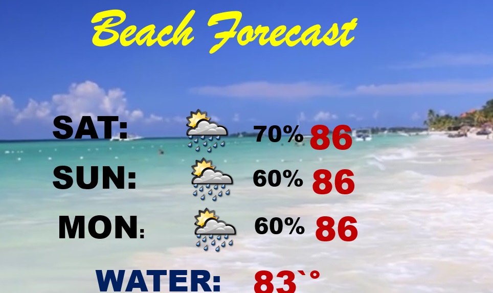
BEACH FORECAST: Have a Plan B. There will be a generous supply of storms roaming around each day. In fact, some storms could be severe. Warm & humid. Mid 80’s. Gulf Water Temperature 84. High rip current risk.
Thanks for reading this Blog this morning! I’ll have another update for you in the morning. Have a nice day!
–Rich