
Good Morning! It’s getting Hotter and more hazy. The July Heat Wave is expanding. Highs in the Upper 90’s today, and we’ll be teasing 100 on Wednesday & Thursday. The heat index will be near or over the 105 danger range, especially by Wednesday & Thursday. For now, our forecast is dry. Rain chance 10% or less. Scattered storms will return to the forecast Friday through Sunday. Here’s my brief Forecast discussion.
TODAY: Hazy Sunshine. Very hot and humid. High 98. Heat index 100 to 105. Should be dry. (10% chance or less) Low tonight 76. (Dewpoints in the upper 60’s to around 70)
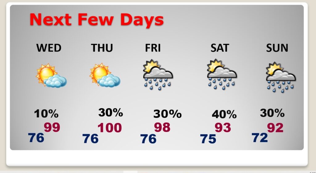
NEXT FEW DAYS: Extremely hot Wednesday and Thursday. We’ll be teasing 100 both days. . The heat index will be near or over the 105 danger range especially by Wednesday & Thursday. For now, our forecast is dry. Rain chance 10% or less. Scattered storms will return to the forecast Friday through Sunday. The weekend will be more typical for July, with lower 90’s and scattered random storms.
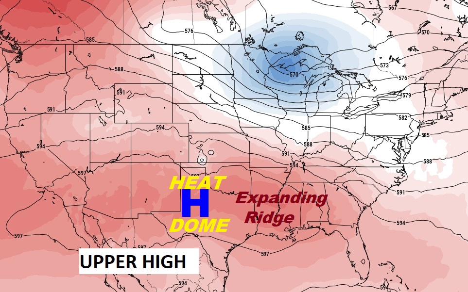
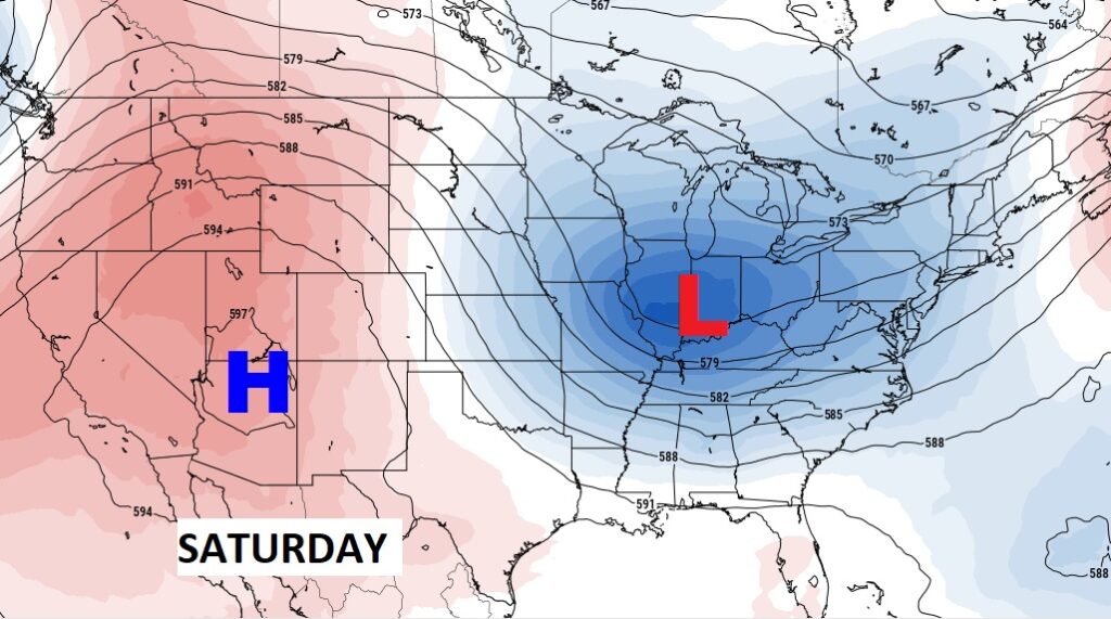
The big upper Heat Dome is expanding into our area, at least briefly. The hottest days will be Wednesday & Thursday. By the weekend, the heat dome retreats. A trough will develop in the east. The weekend will be more typical for July, with lower 90’s and scattered random storms.
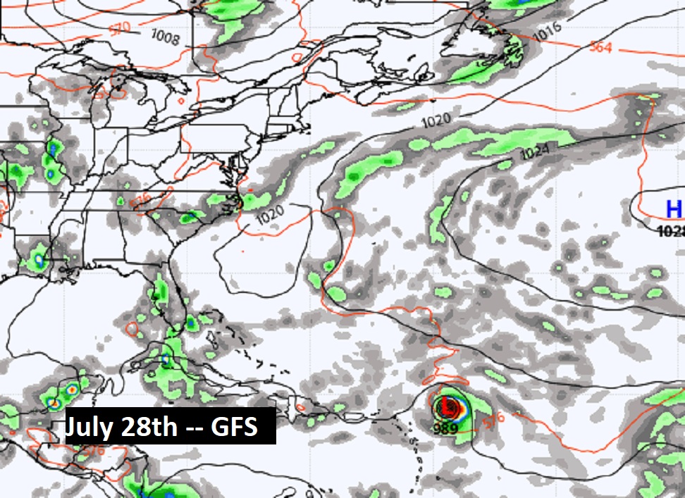
TROPICAL UPDATE: Tropical Storm Don is still spinning around in the central Atlantic. Maximum winds are now 40 mph. Not threatening any land areas. The rest of the tropics are quiet for now.

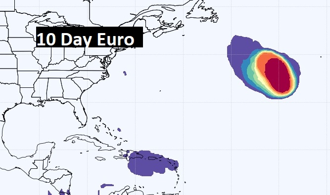
Both the GFS and the EURO are hinting at some Atlantic mischief in about 10 days. We’ll see.
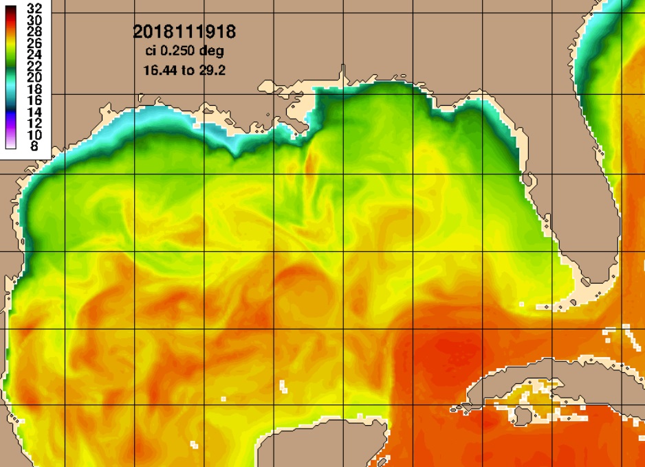
Sea surface temperatures are ridiculously high. Off the Florida southeast coast, some SSTs are in the lower 90’s. I’m not sure I’ve ever seen that.
Thanks for reading this Blog this morning! This morning we are LIVE on the radio from 6 to 9 on NewsTalk 93.1. Watch us on TV on CBS 8 and ABC 32. I’ll have another update for you in the morning. Stay cool. Stay hudrated. Have a nice day!
–Rich