
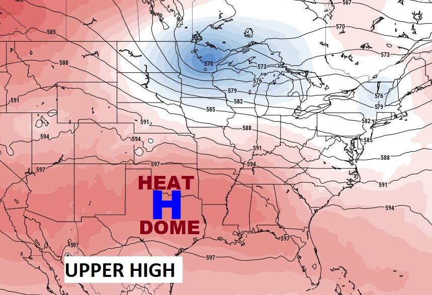
Good Morning! The Big Upper Heat Dome covers all the Southern U.S. from California to Jacksonville. Dangerous heat indices continue. The Heat Advisory continues today. Yesterday at MGM the Heat Index reached 110. We’ll be near 110 again today. Rain chances are very low through Friday. But, as the upper high retreats, expect big changes over the weekend. Scattered to numerous random storms will return, as a front slides southward into the state. Temperatures will be much more reasonable with highs in the lower 90’s. Here’s my brief Forecast discussion.
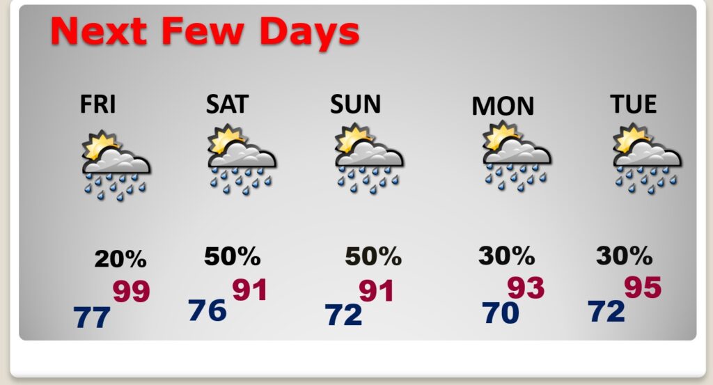
TODAY: HEAT ADVISORY continues. Hazy Sunshine. Very hot and humid. High 99. Heat index near 110. Rain chance 10% at best. Low tonight 77.
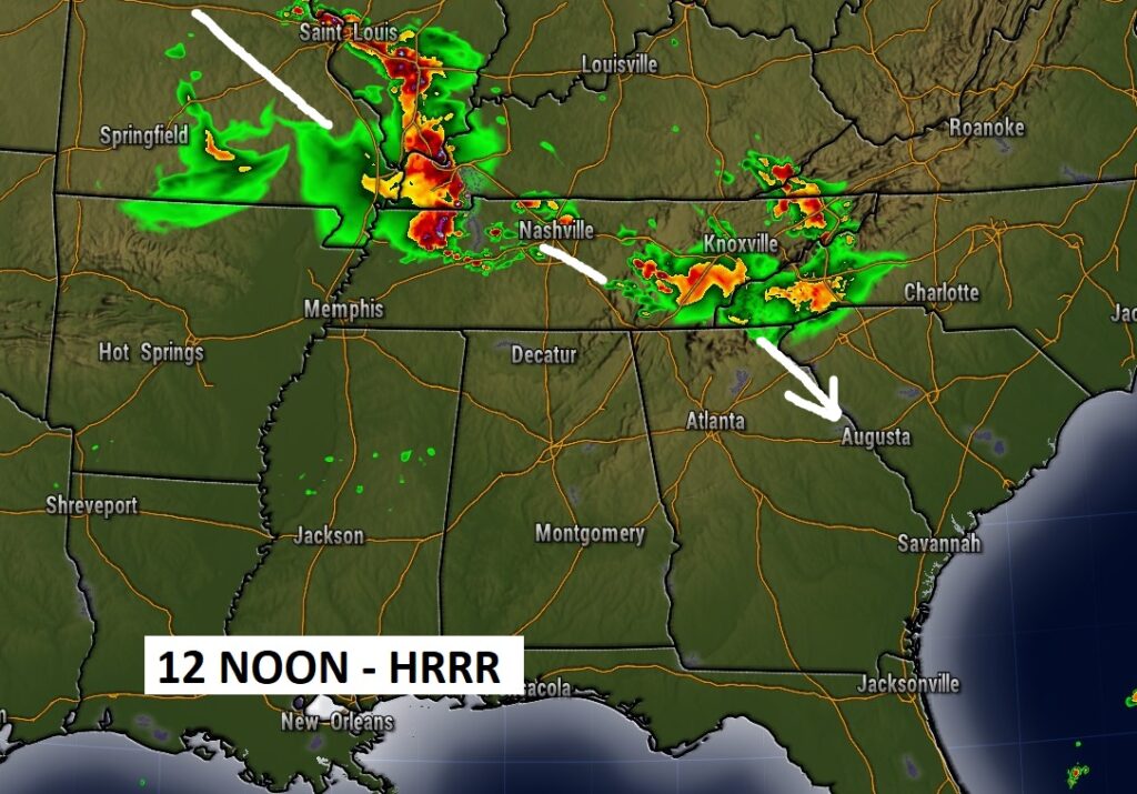
Future Radar (HRRR) showing today’s Storm Clusters (MCS) are likely to by-pass us. Perhaps clipping NE Alabama and into Georgia.
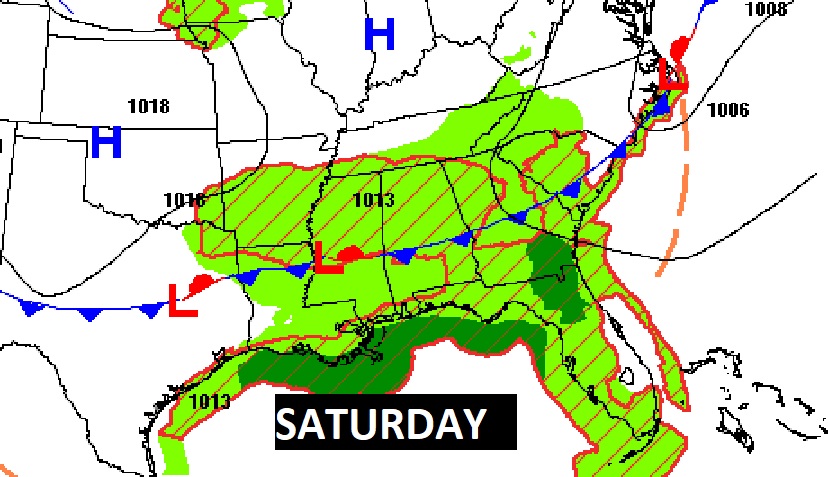
NEXT FEW DAYS: Extremely hot Wednesday and Thursday. We’ll be teasing 100 Thursday . The heat index will be near 108 again. For now, our forecast is dry. Rain chance under 20%. Scattered storms will return to the forecast Friday. Storms become much more numerous over the weekend, as high temperatures come down to the lower 90’s.
The big upper Heat Dome has expanded into our area, at least briefly. The hottest days will be today & Thursday. By the weekend, the heat dome retreats. A trough will develop in the east. The weekend will be more typical for July, with lower 90’s and scattered to numerous random storms.
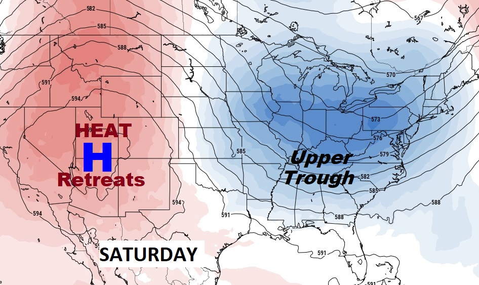
That upper trough Saturday will allow a front to drift southward into the state. .
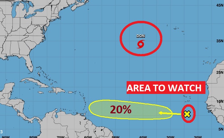
TROPICAL UPDATE: “Fish” storm, Tropical Storm Don is still spinning around in the central Atlantic. But, now NHC is tracking a new feature. A Tropical Wave in the Tropical Atlantic is tracking westward. So far, a low 20% chance of development in the next 7 days.
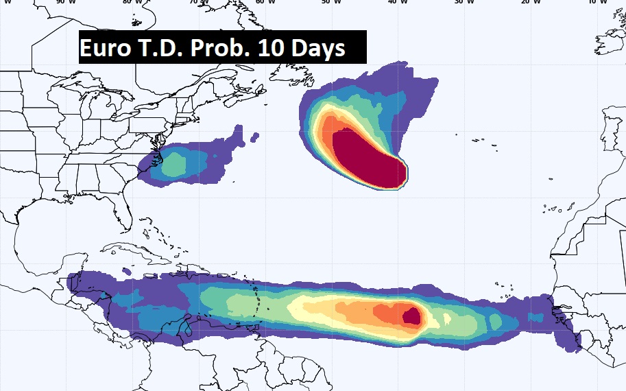
The Euro model shows the potential for tropical development in the Caribbean is growing over the next 10 days.
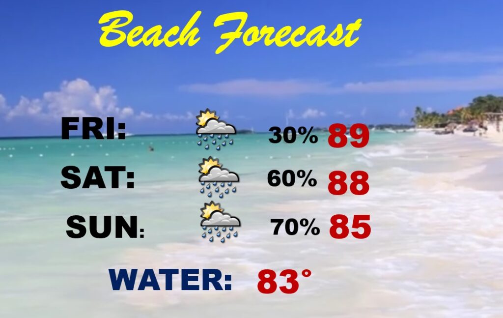
BEACH FORECAST: It has been a great week at the Beach. But,Storms will become more numerous over the weekend, particularly Saturday and Sunday.
Thanks for reading this Blog this morning! This morning we are LIVE on the radio from 6 to 9 on NewsTalk 93.1. Watch us on TV on CBS 8 and ABC 32. I’ll have another update for you in the morning. Stay cool. Stay hydrated. Have a nice day!
–Rich