
Good Morning! Today should be dry and hot. But, an approaching front will bring some storms to north Alabama today. That’s the front that will bring a small chance of showers and thunderstorms to our forecast tomorrow. But, behind that front on Friday, expect a big drop in humidity. Some nice air. That nicer air will stick around this weekend, too. In the Tropics, all eyes are on Lee, which is expected to become a hurricane today. It’s already intensifying quickly, but it could undergo “Explosive rapid intensification to a major hurricane status within the next 48 to 72 hours. We’ll be watching Lee for several days. It’s ultimate future potential interaction with land is uncertain. Have a nice day! Here’s my brief forecast discussion.
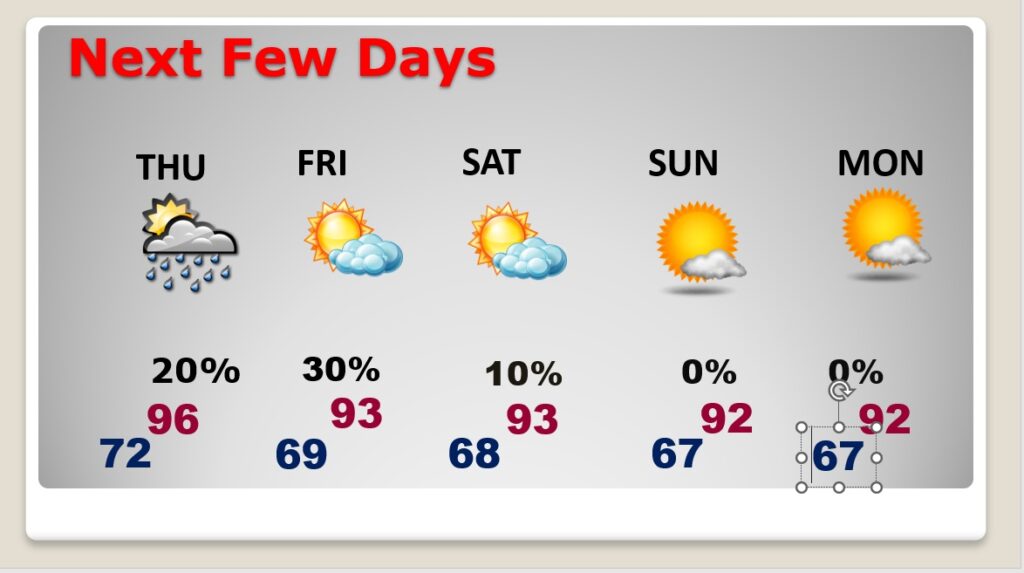
TODAY: Mostly sunny & Hot. High 96. Heat index near or above 100. SE wind 5 to 10. Increasing clouds tonight. Low near 72.
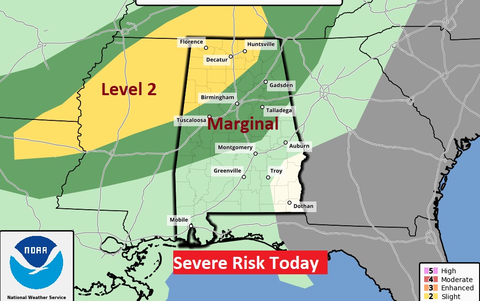
Although central and south Alabama should be dry today. A few strong thunderstorms are possible across north Alabama ahead of an approaching front.
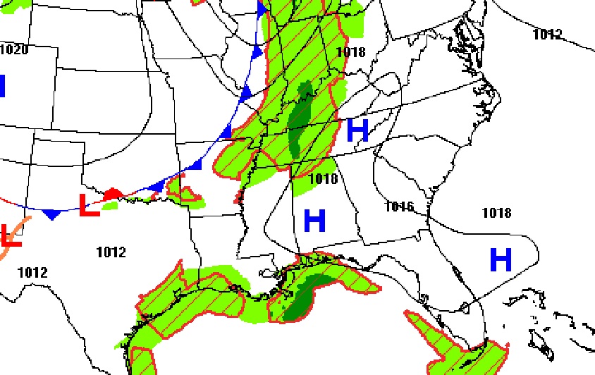
That’s the front that will bring a small chance of showers and thunderstorms to our forecast tomorrow.
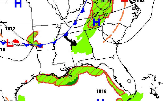
NEXT FEW DAYS: That approaching front will bring Widely scattered storms on Thursday. But, behind that front on Friday, expect a big drop in humidity. Some nice air. That nicer air will stick around this weekend, too.
TROPICAL UPDATE: There are currently three features in the east Atlantic.
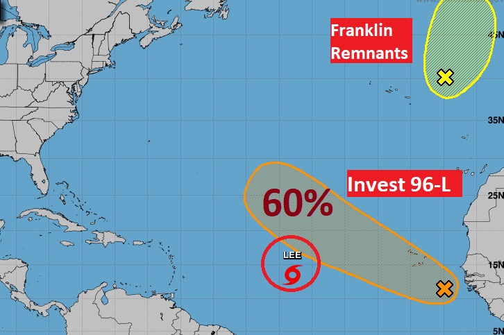
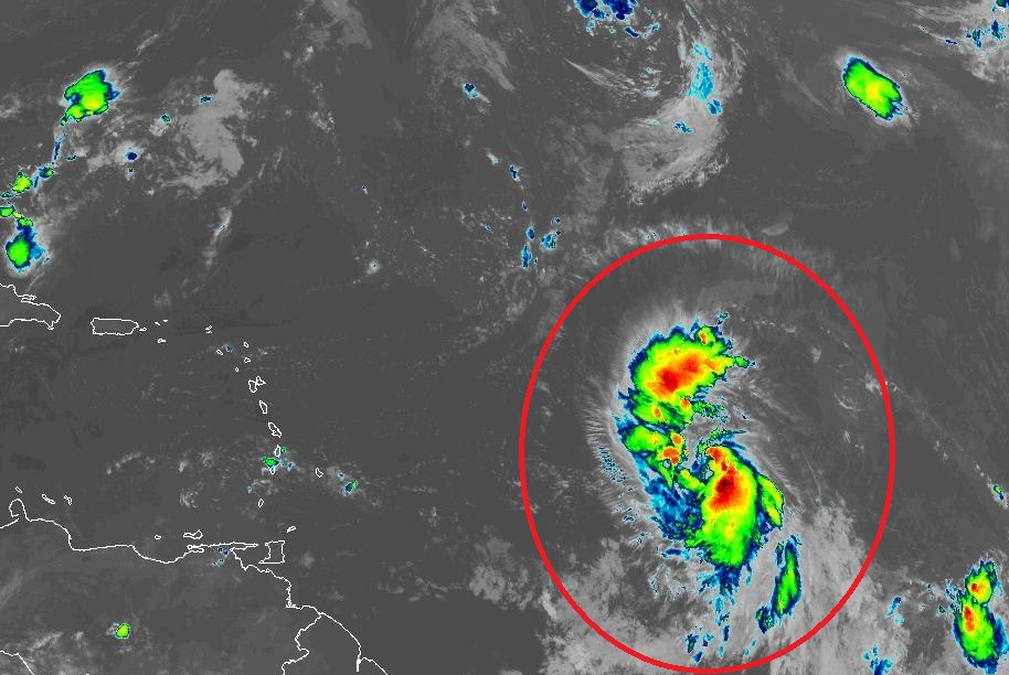
There’s only one we’re going to talk about. Make no mistake about it, LEE is going to become a big deal and its ultimate destination and potential interaction with land areas is not known. It is already quickly intensifying with 65 mph winds and is expected to become a hurricane today.
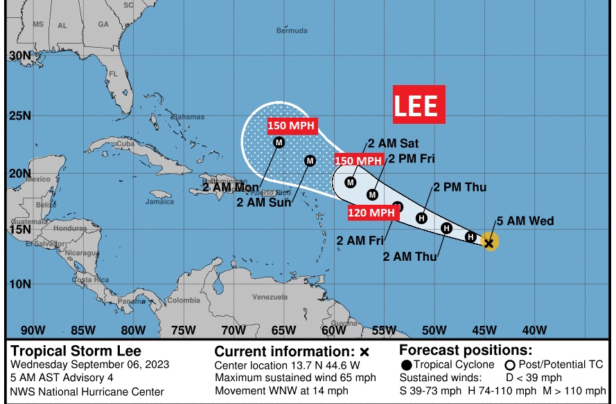
Most models take Lee to Major Hurricane Status rather quickly. In fact, NHC is using words like, “Potential Explosive intensification in a very favorable environment. NHC takes the storm to 150 mph intensity in 72 hours. Cat 5 begins at 158 mph. Lee is expected to just miss the northern Leeward islands, but the track is uncertain.
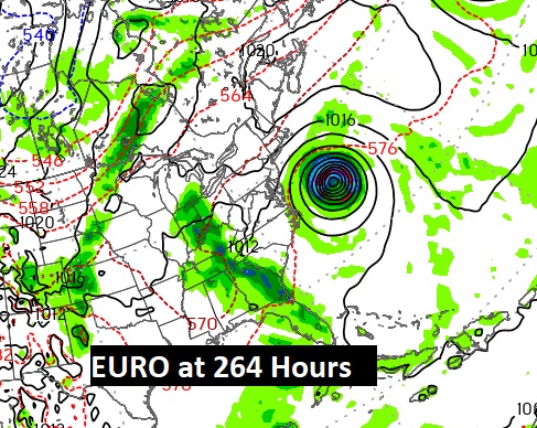
Here’s the Euro Ensemble Model tracks. You can see there are many possibilities.
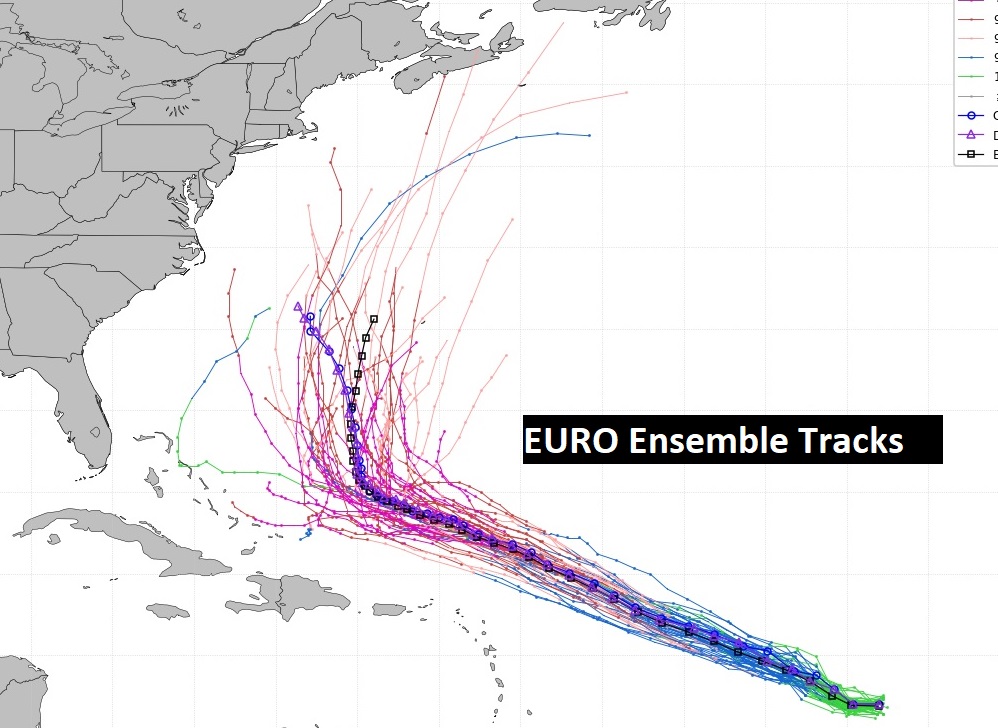
Could LEE ever threaten the eastern United states in the next 9-11 days? Too early to say.
Thanks for reading this Blog this morning! This morning we are LIVE on the radio from 6 to 9 on NewsTalk 93.1. I’ll have another update for you in the morning. Have a nice day!
–Rich