
4:00 PM CDT NHC:
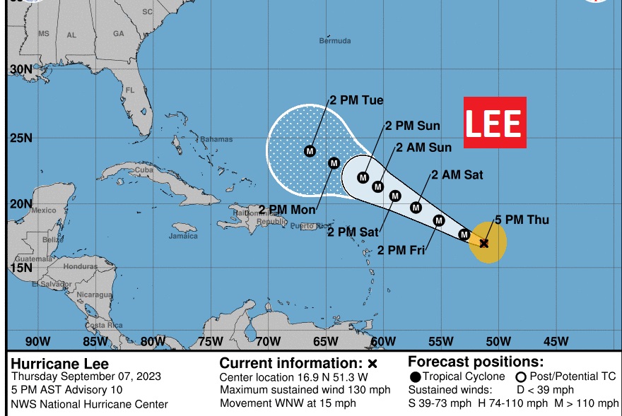
Talk about RAPID intensification. LEE has intensified from 105 Mph Cat 2 status to 130 mph Cat 4 status on the 5PM EDT Update. Expected to reach incredible 165 mph Cat 5 status is 24 hours. Historic intensification. RECON Mission currently headed toward #Lee
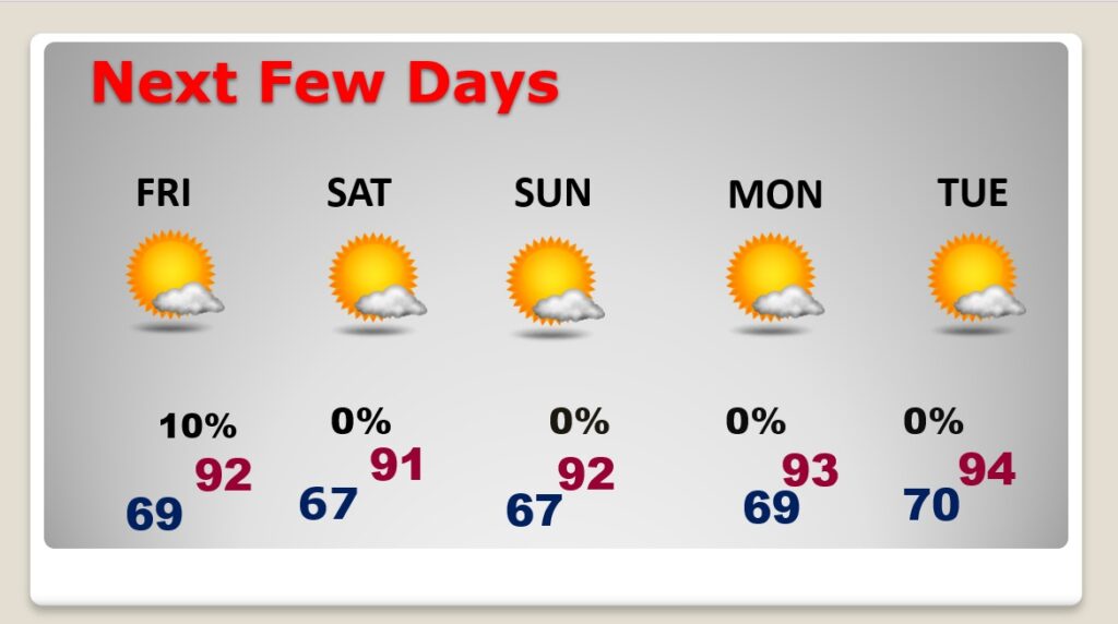
Good Morning! Our forecast for the next few days is simple and uneventful. We’re headed for the mid 90’s again today with a Heat Index close to 100. But, a southward moving front could touch off a few isolated showers or storms in central and south Alabama. But, not many. Behind the front, the humidity will be noticeably lower on Friday. And, this trend to lower humidity will continue through the weekend. The weekend will be sunny and dry. There could be some widely scattered storms by the middle of next week. In the Tropics, all eyes are on LEE, which is likely to become a monster, dangerous historic Category 5 hurricane in the Atlantic. Here’s my brief forecast discussion.
TODAY: Mostly sunny & Hot. Rain chance 20% at best. High 95. Heat index near 100. Light wind. Partly cloudy tonight. Low near 69.
A southward moving front could touch off a few isolated showers or storms in central and south Alabama. But, not many.
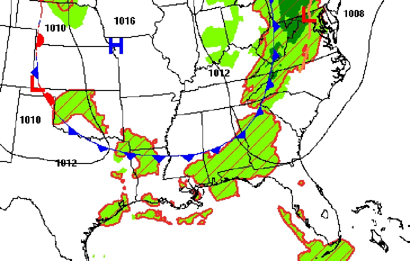
The front that will bring a small chance of showers and thunderstorms with the best chances south of US80/I-85.
NEXT FEW DAYS: Behind that front on Friday, expect a big drop in humidity. Some nice air. That nicer air will stick around this weekend, too. Highs mostly low 90’s. Upper 60’s at nice will feel good. Perhaps a small rain chance by the middle of next week.
TROPICAL UPDATE: There are currently three features in the east Atlantic. Invest 96-L will probably become Margot.
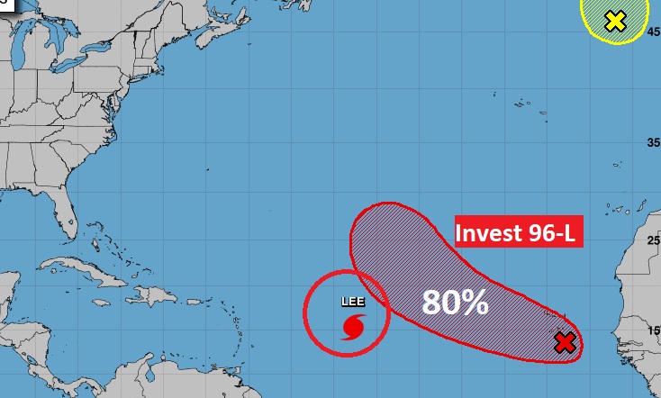
Lee is the big deal. A potential historic monster hurricane. It’s looking better and better on the satellite this morning.
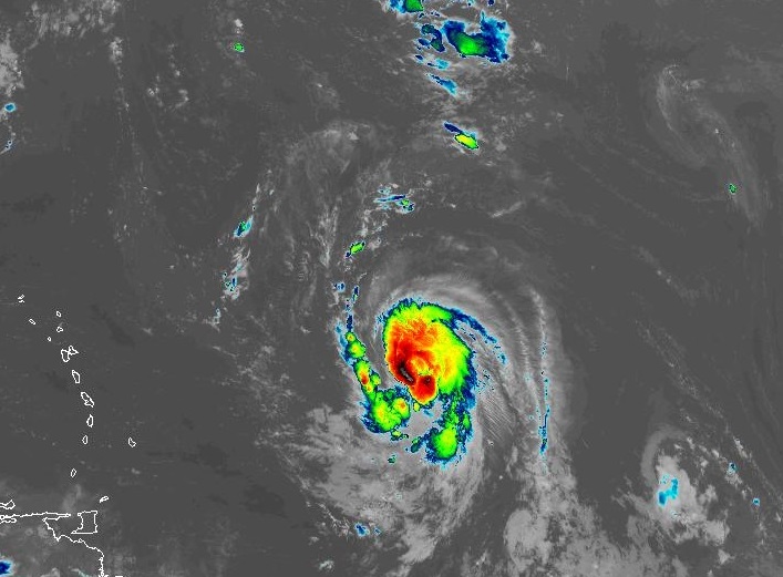
Hurricane Lee, this morning is intensifying Winds now 80 mph. NHC takes the storm to major hurricane status is 36 hours, and nearly Cat 5 155 mph intensity in 60 hours. Cat 5 begins at 158 mph. Lee is expected to just miss the northern Leeward islands, but the track is uncertain. It’s now less than a 1000 miles from the northern Leeward Islands.
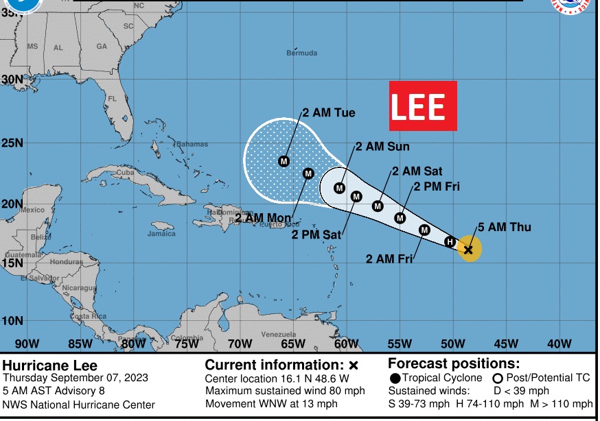
Here’s the Euro Ensemble Model tracks. You can see there are many possibilities. But, the point is, most of the tracks take Lee to the north – away from the eastern United states. But, it’s not a done deal yet. Much depends on a steering trough of low pressure over the eastern US next week.
Thanks for reading this Blog this morning! This morning we are LIVE on the radio from 6 to 9 on NewsTalk 93.1. I’ll have another update for you in the morning. Have a nice day!
–Rich
Here’s my brief forecast discussion.
Thanks for reading this Blog this morning! This morning we are LIVE on the radio from 6 to 9 on NewsTalk 93.1. I’ll have another update for you in the morning. Have a nice day!
–Rich