
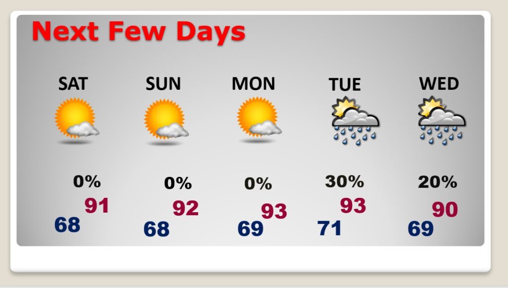
Good Morning! The weekend news looks pretty good. The front that moved through yesterday will deliver slightly lower humidity today and over the weekend. Highs will still be in the lower 90’s, but the dewpoint will be lower. For instance, instead of dewpoints in the low 70’s, it will be closer to 60 this afternoon. Better! And, even Lows in the upper 60’s at night. Looks like a dry weekend forecast with lots of sun. Dry through at least Monday. Slight chance of showers will return by the middle of next week. Monster Historic Cat 5 LEE is exploding in intensity in the Atlantic. Where will it be late next week? Here’s my brief forecast discussion.
TODAY: Mostly sunny. Not as humid. Noticeably lower. High near 90. Light wind. Mainly clear tonight. Low in the upper 60’s.
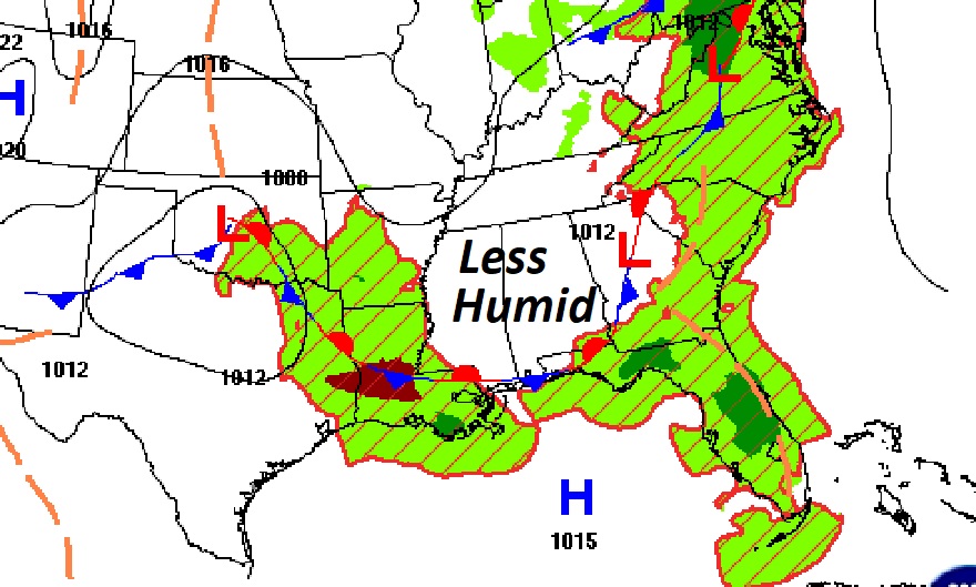
The front has gone close to the coast. Less humid air is flowing into Alabama.
NEXT FEW DAYS: The weekend news is very good. That nicer air will stick around this weekend, too. Sunshine will dominate. Storm-free/dry. Highs mostly low 90’s. Upper 60’s at nice will feel good. Perhaps a small rain chance by the middle of next week.
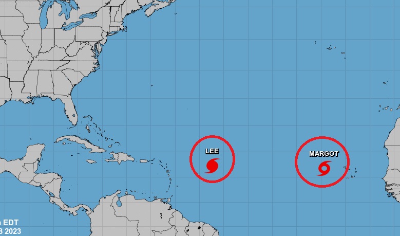
TROPICAL UPDATE: There are currently two features in the east Atlantic. Monster Hurricane Lee and Tropical Storm Margot.
Lee is HISTORPIC. Talk about Rapid Intensification, there are few storms in history that have exploded in intensity as quickly as Lee. Simply frightening.
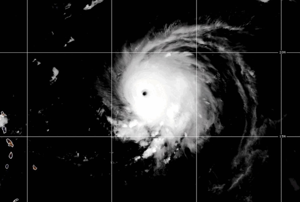
Hurricane Lee is an extremely dangerous Category 5 Super Hurricane it continues to intensify. Yesterday at 4AM it was a 105 Cat 2 Hurricane. By 10PM last night it was ax extremely dangerous Cat 5 Hurricane. Historic Rapid Intensfication. Here’s the latest advisory from
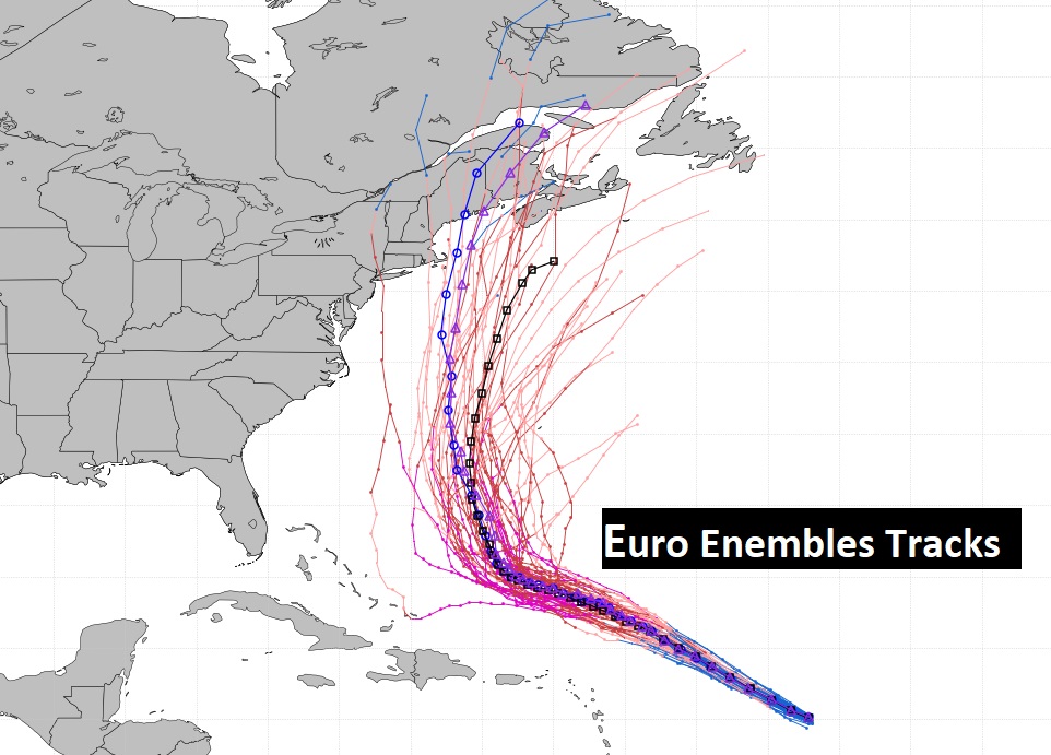
Here’s the Euro Ensemble Model tracks. You can see there are many possibilities. As you can see, late next week, there are many disturbing possibilities for the northeastern coast of the United States, and costal Atlantic Canada. Lee will undergo several intensity adjustments over a period of several days.
Thanks for reading this Blog this morning! I’ll be on an airplane early this morning. Heading to hyet another weather conference. This one in Kansas City. National Weather Association Annual conference. I’ll have a brief Blog update for you in the morning. Have a nice day!
–Rich