
Good Morning! No “big ticket” weather next few days. Summer officially continues for 9 more days, and no doubt about it, it’s still a routine summer pattern. The best news is – we may fall short of the 90 degree mark for the next several days. Highest rain chance of the next five days could be Saturday. There will be a an “inverted” trough over us, and plenty of Atlantic and Gulf moisture. But, there’s no tropical concerns for us in this part of the world, and here at the peak of the season, that’s significant. Meanwhile, the Atlantic is on fire. Here’s a brief forecast discussion.
TODAY: Partial sunshine. High 86. Spotty random scattered storms, especially afternoon and evening. Low tonight 69.
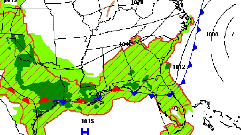
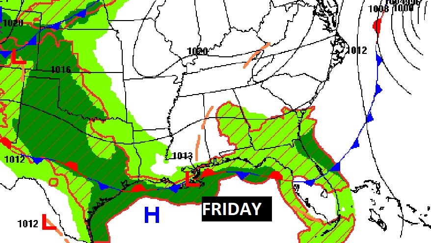
The frontal system will stay closer to the coast today and tomorrow.
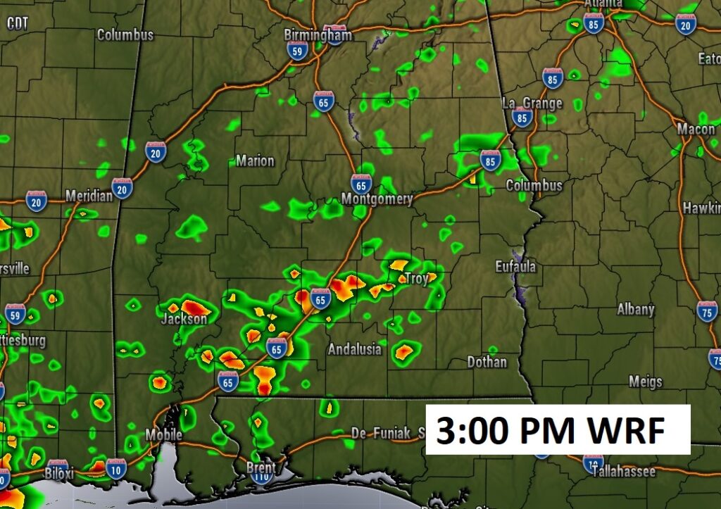
Future radar. Scattered random storms.
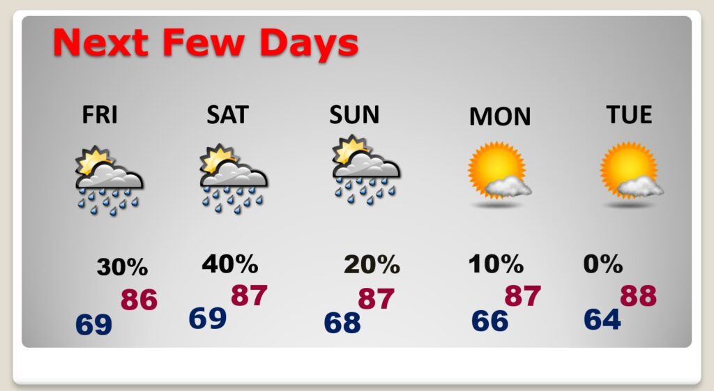
NEXT FEW DAYS: The best news is, it looks like we will stay below 90 degrees Thursday through Tuesday. Highs in the 80’s daytime, 60’s at night. Spotty random storms each day. The chances are a tad higher, Saturday. Be prepared for scattered showers and thunderstorms. Storms will be widely scattered Sunday. Monday looks dry.
TROPICAL UPDATE: There are currently 3 features in the east Atlantic. Lee and Tropical Storm Margot. Plus, there’s Invest 97-L, which is likely to become Nigel. Nigel might be the next storm to tease the United States several days from now.
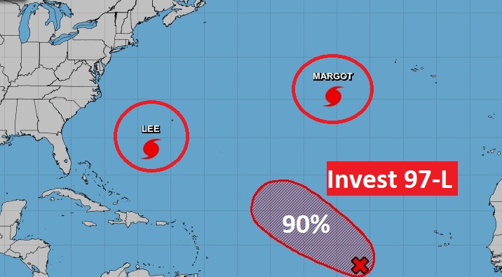
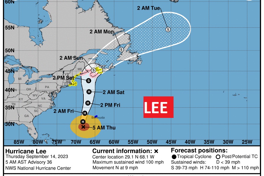
Hurricane Lee is a Category 2 Hurricane with 100 mph winds. Moving slow… It’s moving NW at 6. The right turn has finally happened. Parts of of New England (particularly Maine) and Atlantic Canada is in the cross hairs. Could make landfall, probably as a Tropical Storm.
Thanks for reading this Blog this morning! This morning we are LIVE on the radio from 6 to 9 on NewsTalk 93.1. I’ll have another update for you in the morning. Have a nice day!
–Rich