
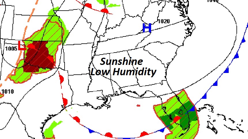
Good Morning! You just couldn’t write a better script for our weather. If you liked yesterday, you’ll love today. Our spectacular Fall Preview continues. Today will be another day of total sunshine, and low humidity after a pleasantly cool “fall-like” morning. This great weather pattern will stick around for the rest of this week. Friday is the last official day of summer. Fall begins on Saturday. The Autumnal Equinox. Enjoy! Here’s my brief forecast discussion.
TODAY: Abundant sunshine. Comfortable humidity. High in the mid to upper 80’s. Little breeze. East wind 5 to 10 mph. Partly cloudy and comfortably cool tonight. Low 61.
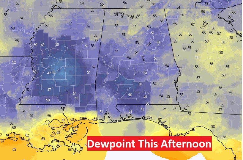
Take a look at Dewpoints this afternoon around 4:00PM. Oh my god. Ideal. Perfect. Comfortable. Good stuff.
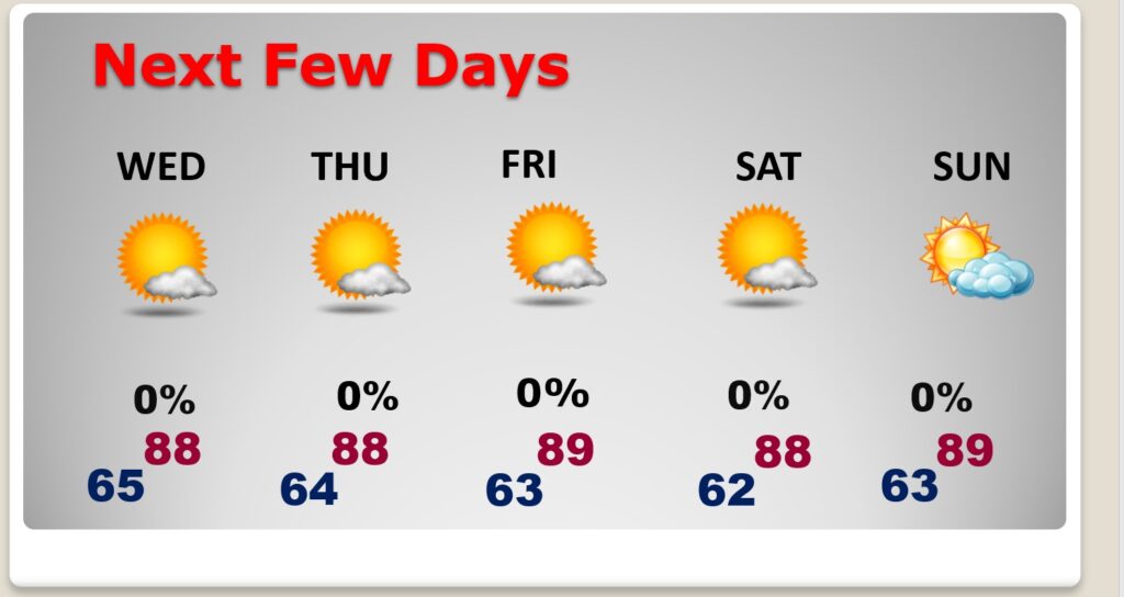
NEXT FEW DAYS: A great Fall Preview. Mostly sunny through Friday with highs in the upper 80’s and very tolerable humidity. Nights in the 60’s. Tuesday night. Dry and storm free. Friday is the last official day of summer. Fall officially begins Saturday. The Autumnal Equinox.
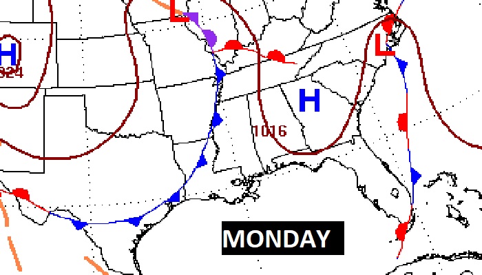
Early next week, a cool frontal system will approach. I’ll put in a small chance of showers in the Monday/Tuesday time frame next week. Otherwise, it’s clear sailing for us.
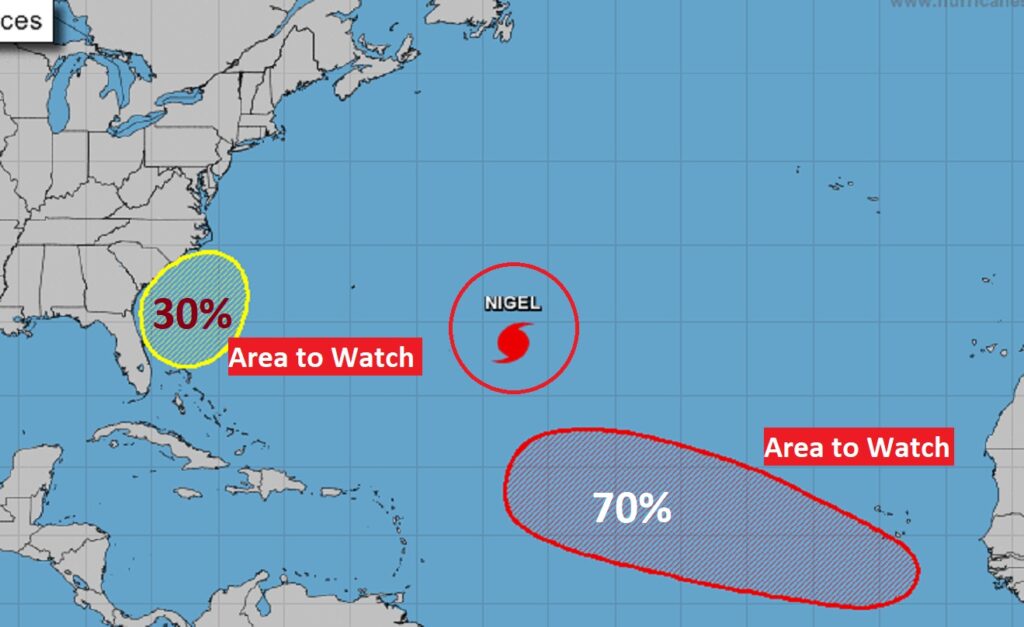
TROPICAL UPDATE: There are currently 3 features in the Atlantic, Including Hurricane Nigel. That Area to Watch off the SE US coast is worth noting. It could acquire some sub-tropical characteristics by the weekend. There’s also an Area to watch in the far east Atlantic. The next two available names are: Ophelia and Philippe. There are no tropical concerns in our part of the world.
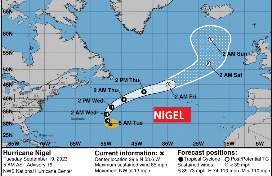
Hurricane Nigel is Cat 1 with 85 mph winds. It is a classic example of what’s called a ‘fish storm”. It will make the big curve into the Atlantic.
Thanks for reading this Blog this morning! This morning we are LIVE on the radio from 6 to 9 on NewsTalk 93.1. I’ll have another update for you in the morning. Have a nice day!
–Rich