
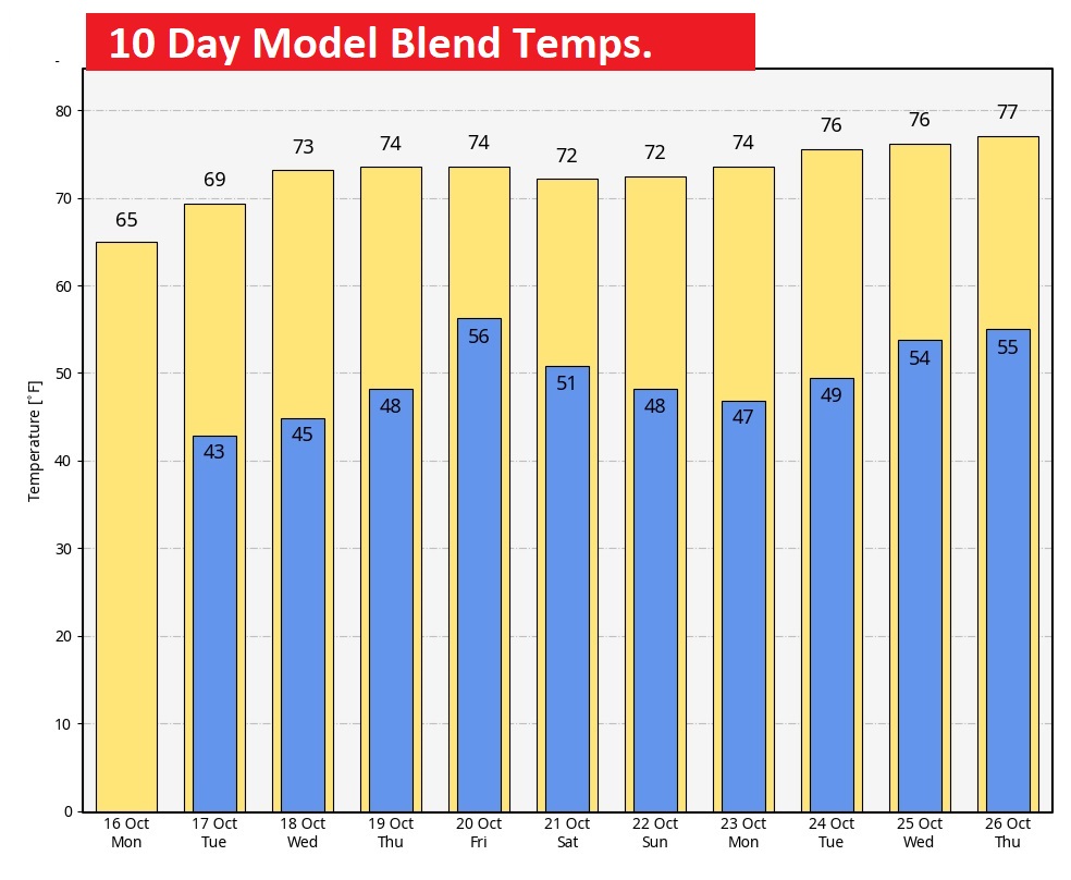
Good Morning! We are settling into a pretty nice pattern for most of the week ahead with cool days and chilly Jacket weather nights. Much of the week ahead will be dry. Expect comfortable 70’s starting tomorrow & Wednesday. Looks like the next chance will arrive by Thursday night/Friday. Showers & thunderstorms. Otherwise, our forecast is uneventful. Here’s my forecast discussion.
TODAY: Nice start to the week. Good bit of sunshine. Breezy. Cool. High 66. Northwest wind 8 to 16 mph. Mostly clear, chilly tonight. Low 44.
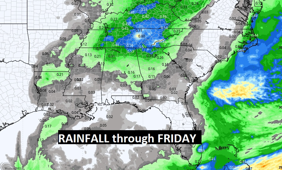
NEXT FEW DAYS: Normal high is 81, low 55. We’ll be below normal for the week ahead. Expect comfortable 70’s starting tomorrow & Wednesday. Looks like the next rain chance will arrive by Thursday night/Friday. Showers and perhaps a few thunderstorms. Right now it does not look like a severe weather situation – but we are edging closer to severe weather season.
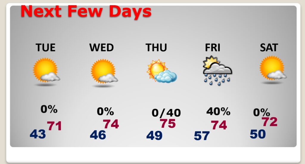
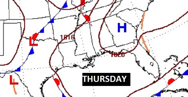
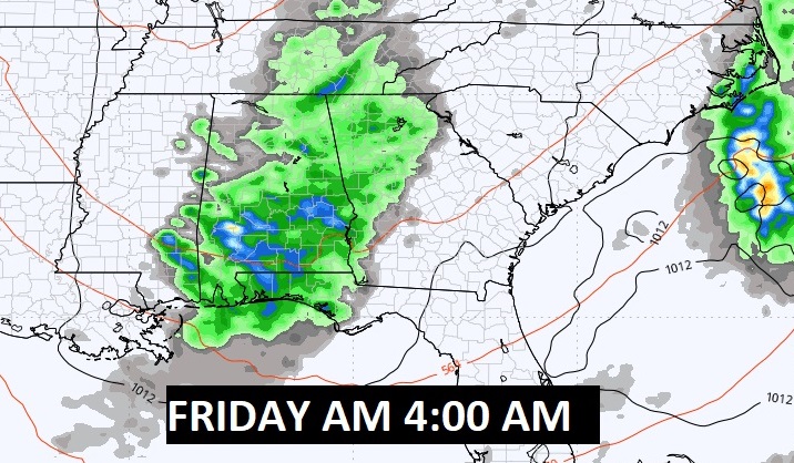
Thursday daytime looks dry, but the risk of showers and storms arrives overnight Thursday into Friday.
Pleasant Fall temperatures next several days.
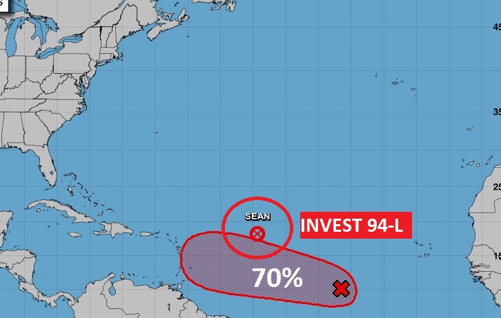
TROPICAL UPDATE: NHC just wrote the last advisory on Post Tropical Cyclone Sean. Invest 94-L will likely become Tammy and could threaten the Islands in a few days. Could eventually become a hurricane.
Thanks for reading this Blog this morning! This morning we are LIVE on the radio from 6 to 9 on NewsTalk 93.1. I’ll have another update for you in the morning. Have a nice day!
–Rich