
Good Morning! We are enjoying a brief break in between Mega Storm Systems. Today will be chilly. Thursday will be a little warmer. But, all eyes are on a potentially strong Friday storm system with potentially Dangerous Tornado Threat. An ENHANCED Level 3 out of 5 risk. Rain and thunderstorms could begin as early as overnight Thursday night, but the main action will be on Friday, and especially Friday afternoon. Then, get ready. We have some arctic air in our future. We’ve been talking about this for weeks. Arctic air floods into the state starting this weekend. Ready or not, get ready for a temperature crash. Here’s my brief forecast discussion.
TODAY: Sunny & Chilly. High 51. West wind 10 to 15 mph. Partly cloudy, chilly tonight. Low 35.
.
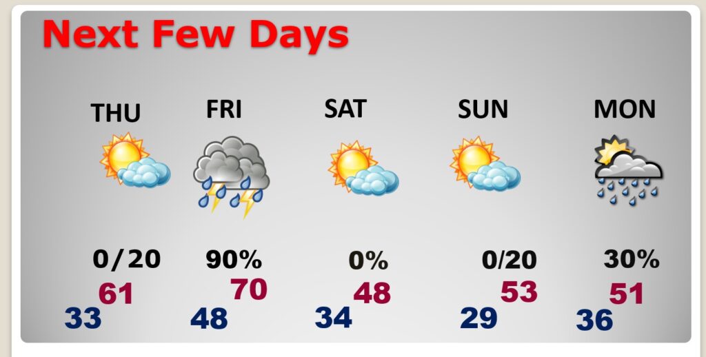
NEXT FEW DAYS: Thursday looks like the best day of the week. Mostly sunny. Temperatures rebound on ahead of the next storm system. Here comes another Big Deal storm system Friday with more rain and thunderstorms and a particularly dangerous tornado threat. Then, get ready for the start of an arctic invasion starting over the weekend. That’s round one. Small chance of precipitation late Sunday night and MLK day Monday. Probably rain. Then round two of Arctic air follows.
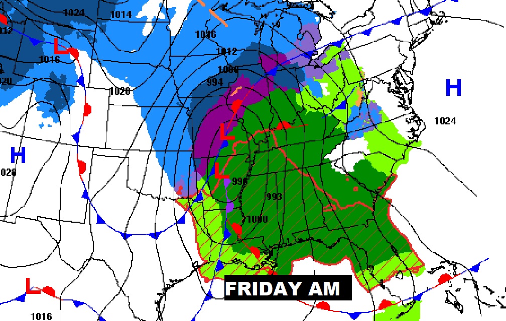
DANGEROUS FRIDAY STORM SYSTEM: On the heals of yesterday’s mega-storm system which affected 30 states, here we go again. You do not have to be a genius to see the enormous scope of this Friday storm system. I’s massive. It’s multi-faceted and it’s DANGEROUS.
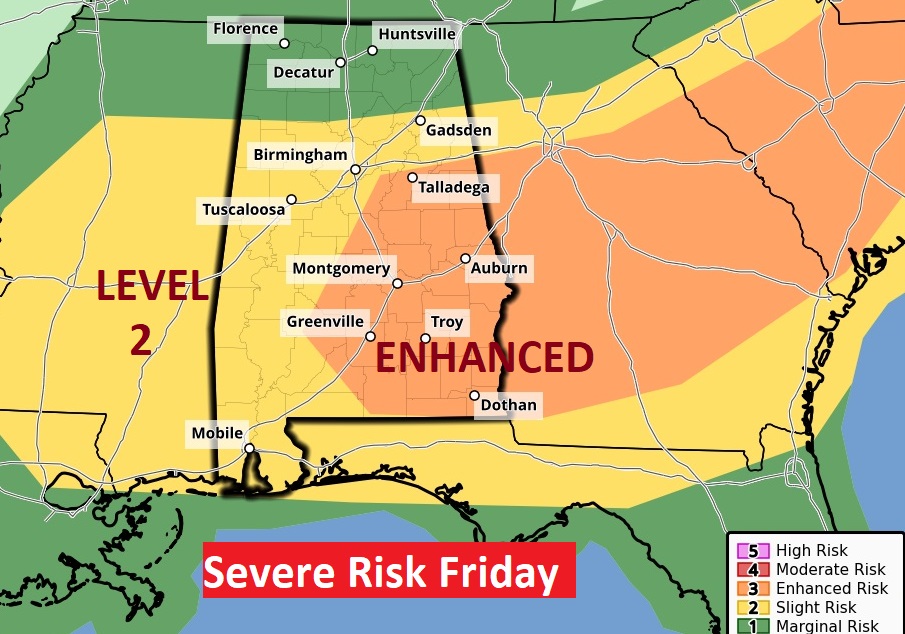
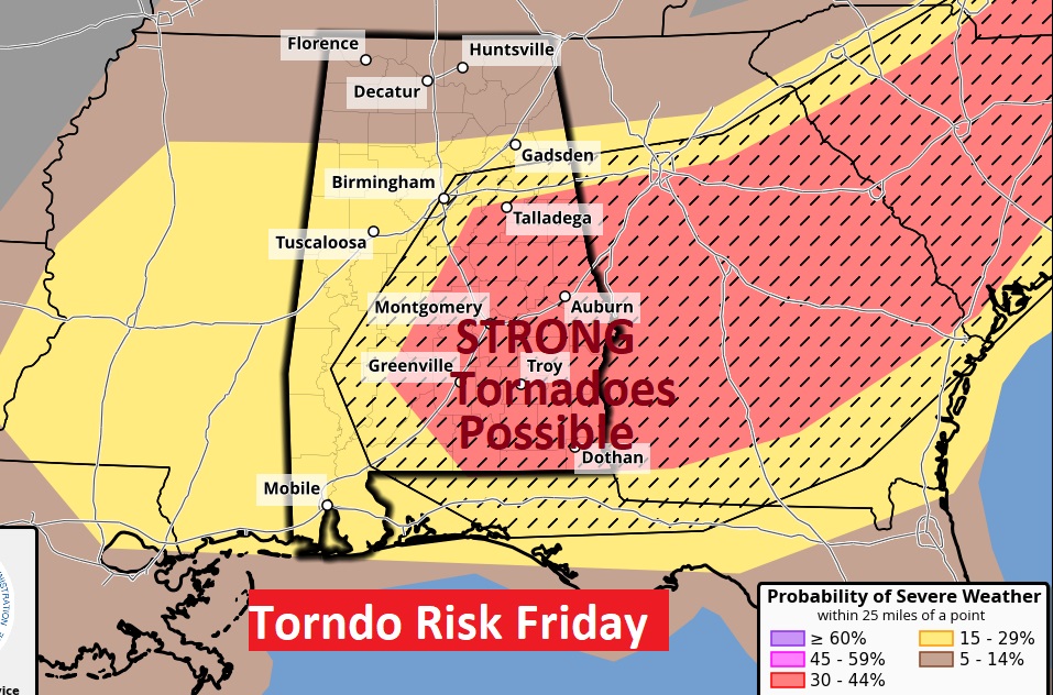
The Severe Weather Outlook from The Storm Prediction Center is ugly. It includes a Level 3 Enhanced Level 3 out of 5 Severe Weather Risk. All modes of severe weather are on the table. But, the map on the right is particularly concerning. Whenever, SPC adds hatched lines on the Tornado Risk map, it suggests the threat of Strong long-lived tornadoes (EF-2+). Fortunately, this time it won’t be in the middle of the night. We’ll continue to monitor this threat closely. We have time to get ready today and Thursday. Ironically, Friday is the one year anniversary of TWO Big Tornadoes last year. Downtown Selma. Plus, the Autauga county tornado which killed seven and injured many.
The Global Models have been hinting for weeks about a potential Big Deal Mid January Arctic Invasion. If you are a regular reader of this blog, we have been hinting about this for weeks. Here’s the 10 day Model Blend Temperature trend, but let me warn you. It may even colder than these numbers indicate. Sometime the models under estimate these temperature crashes. Not happy about this.
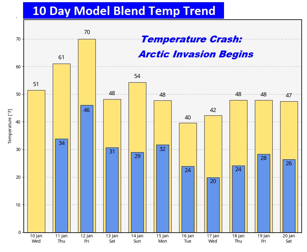
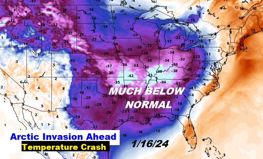
Rich is NOT a happy guy this morning. Very worried about the Friday tornado threat, and really not happy about the Arctic Invasion that follows, even though we’ve sorta known about this scenario for weeks.
This morning everything is normal including Live on the radio 6 to 9AM on NewsTalk 93.1 WACV. There will be another Blog update in the morning.
–Rich