
Good Morning! Yesterday, Alabama and the Gulf South got a break from Mother Nature. There simply was not enough instability for storms to become severe. Fortunately, this time, the Severe Threat fizzled. Our weekend will be uneventful. It’ll be chilly, but storm-free, dry and mostly sunny. We’ll be running about 7 or 8 degrees below normal. But, hang on. I’m sure you know by now. We’re in for a Temperature Crash in the week ahead, as an Arctic Invasion engulfs much of the Nation. The main Arctic Temperature Crash arrives here Tuesday. We’ll be in the teens by Wednesday and Thursday morning. Wind Chill will be fall to the single digits. Plus, parts of the state may see wintry mix or some light snow. Accumulation, if any would be very minor. Details on the time line below.
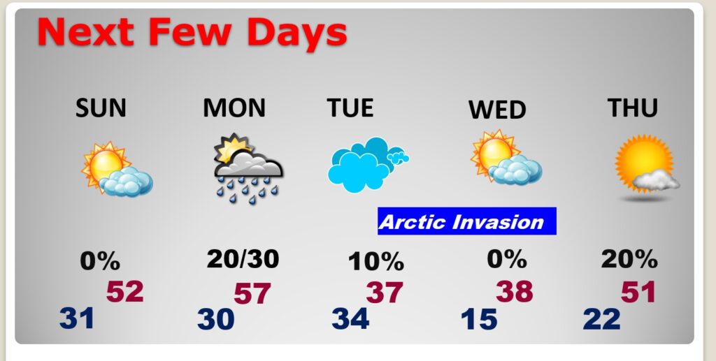
TODAY: Mostly Sunny and quite chilly. High 49. West wind at 10 to 15 mph will add a bite. Partly cloudy and cold tonight. Low 31.
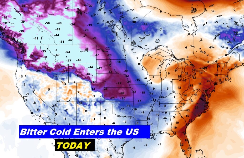
Here’s where the Extreme Arctic Air is today.
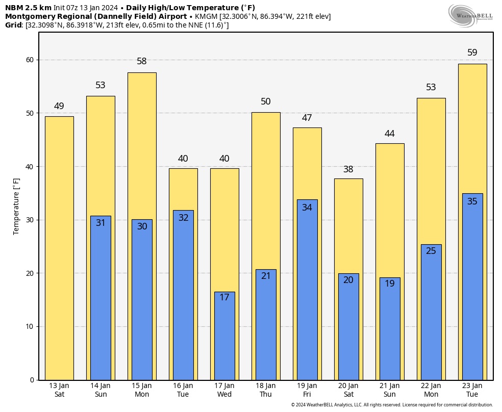
NEXT FEW DAYS: Get ready for a Temperature Crash. We have some very cold arctic air in our future. The main Arctic Temperature Crash arrives Tuesday. Highs on Tuesday and Wednesday may not make it out of the 30’s. We’re headed for the teens Wednesday and Thursday mornings. Not only that. Wind chill will be in the single digits Wednesday morning. It’ll be the coldest air since Christmas Week 2022.
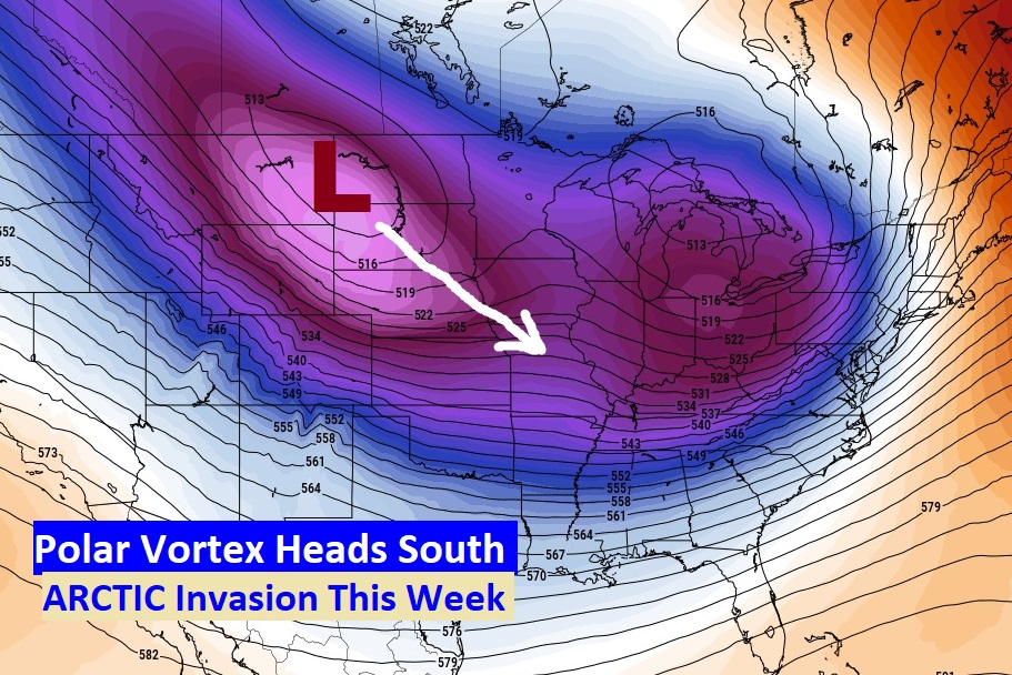
The so call Polar Vortex will be heading southeastward. Get ready for a temperature crash.
Not only that. Some parts of the state could see some wintry precipitation including some light snow. Impacts are expected to be minor Monday night into Tuesday. See map below for details.
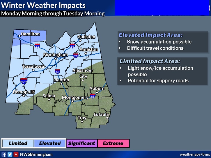
What about farther south? Small rain chance Monday and Monday night here in central Alabama. Could there briefly be a wintry mix? I suppose. It would be light and brief. Minor. We’ll continue to monitor this. Here’s the EURO late Monday night. It favors north Alabama. The GFS is a little more bullish south.

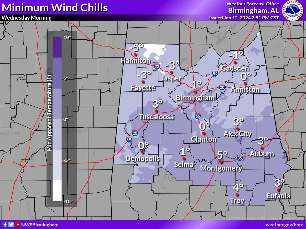
WIND CHILL will be a BIG BIG deal with this Arctic Outbreak. Take a look at this map. It shows a potential wind chill of 4 in Troy Wednesday morning. OUCH!
Here’s the 10 day Model Blend Temperature trend. Some of the numbers here could be lower. I think Tuesday and Wednesday will not make it out of the 30’s.
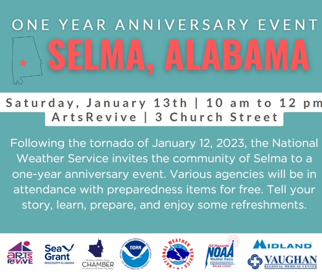
Ironically, Yesterday was the one year anniversary of a big 15 tornado day in Alabama. There were TWO Big Tornadoes that day. Much of Downtown Selma was destroyed. In Autauga county, a tornado killed seven and injured many. Today in downtown Selma, there will be a Special anniversary event, along with National Weather Service, Emergency Management, Midland Weather Radio and others. I will be in Selma today, for this event, along with Shane Butler, James Spann and other broadcasters. See below for more.
The next FULL Blog Update and Video is scheduled for Monday morning. But there will be other updates as needed before then. Have a nice weekend.
–Rich