
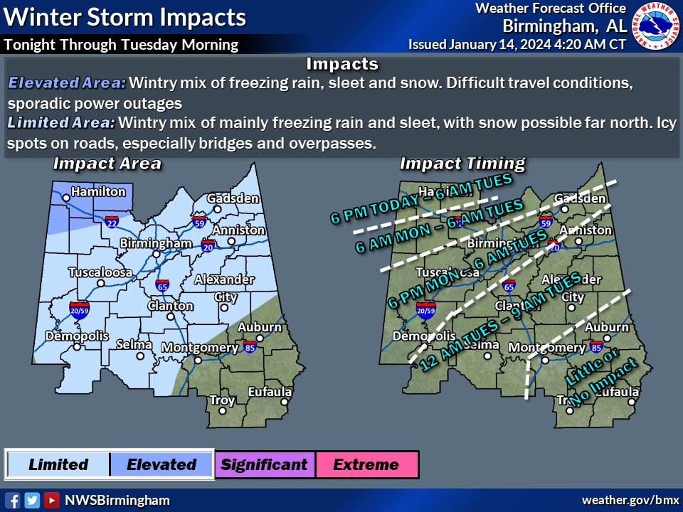
..Just a quick update on Alabama’s developing Winter Precipitation Potential . First, through Monday, the issues will be far to the north, above the I-20 corridor. Expect a Wintry Mix with possible light accumulation and slippery travel. The best chance of accumulating snow would be in extreme north Alabama near the Tennessee border. Then, by late Monday night and Tuesday AM, the threat of a light wintry mix will extended farther south, perhaps to the I-85 corridor. That could make for very slippery travel on Tuesday morning. NWS will issue a Winter Weather Advisory by later today. (this afternoon) Then, get ready for the arctic blast. Highs Tuesday will be in the 30’s. Low Tuesday night into the middle teens. Brutal wind chill numbers may reach the lower single digits by Wednesday Dawn. Get ready. The Arctic Express is headed for Alabama. It’ll be a shock to the system. We’ll get back to a regular extensive blog update and video in the morning. I’ll post the Winter Weather Advisory when it comes out later today. Today will be a fairly nice January day with a high 56°. Helpful maps below.
THIS IS VERY HELPFUL addressing timing of this event. On the south End..problems could start after Monday night until 9AM Tuesday AM.
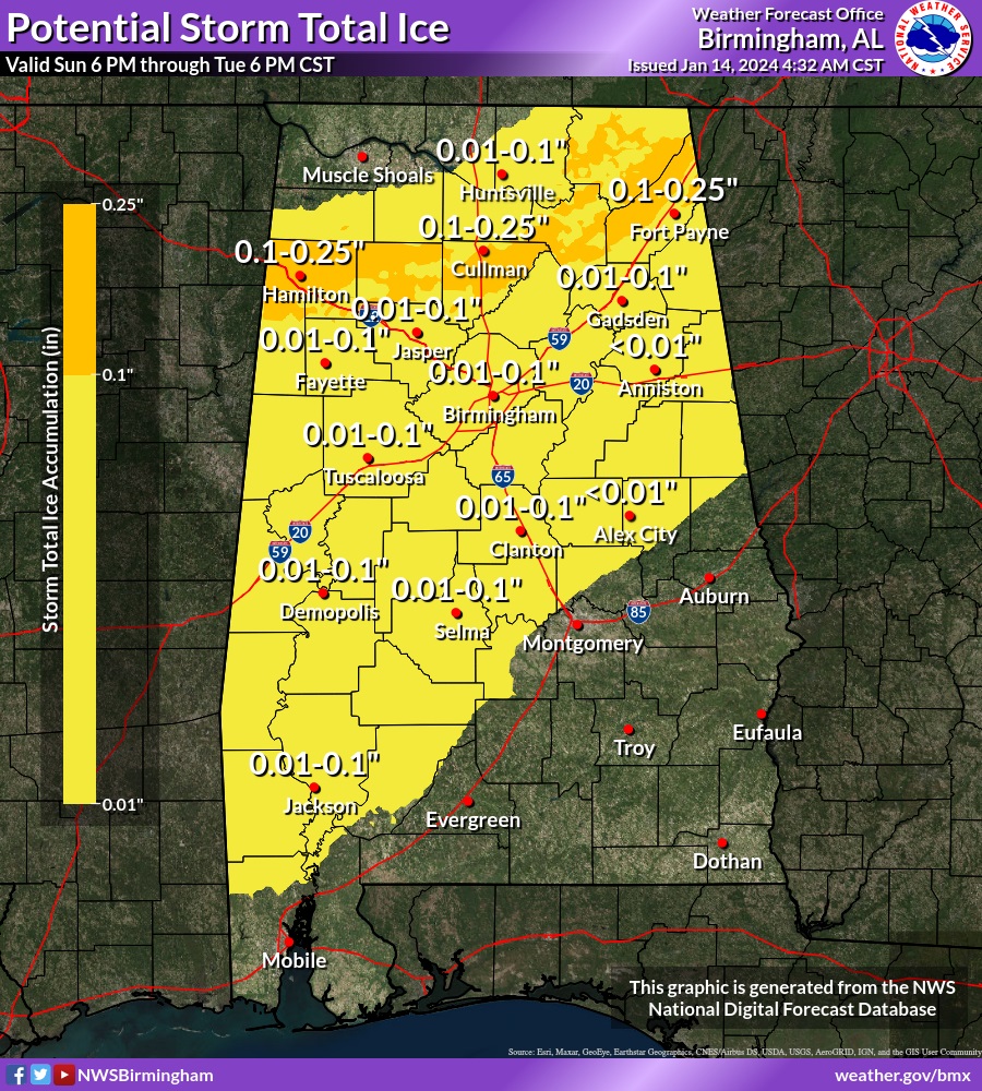
Here’s the potential ICE accumulation map. In an ice situation less than .10″ seems like no big deal. BUT, It only take the thinnest layer of ice to cause significant issues. Tuesday AM travel could be a problem.
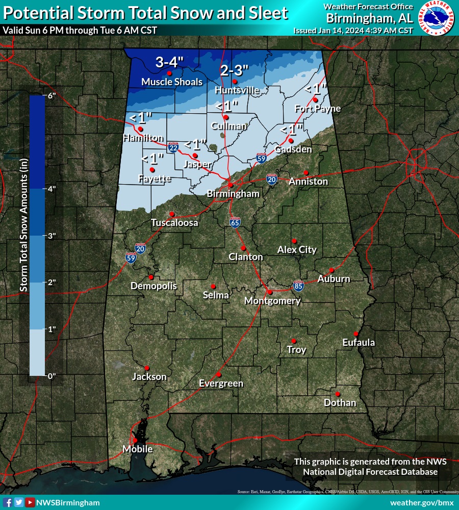
Here’s the potential snowfall accumulation in our state.
How cold are we going to get? Here’s the potential wind chill values on Wednesday morning. An Arctic shocker. We have not experienced Wind Chill this low in a few years. Actual lows will reach the mid teens. #alwx
