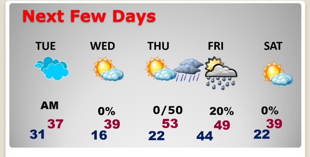
Good Morning! Today will be the last routine day before Old Man Winter roars into town. Today’s high near 60. The problems here in central Alabama start late tonight after Midnight. As an Arctic Cold Front plunges southward light rain will be become a Wintry Mix, just enough to cause slippery travel conditions, especially on bridges and overpasses. Then, very Cold Arctic air takes over. Highs Tuesday will only be in the 30’s. Low Tuesday night into the middle teens. But, expect Brutal wind chill numbers may to reach the lower single digits by Wednesday Dawn. Get ready. The Arctic Express is headed for Alabama. Then, another disturbance brings precipitation to the state by Thursday night. For us, it looks like probably rain. Yet another chunk of Arctic air arrives by the weekend. Next week, though, there may be a wild swing to much warmer by Wednesday 1/24. What a wild rollercoaster ride. Strap yourself in. Here’s my brief forecast discussion.
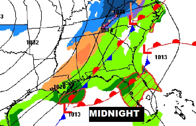
TODAY: On this MLK holiday…not bad! A mild, dry day. Increasing clouds. South wind 5 to 10 mph. High 59. Cloudy. Precipitation begins late after midnight. Perhaps a rain/sleet mix at first, then more of Wintry Mix, continuing through the early morning hours. It’ll be light, but could be just enough to cause a very thin coating of ice, especially on bridges and overpasses.
Here’s the Map set up for tonight at Midnight.
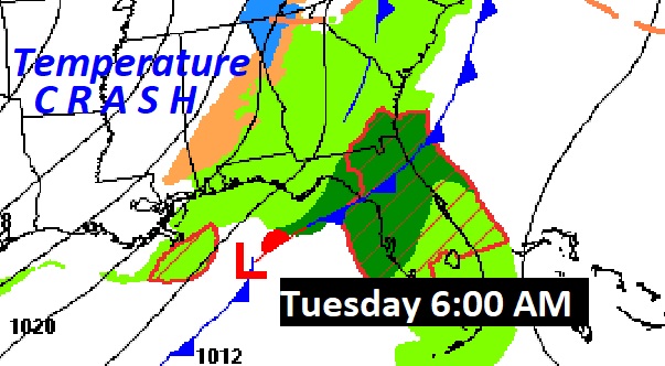
And the set-up tomorrow morning at 6AM.
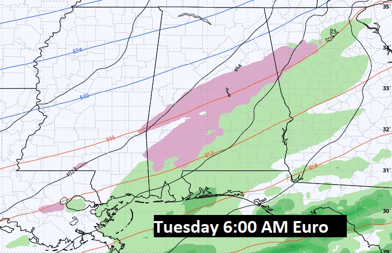
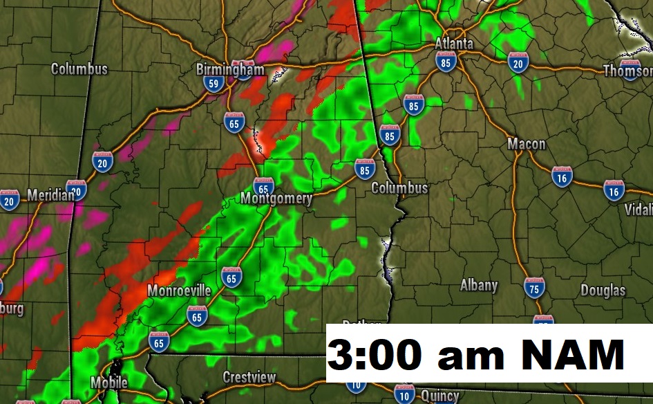
Future radar: two model examples. Note the Wintry Mix in the early morning. Probably this will depart the River region well before 9AM. Hazardest travel potential especially on bridges and overpasses.
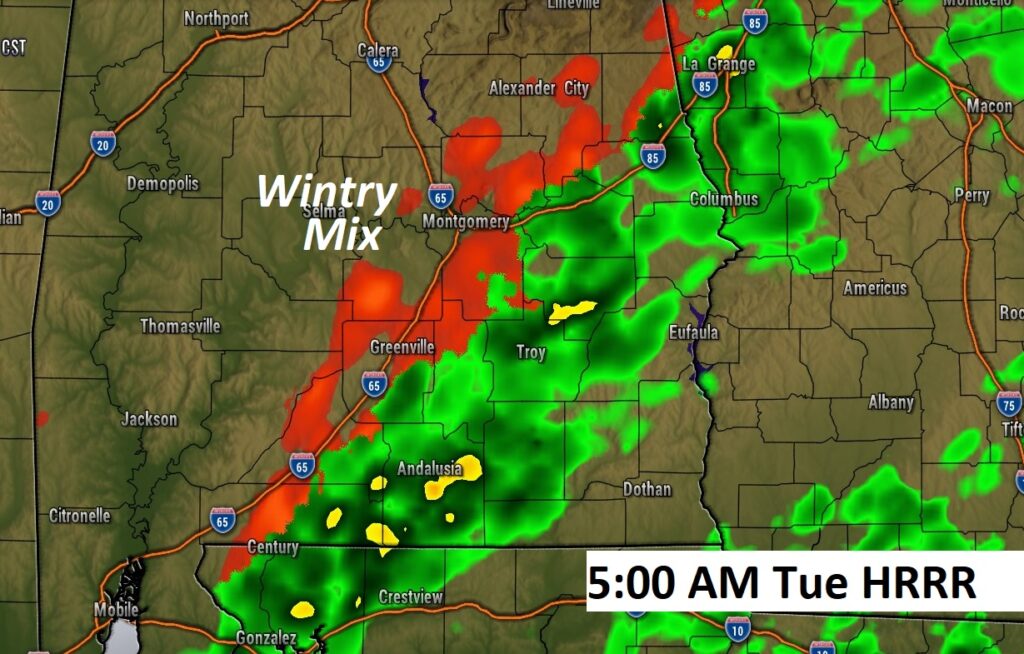
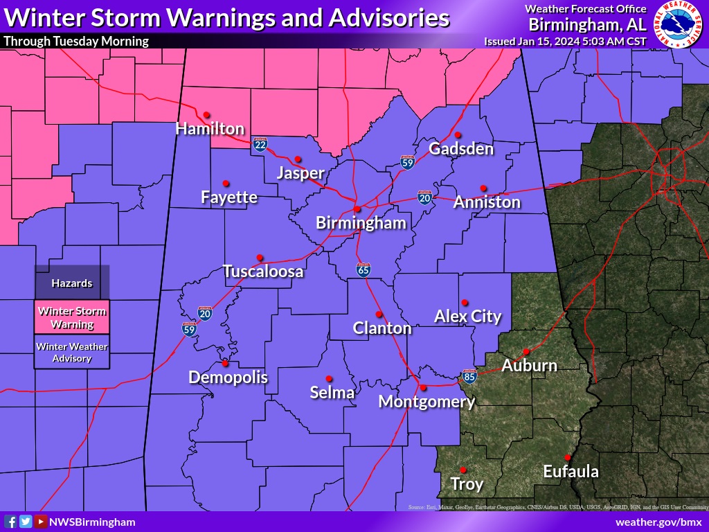
No snow for US, but way up north, in the Winter Storm Warning area, there could be accumulating snow north of a Fayette/Cullman/Fort Payne line. Some spots near the TN line could see 4”+. South of the Winter Storm Warning area, there could be significant travel issues due to a Wintry Mix in the Winter Weather Advisory counties…witch have now been extended to include all the River Region to the I-85 corridor, as far east and south as Montgomery county.
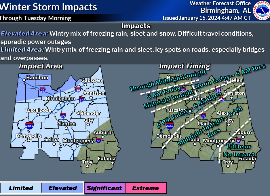
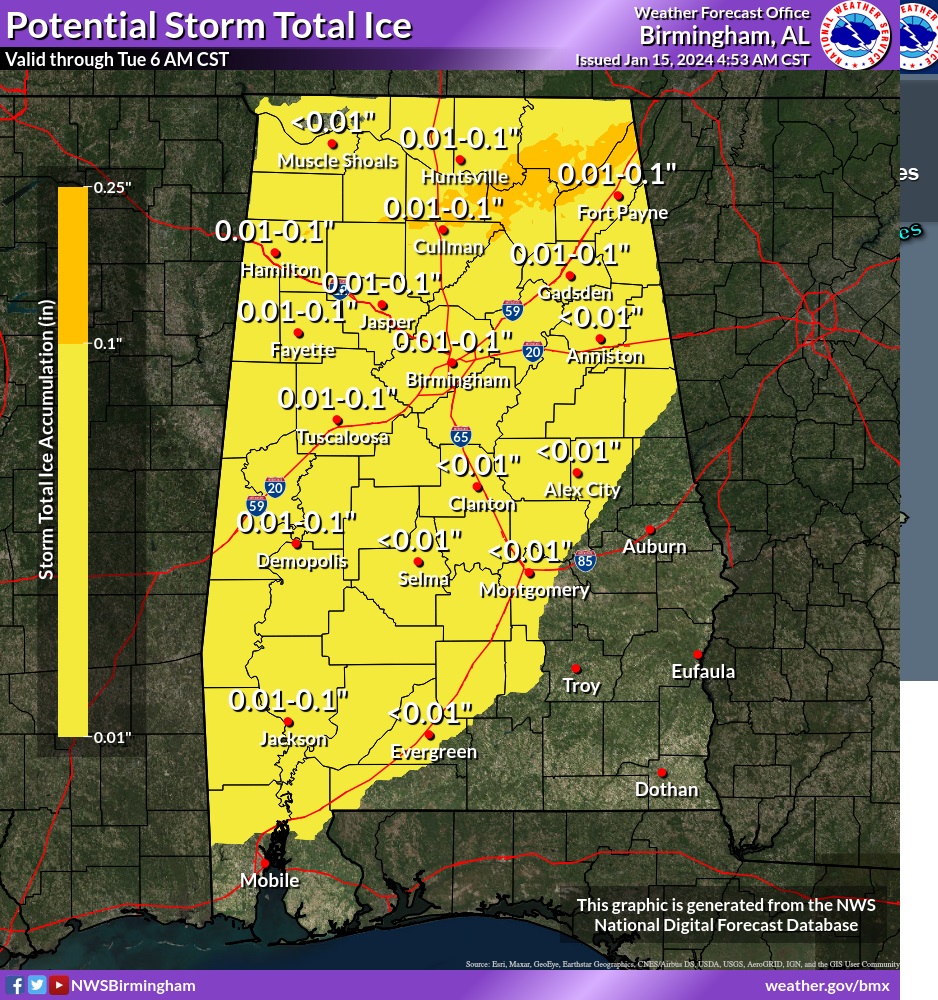
For the rest of us, potential minor ice accumulation on the roadway could cause major problems. .01 to .10” accumulation may not sound like much, but only a thin coating could cause major travel issues on bridges and overpasses.
NEXT FEW DAYS: Wednesday AM will be the coldest since Christmas week 2022 when pipes were bursting all over town. Low in the mid teens. HARSH wind chill values could fall to the low single digits. We’ll be back in the 50’s Thursday. Then, another disturbance brings precipitation to the state by Thursday night. For us, it looks like probably rain. Yet another chunk of Arctic air arrives by the weekend.
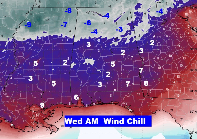
WIND CHILL will be a significant factor. This map will be your attention. This is Wednesday AM at Dawn. We have seen wind chill like this in a few years.
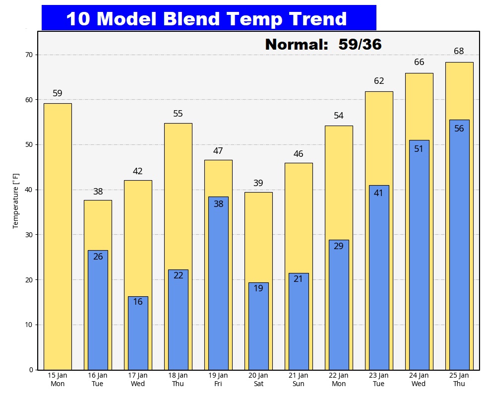
Here’s the 10 day Model Blend Temperature trend. TALK ABOUT WILD. Extremely cold Tuesday/ Wednesday morning. Another shot of arctic air arrives by this weekend. Then, look at next week! Significantly warmer air.
This morning everything is normal including Live on the radio 6 to 9AM on NewsTalk 93.1 WACV. There will be another Blog update in the morning.
–Rich
