
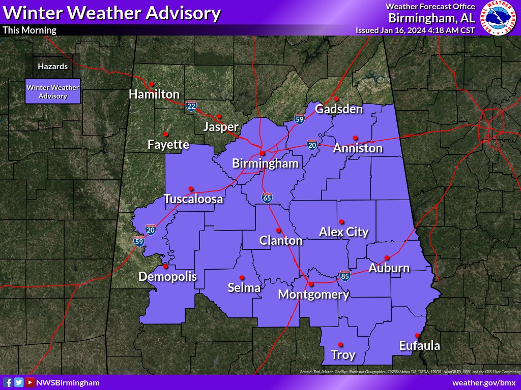
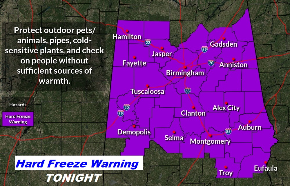
Good Morning! Early this morning the temperature is dropping quickly as light rain falls. Winter Weather Advisory until 9AM for the risk of light freezing rain which will cause travel problems, particularly on bridges and overpasses. The precipitation departs early. Windy & COLD. Highs today will only be in the low to mid 30’s at best. Daytime wind chill 16 to 23. HARD FREEZE WARNING TONIGHT. Low tonight into the middle teens. But, expect Brutal wind chill numbers may to reach the lower single digits by Wednesday Dawn. Take whatever precautions are needed. Then, another disturbance brings precipitation to the state by Thursday night. For us, it looks like rain. Yet another chunk of Arctic air arrives by the weekend. Next week, though, there may be a wild swing to much warmer by the middle of next week. It’s going to be quite a wild rollercoaster ride. Here’s my brief forecast discussion.
TODAY: Winter Weather Advisory until 9AM for the risk of light freezing rain which will cause travel problems, particularly on bridges and overpasses. The precipitation departs early. Windy & COLD. Highs today will only be in the low to mid 30’s at best. Daytime wind chill 16 to 23. Northwest wind at 10 to 20+ mph. HARD FREEZE WARNING TONIGHT. Clear and very cold. Low tonight into the middle teens. But, expect Brutal wind chill numbers may to reach the lower single digits by Wednesday Dawn. Take whatever precautions are needed.
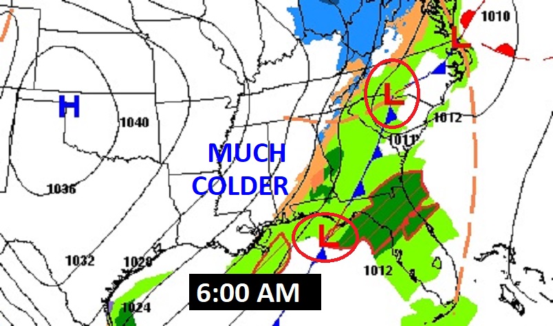
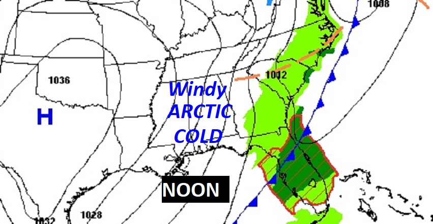
Here’s the Map set up at 6AM and Noon.
Future radar early this morning. 6AM Freezing rain dominates much of central Alabama, shifting closer to between MGM and Troy at 9AM.
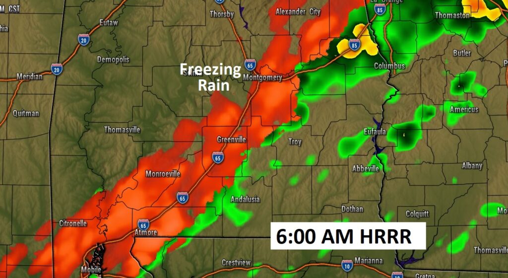
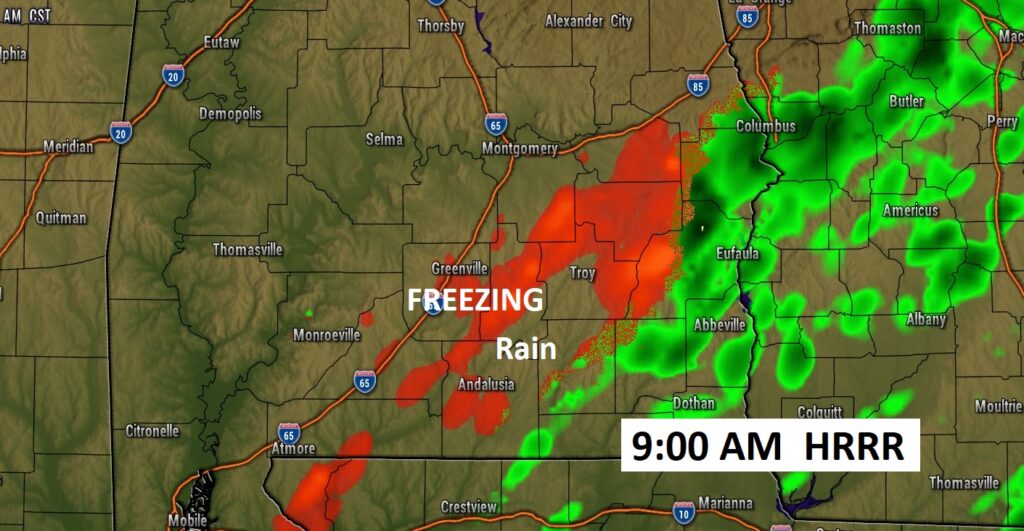
Potential minor ice accumulation on the roadway could cause major problems. .01 to .10” accumulation may not sound like much, but only a thin coating could cause major travel issues on bridges and overpasses.
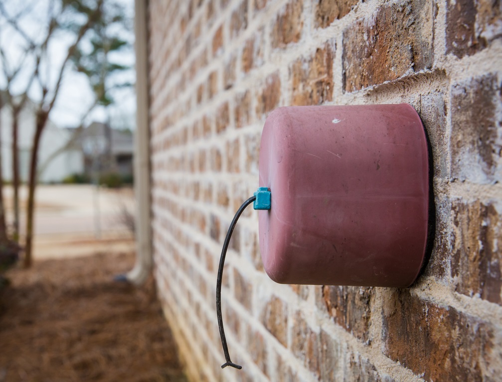
Take whatever precautions you need for tonight. See below. Pipes, Pets Plants. Insulators. Dripping faucet.
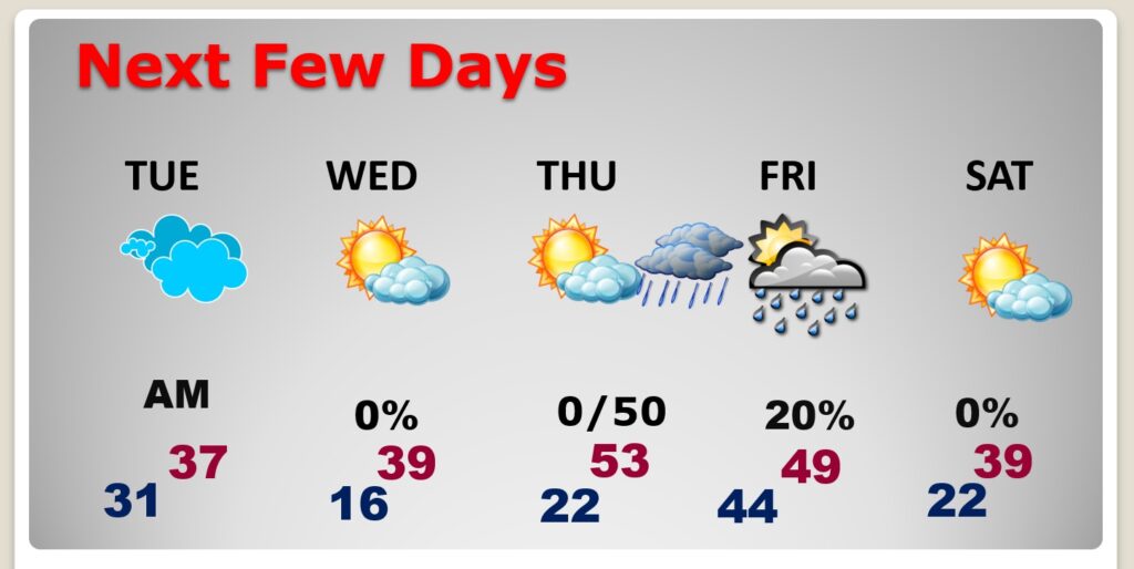
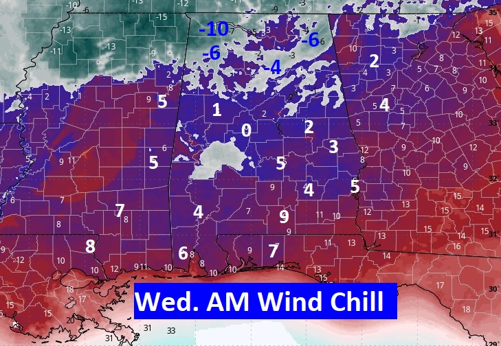
NEXT FEW DAYS: Wednesday AM will be the coldest since Christmas week 2022 when pipes were bursting all over town. Low in the mid teens. HARSH wind chill values could fall to the low single digits. We’ll be back in the 50’s Thursday. Then, another disturbance brings precipitation to the state by Thursday night. For us, it looks like probably rain. Yet another chunk of Arctic air arrives by the weekend.
WIND CHILL will be a significant factor. This map will be your attention. This is Wednesday AM at Dawn. We have seen wind chill like this in a few years.
Here’s the 10 day Model Blend Temperature trend. Crazy. A second shot of Arctic Air arrives Saturday. But, look at next week! A significant warming trend is in our future next Tuesday through Saturday. (Next week)

This morning everything is normal including Live on the radio 6 to 9AM on NewsTalk 93.1 WACV. There will be another Blog update in the morning.
–Rich