
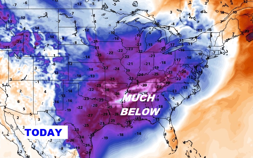
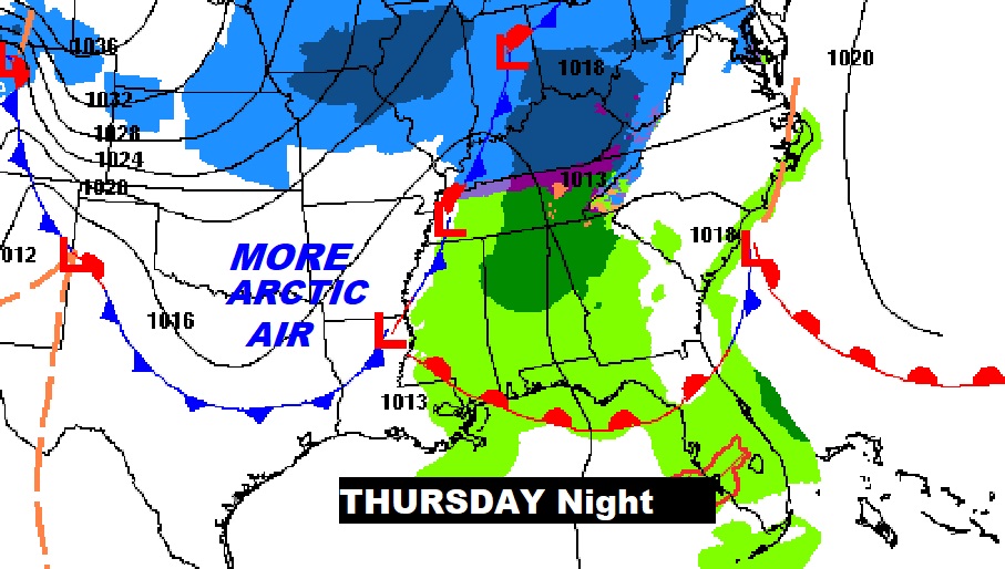
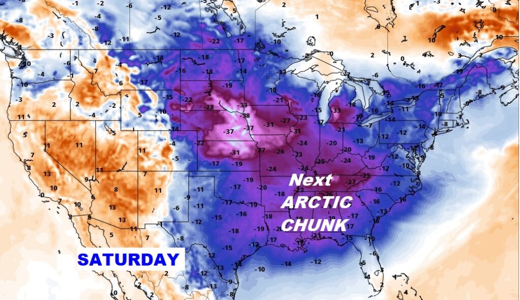
Good Morning! It’s an Arctic Cold Wednesday morning with temperatures in the teens and brutal wind chill numbers. Today – temperatures will be running 18-20° below normal. More changes are on the way as the next Arctic Front approaches. We’ll recover to the lower 50’s Thursday, but more rain in on the way Thursday night. Behind the front, another reinforcing shot of Arctic Air arrives Friday. We’ll be back the teens Friday night. Saturday’s high will only be in the 30’s. If you don’t like the cold, hang on. There will be a radical change to much warmer air by the middle and later part of next week. The numbers below on this blog will make you smile. Here’s my brief forecast discussion.
TODAY: Mostly sunny. High 39-41. Not as windy. North wind 7 to 13 mph will add a little bite. Mainly clear and cold tonight, Low 22.
NEXT FEW DAYS: Not quite as cold Thursday. Mostly sunny. We’ll be back in the lower 50’s. The next disturbance brings light rain to the state Thursday night. Yet another chunk of Arctic air arrives on Friday. Mid 40’s Friday. Back to the teens on Friday night. Saturday’s high only in the 30’s. Mid 40’s Sunday. Next week will be MUCH WARMER.
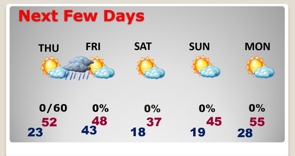
Cold today. Thursday night rain, then another Arctic set-back Friday.
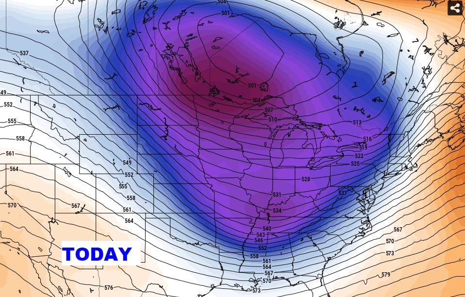
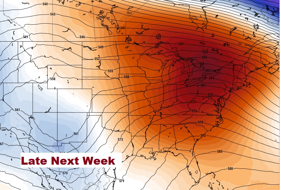
Get ready for a wild Switch in patterns. Here’s the upper air pattern today and late next week.
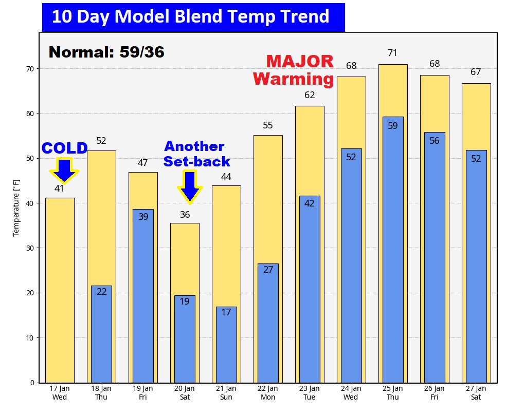
Here’s the 10 day Model Blend Temperature trend. I LOVE the numbers I’m seeing next week! Hang on.
SIX YEARS AGO TODAY….
This morning everything is normal including Live on the radio 6 to 9AM on NewsTalk 93.1 WACV. There will be another Blog update in the morning.
–Rich