
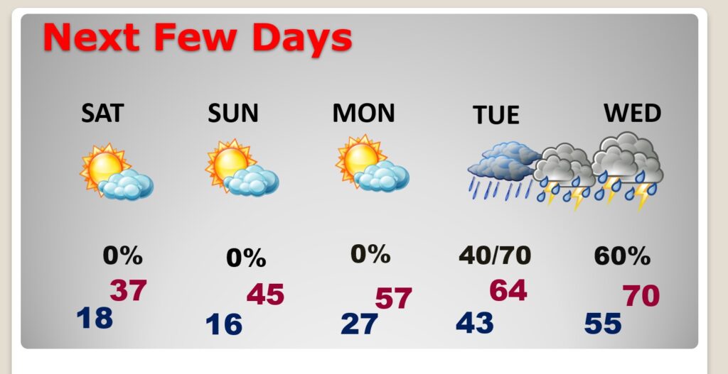
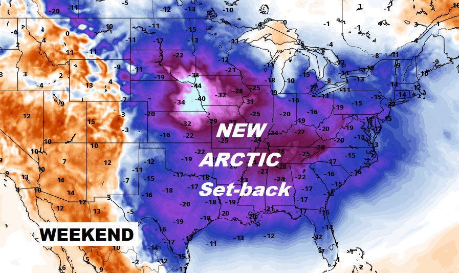
Good Morning! A fresh new reinforcing batch of Arctic Air is funneling into Alabama. Today will be Windy and Cold. Deep Freeze Warning tonight. Upper teens by Dawn tomorrow. Frigid Saturday with highs in the 30’s, and more teens Saturday night. But, stand by for a big pattern flip next week. Get ready for a January thaw. Temperatures will soar into the 60’s starting Tuesday. Expect 70+ Wednesday through Friday. The trade off will be wet & stormy weather. Showers & thunderstorms at times, most days. Here’s my brief forecast discussion.
TODAY: Today will be windy and Cold. Cloudy, then sunshine later. High only 45. Northwest wind at 11 to 20 mph will add a bite. DEEP FREEZE WARNING tonight. Clear and very cold. Low 18. (morning Wind Chill 8 to 13)
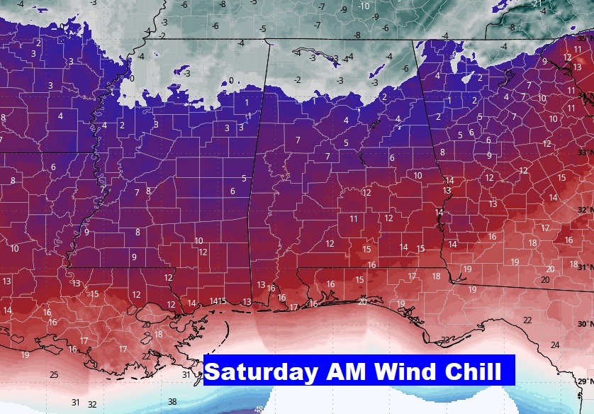
NEXT FEW DAYS: Mostly sunny this weekend, Arctic Cold. Frigid Saturday with highs in the 30’s, and more teens Saturday night. But, stand by for a big pattern flip next week. Get ready for a January thaw. Temperatures will soar into the 60’s starting Tuesday. Expect 70+ Wednesday through Friday. The trade off will be wet & stormy weather. Showers & thunderstorms at times, most days.
A fresh supply of Arctic Air is flowing into the state.

Next week will be MUCH WARMER. Get ready for a significant Switch in patterns. A January Thaw An upper ridge of high pressure builds. Temperatures will be way above normal. The trade off will be wet and stormy at times much of next week.
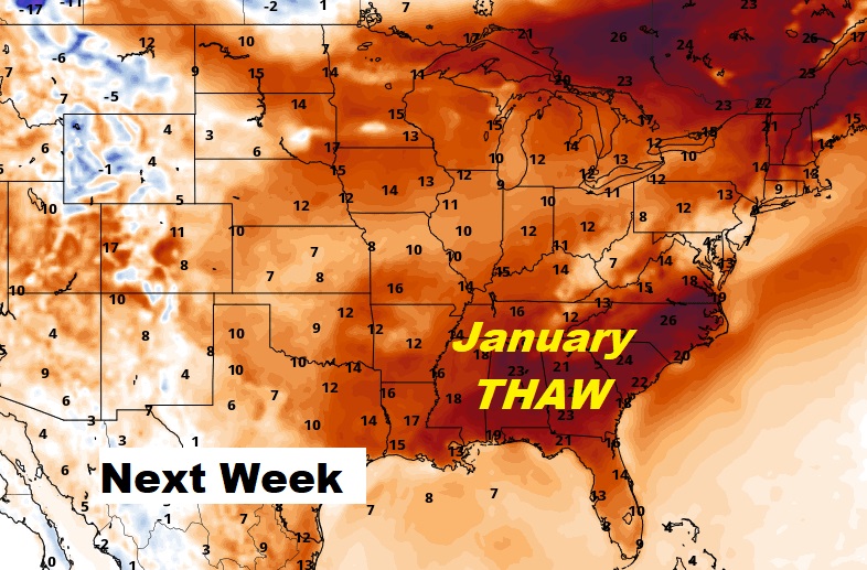
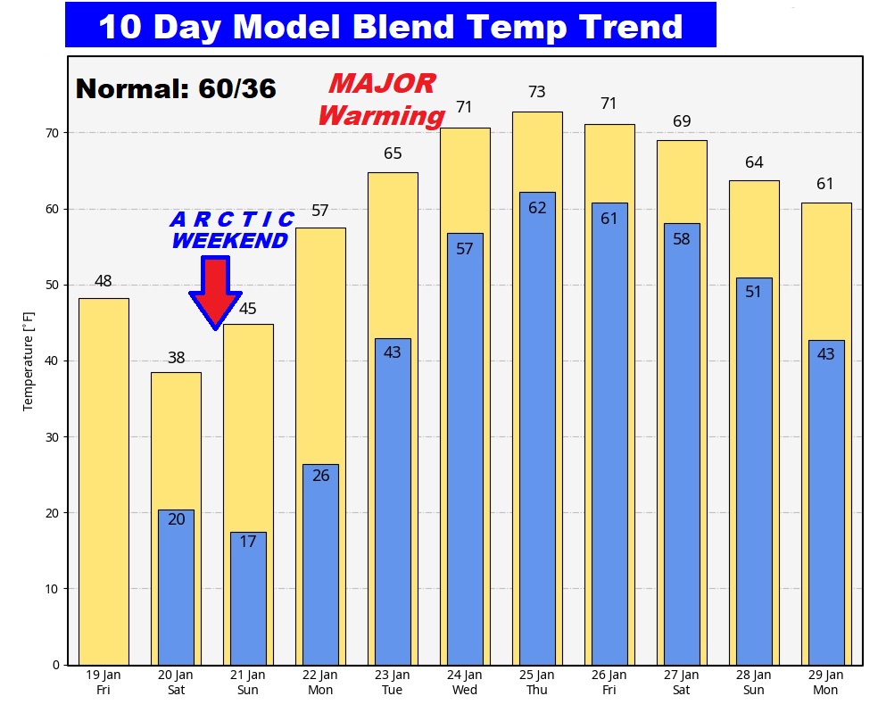
Here’s the 10 day Model Blend Temperature trend. What a radical shift from Arctic Cold to much above normal.
This morning everything is normal including Live on the radio 6 to 9AM on NewsTalk 93.1 WACV. There will be another Blog update in the morning.
–Rich