
Good Morning! Hard freeze Warning continues early this morning. Today will be a very cold winter’s day with a high only in the 30’s. Tonight will be colder. Another Hard Freeze. Even Sunday will be very chilly. But, get ready for a radical change. A complete flip to much warmer temperatures this next week. A January Thaw. It’s going to be quite a ride from 16 tonight to 72 on Thursday! The Rollercoaster ride begins. But, the trade-off will be a wet and stormy pattern. We could see excessive rainfall, easily in the 3 to 5+ inch range. Not sure about severe weather yet, but we could see a Marginal Risk, perhaps by Wednesday or Thursday.
TODAY: Today will be rather cold. The normal high is 60. Today we’ll be lucky to make it to 37. Sunshine. Northwest wind at 11 to 20 mph will add a bite. HARD FREEZE WARNING again tonight. Clear and very cold. Low 16

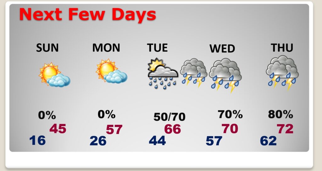
NEXT FEW DAYS: Mostly sunny, continued cold Sunday. High in the mid 40’s. But, stand by for that big pattern flip. next week. I think Monday will be perhaps the nicest day of the week with lots of sun and a high of 57. We’ll be in the 60’s Tuesday, and 70 or above Wednesday through Friday. Risk of rain begins Tuesday. Rain and thunderstorms likely, at times, Tuesday night through Friday.
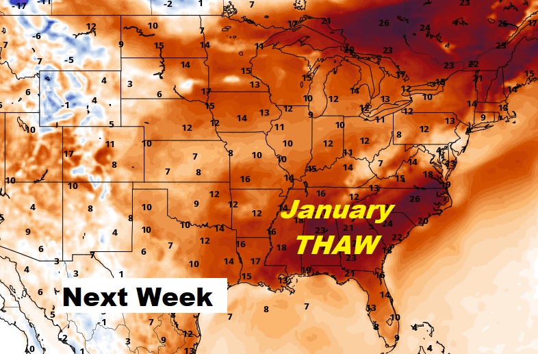
A big ridge of high pressure will wipeout the Arctic Cold and promote warmth.
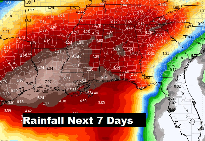
Rainfall amounts could be excessive next week. We could easily see 3 to 5+” for most of us, but even heavier down south. What a change!
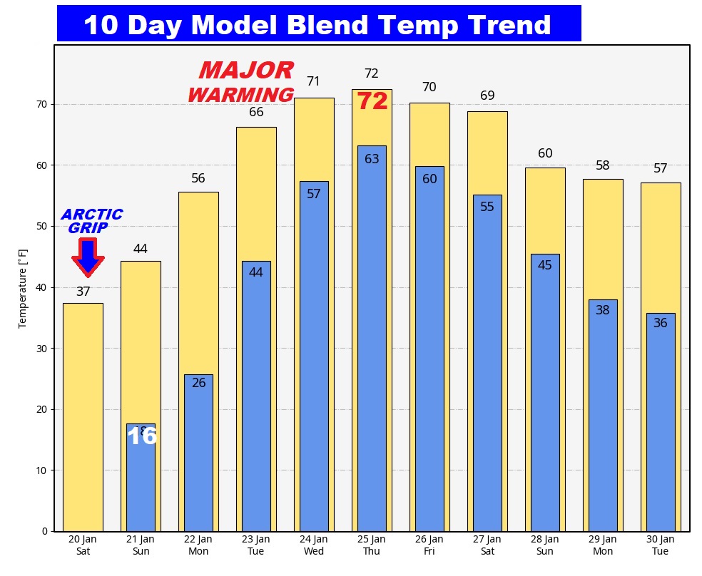
Here’s the 10 day Model Blend Temperature trend. What a radical shift from Arctic Cold to much above normal.
Have a nice weekend! Stay warm! My next scheduled complete Blog Update will be Monday morning.
–Rich