
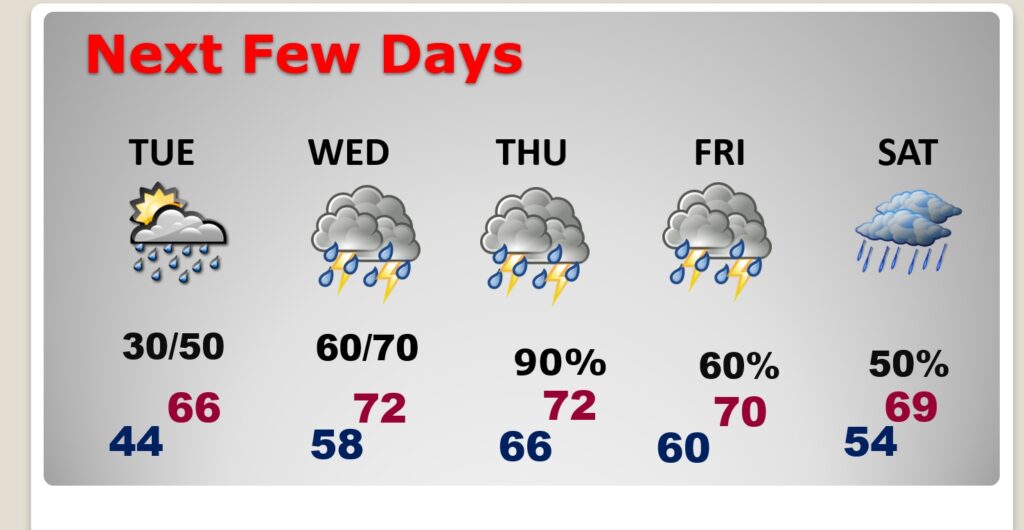
Good Morning! Our big temperature turn-around begins today. By Tuesday, well be well up in the 60’s. Looks like we’ll reach 70+ Wednesday through Friday. What a change in reality. Rainfall amounts could be quite excessive in spots this week. Not sure about severe weather yet, but we could see a Marginal Risk, perhaps by Wednesday or Thursday. Here’s my brief forecast discussion.
TODAY: A Cold sub-freezing start in the 20’s this morning.But, say bye bye to Arctic Air. Our big temperature turn-around begins today. Sun & cloud mix. Increasing clouds. High 57. (Normal: 60/36). Mosty cloudy, not nearly as cold tonight. (isolated shower overnight?) Low 44. A great start to our recovery. (Sunday’s lo/hi 18/44. Awful!)
NEXT FEW DAYS: Our memories of the Arctic Cold will soon will be a distant memory. Tuesday’s high of 66 will be nice change. We’ll be 70 or above Wednesday through Friday. Rain and thunderstorms likely, at times, Tuesday night through Saturday. What a radical change of patterns.
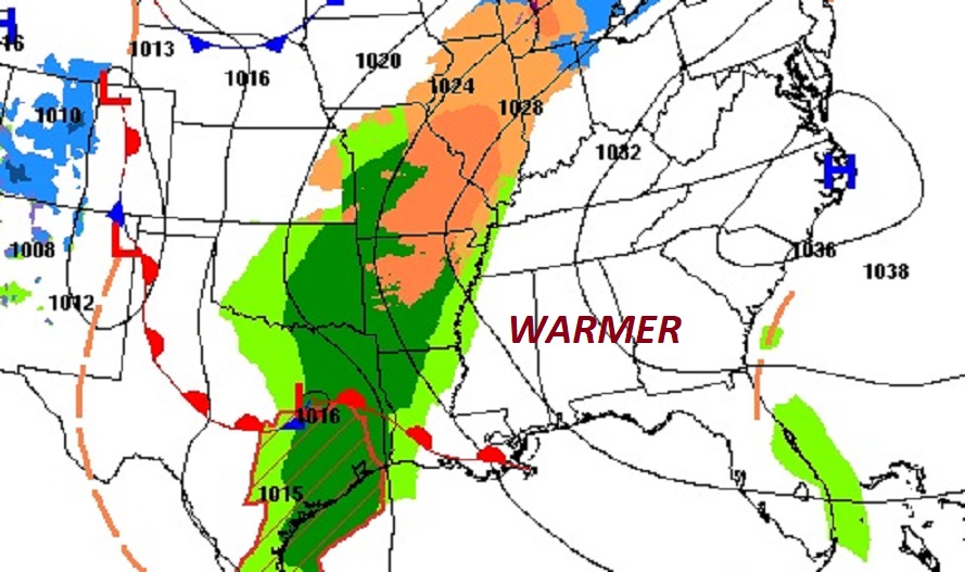
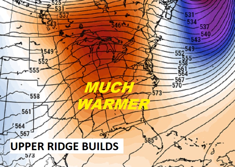
A big ridge of upper level high pressure will wipeout the Arctic Cold and promote warmth.
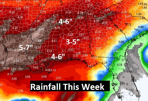
Rainfall amounts could be quire excessive in spots this week. Perhaps 3-5”. Maybe more in some areas.
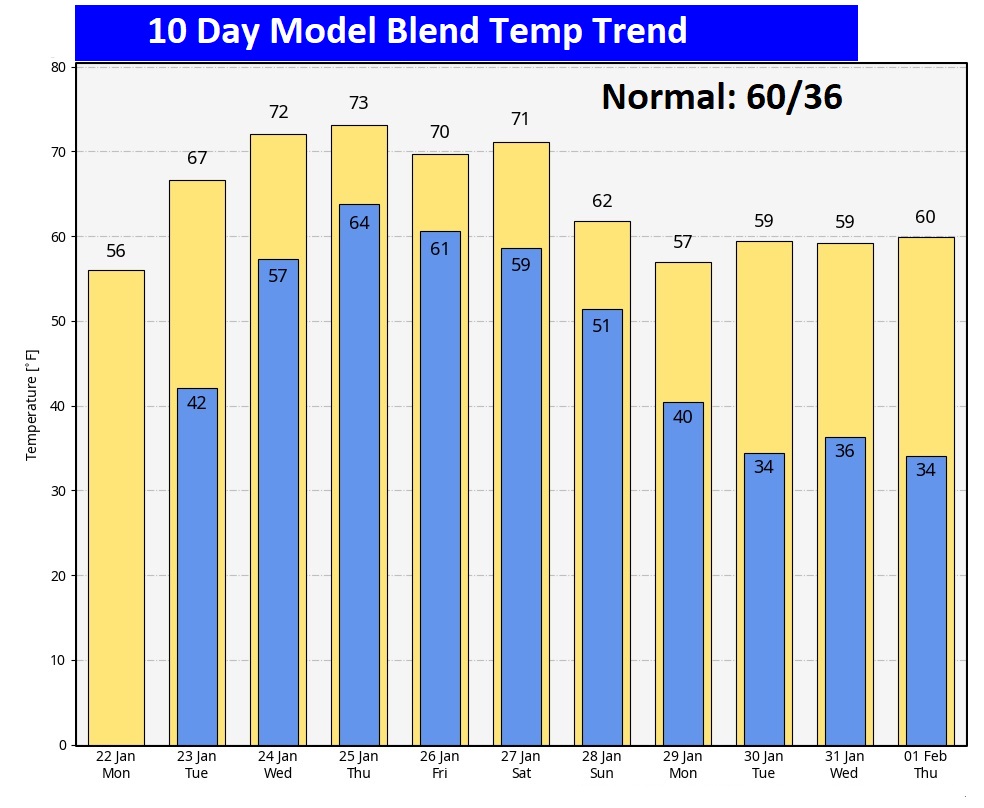
Here’s the 10 day Model Blend Temperature trend. Talk about a complete pattern turn-around.
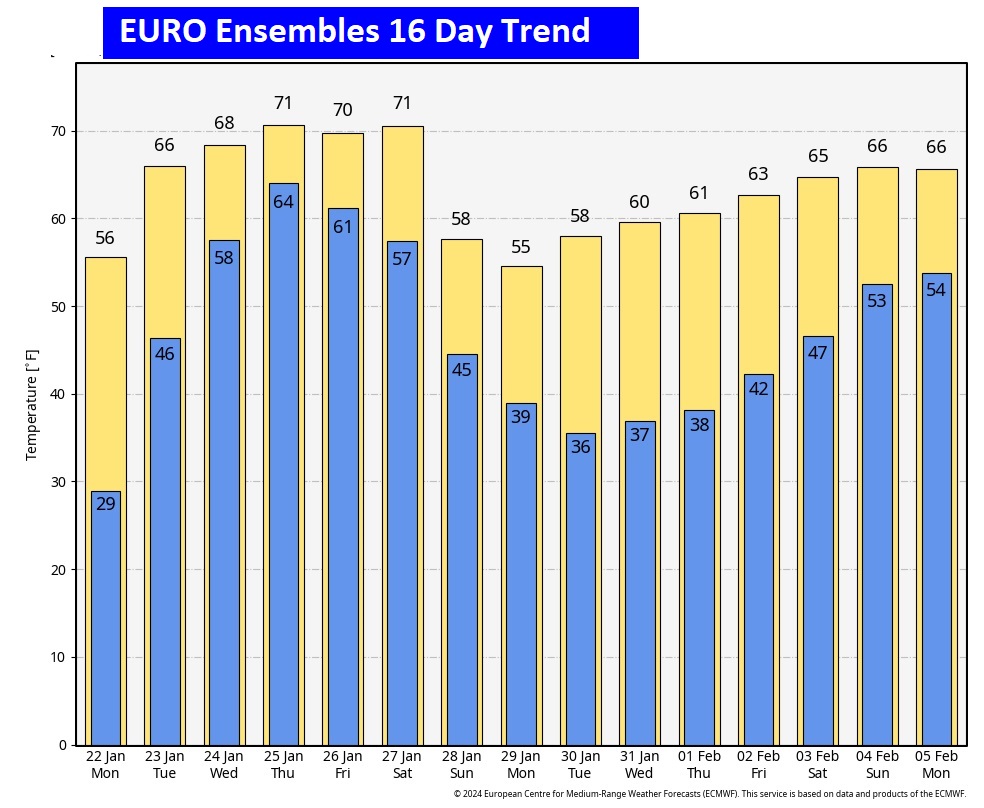
Want to peek farther out? Here’s the EURO model 16 days out. Happy to say I do not see any Arctic Air through 16 days.
This morning everything is normal including Live on the radio 6 to 9AM on NewsTalk 93.1 WACV. There will be another Blog update in the morning.
–Rich