
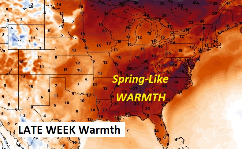
Good Morning! The radical, much talked about shift from an Arctic Blast to a complete shift to significantly warmer continues. Normal high is 60. Today’s high of 66 will be remarkable, considering we were only in the 30’s on Saturday. Expect 70 or above tomorrow, and at least 70+ each day through Saturday. Then, there’s the WET side. Early this morning, light rain has entered the state. Scattered showers will be roaming around much pf the day, especially this afternoon, and tonight. Rainfall amounts from this first system will be light. But, there are some more wet and stormy days in our future. Periods of showers and thunderstorms will dominate our forecast Wednesday through Saturday. Rainfall amounts will be locally heavy. Think of it this way. We did an about face from a winter pattern to a spring-like pattern. I don’t see any Arctic threat in the next 16 days. However, that doesn’t mean we’re done with Winter. Here’s my brief forecast discussion.
TODAY: The warm-up continues! Normal high 60. Today will be the first above normal temperature in several days. Today’s high 66. Risk of some spotty showers this afternoon. Scattered showers tonight. Low tonight…very mild, low 58. Amazing. East wind at 10 to 15 mph.
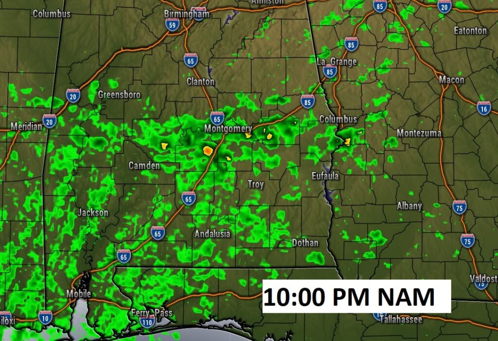
This lead disturbance today and tonight is not such a big deal.
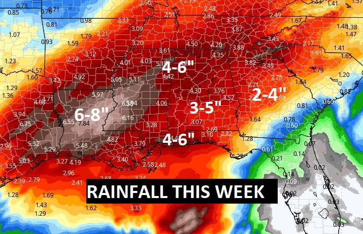
NEXT FEW DAYS: Our memories of the Arctic Cold will soon will be a distant memory. Monday’s high was 56. We’ll be 70 or above Wednesday through Friday. Rain and thunderstorms likely, at times, Tuesday night through Saturday. But, there are some more wet and stormy days in our future. Periods of showers and thunderstorms will dominate our forecast Wednesday through Saturday. Rainfall amounts will be locally heavy. Sunday will be several degrees cooler.
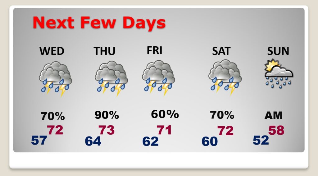
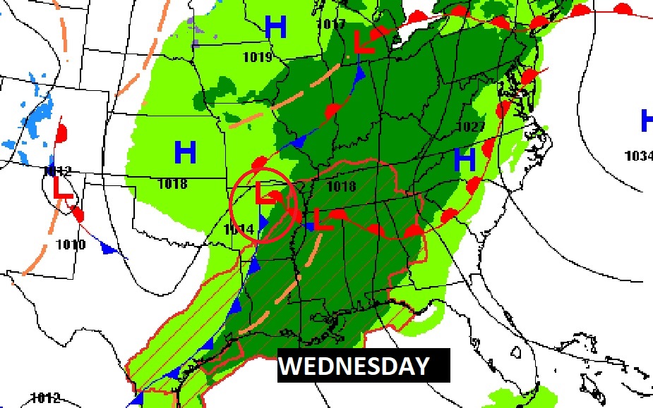
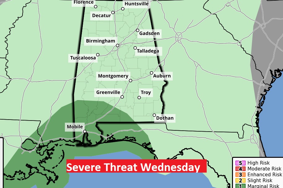
The Wednesday storms system will be stronger. The Severe Weather Risk will be mainly near the coast, but that could be adjusted. Thursday afternoon needs to be monitored for potential strong to severe storms. We’ll be watching Saturday, too.
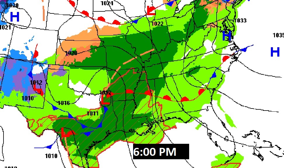
A massive area of MUCH above normal temperatures will cover the east and southeast US.
Rainfall amounts could be quire excessive in spots this week. Perhaps 3-5”. Maybe more in some areas.
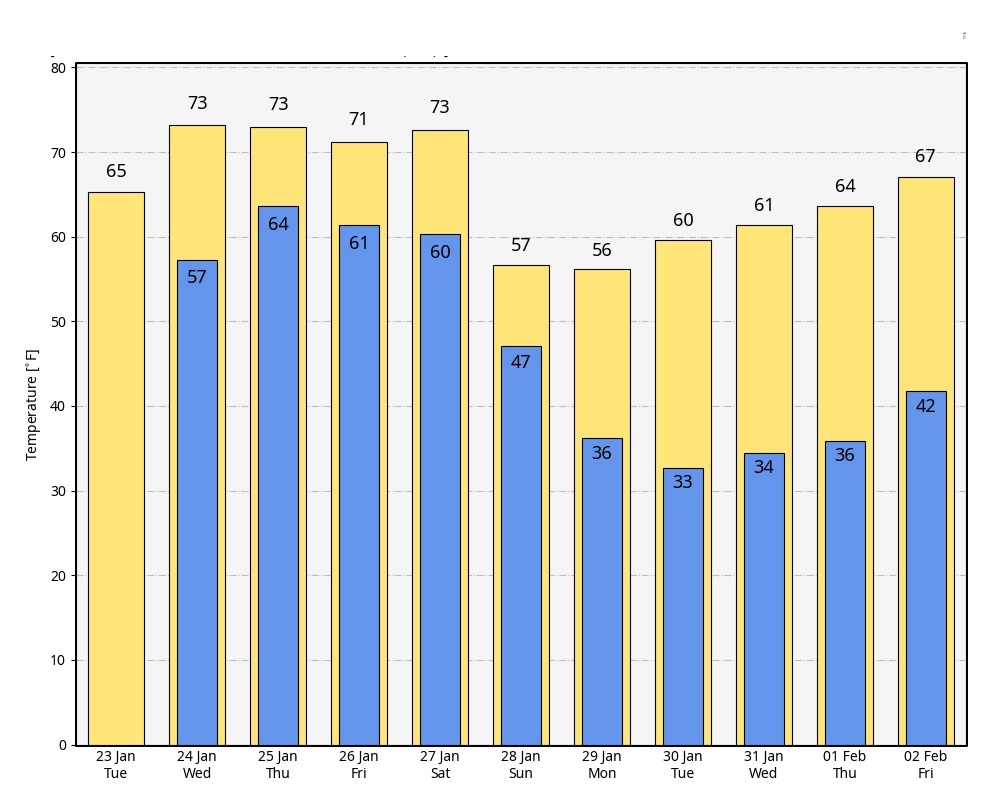
Here’s the 10 day Model Blend Temperature trend. Looks very reasonable for the Dead of Winter.
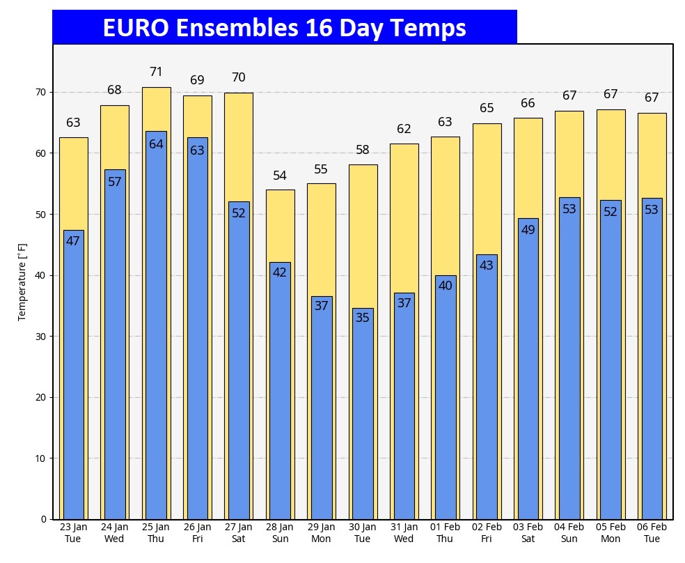
Here’s the EURO model 16 days out. Happy to say I do not see any EVIL Arctic Air through 16 days. Stay tuned though. We have February to deal with…and I’m worried about some clues way out there past mid-month.
This morning everything is normal including Live on the radio 6 to 9AM on NewsTalk 93.1 WACV. There will be another Blog update in the morning.
–Rich