
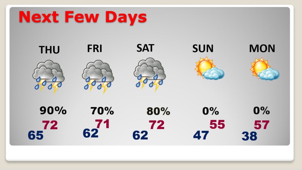
Good Morning! We are enjoying a remarkable change of climate. Yesterday’s high was 67, today we’ll be in the lower 70’s. But, the trade-off is a parade of storm systems. There are more wet and stormy days in our future. Periods of showers and thunderstorms will dominate our forecast today through Saturday. Rainfall amounts will be locally very heavy. There is a Marginal Severe Risk on Thursday. We’re also keeping track of another potentially stronger system Saturday. Cooler air moves in Sunday and Monday, but no arctic air. Here’s my brief forecast discussion.
TODAY: Cloudy and mild. High 72. Scattered showers this afternoon. Showers and storms become likely this evening and tonight. MILD tonight. Low 65. Southeast wind at 10 to 15 mph.
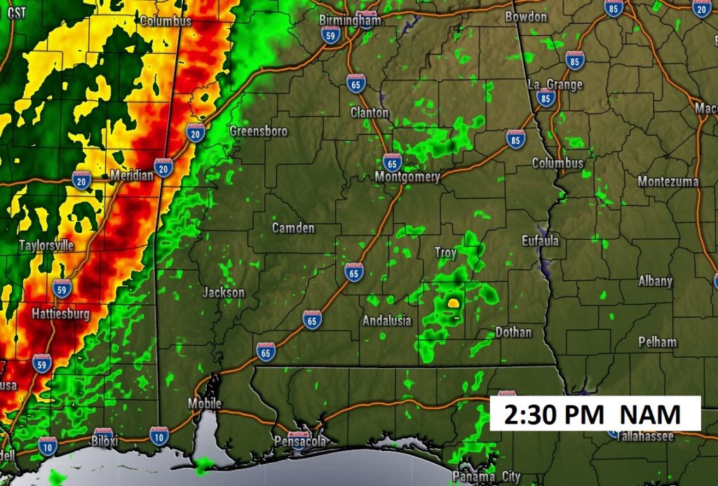
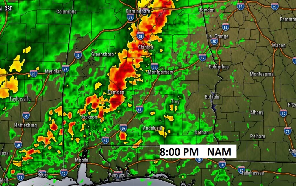
Future Radar. Scattered showers this afternoon. Showers and storms become likely this evening and tonight.
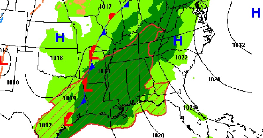
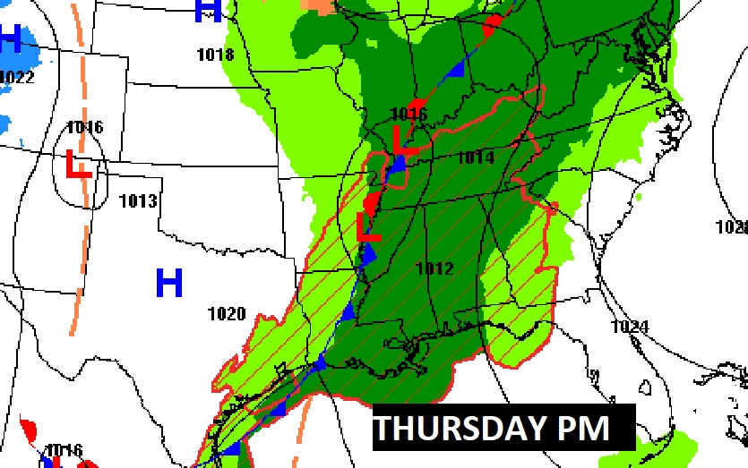
NEXT FEW DAYS: Flood Watch through Thursday. Rain and thunderstorms likely, at times, through Saturday. But, there are some more wet and stormy days in our future. Periods of showers and thunderstorms will dominate our forecast Today through Saturday. Rainfall amounts will be locally excessive. Sunday and Monday will be several degrees cooler, but no arctic air.
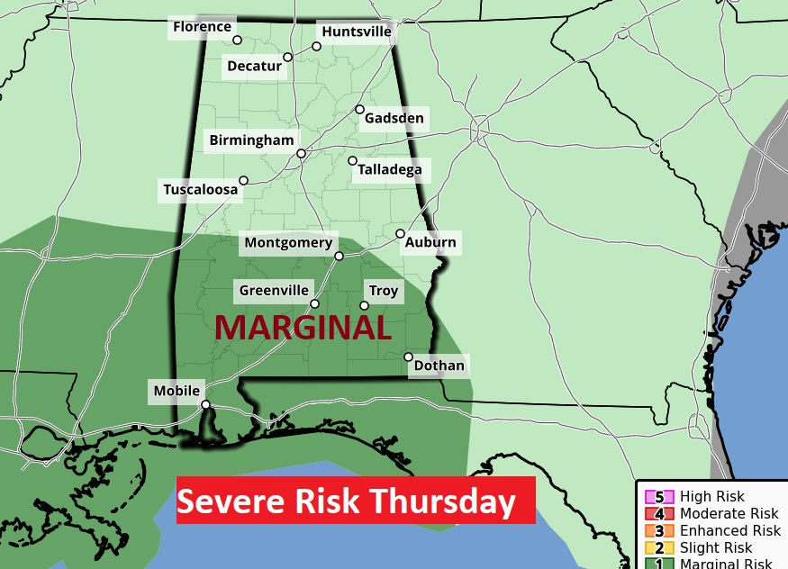
The Thursday storms system will be stronger. The Marginal Severe Weather Risk will be mainly along and south of the US 80/I-85 Corridor. Damaging wind gusts are the main threat. We are also watching Saturday, too.
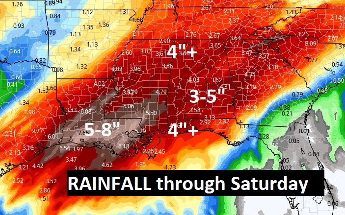
Rainfall amounts could be quire excessive in spots this week. Perhaps 3-5”. Maybe more in some areas.
Here’s the 10 day Model Blend Temperature trend. There will be a bit of a set-back Sunday and Monday, but then, temperatures will recover again next week.

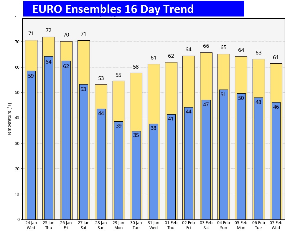
Here’s the EURO model 16 days out. Fingers crossed. The Arctic Flood gates are close for now.
This morning everything is normal including Live on the radio 6 to 9AM on NewsTalk 93.1 WACV. There will be another Blog update in the morning.
–Rich