
7:00AM UPDATE:
The adjusted Severe Weather Outlook from SPC shifts today’s greatest threat to the Southeast third of the state mainly along and south of I-85 in the general 1PM-8PM timeline. Damaging wind gusts. Brief tornadoes possible.

6:00 AM UPDATE:
Good news: Our friends at NWS are backing off on the AM Severe Weather Potential. We’ll still be watching the afternoon/evening threat closely.
EARLY MORNING UPDATE:
Good Morning! Strong to Severe Storms are possible today as a potent frontal system approaches. Today’s Severe Threat may come two rounds – one this morning, and second round late this afternoon into this evening. Round 2, along the front itself, could produce some brief tornadoes. The late morning round will be primarily a Marginal Wind Damage threat, and essentially along and southeast of I-85/I-65. More on the details below. Much cooler Sunday and Monday with highs in the 50’s. Coldest morning will be Tuesday. Temperatures will start to recover by mid-week.
TODAY: Very Spring-like today. High 73. Today’s Severe Threat may come two rounds – one this morning, and second round late this afternoon into this evening. Round 2, along the front itself, could produce some brief tornadoes
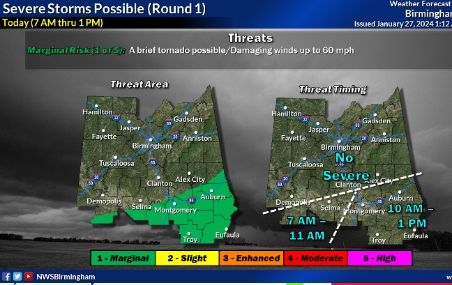
SEVERE THREAT ROUND 1: A robust line of storms will sweep across the area this morning into early afternoon. A few storms could reach severe limits.
This Map from NWS will help with timing.
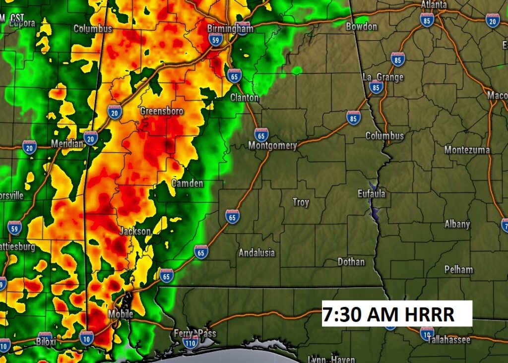
Future Radar shows the progress of the eastward movement of the first line.

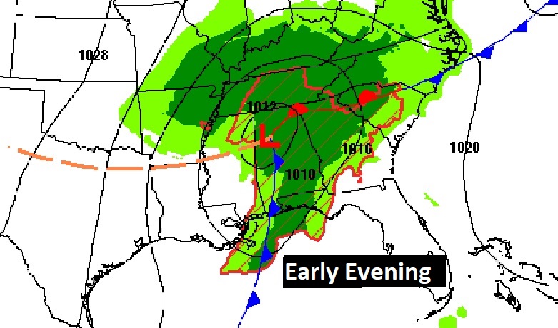
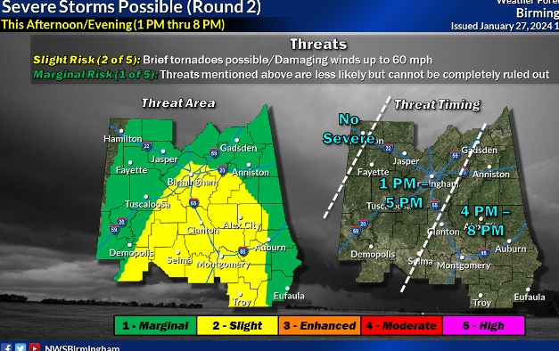
SEVERE THREAT ROUND 2: Round 2 is very conditional, along the front itself. Will a line of severe storms be able to form? There are many question marks, depending on what the morning round does to the atmosphere. But, if storms can get going, this second round could produce a few brief tornadoes, late this afternoon into the evening hours. Again, this is very conditional. We are in a Level 2 Severe Weather Threat.

This graphic will help with potential timing of round 2.
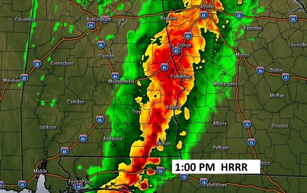
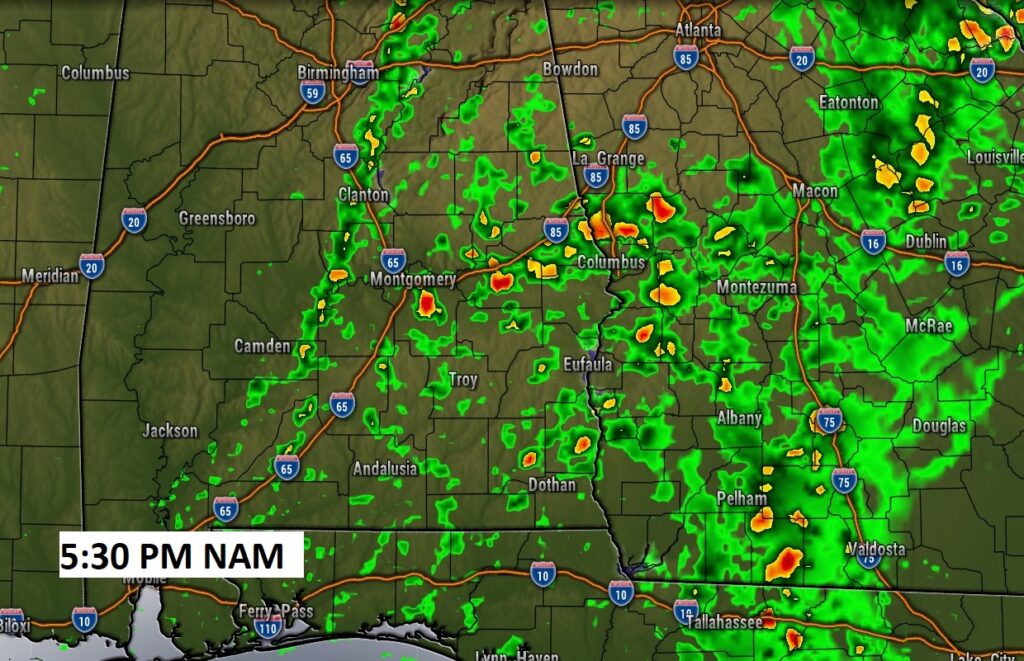
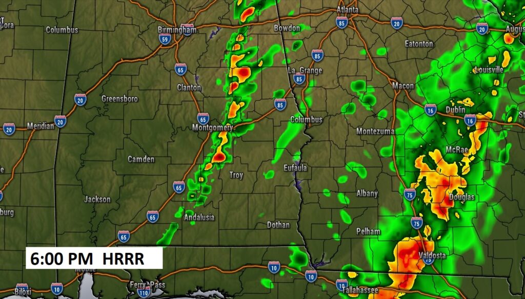
Here’s a couple of Future Radar Snapshots late this afternoon/early this evening.
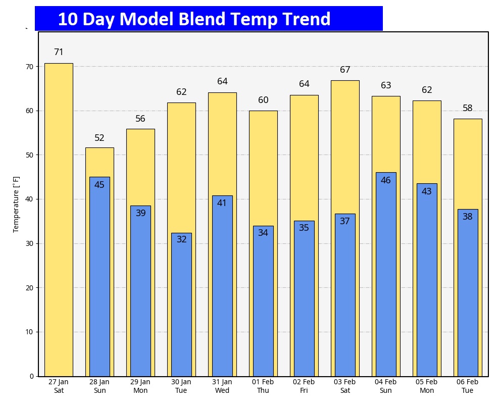
NEXT FEW DAYS: Much cooler overspreads the area Sunday and Monday with highs in the 50’s. Coldest morning will be Tuesday. Temperatures will start to recover by mid-week.

Here’s the 10 day Model Blend Temperature trend. There will be a bit of a set-back Sunday through Tuesday, but then, temperatures will recover again next week.
Thanks for reading the blog. The next scheduled blog will be Monday morning. Stay Weather Aware!
–Rich