
Good morning! Pre-dawn – a line of “gusty” showers is moving through the state, reaching Southeast Alabama by Dawn. Wind gusts up to 40 mph in some of these showers. This is ahead of a Pacific Front. The air behind this front is relatively mild. High today near 70, upper 60’s Saturday and low 70’s Sunday. Not a bad last weekend in February. A big warm-up is in the cards next week. We could reach near 80 for the first time in 2024 by Tuesday. Meanwhile, all eyes are on a mid week storms system in the Wednesday night/Thursday time frame. Already the Storm Prediction Center has outlooked much of our state for a Severe Weather, including the risk of tornadoes. We’ll learn more and more about the severity and time line of this system as we get closer to this event. February may end on a very stormy note. Here’s my brief forecast discussion.
.
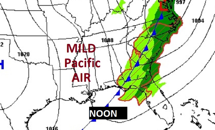
TODAY: Pre-dawn – a line of “gusty” showers is moving through the state, reaching Southeast Alabama by Dawn. Wind gusts up to 40 mph in some of these showers. This is ahead of a Pacific Front. Cloudy skies this morning, will give way to sunshine later. High near 70. NW wind 10 to 20 mph. Clear chilly tonight. Low 43.
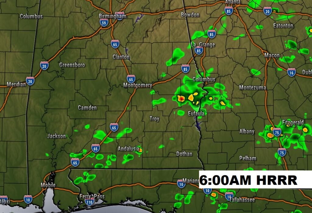
Future radar at about 6AM shows the line of showers falling apart and drifting into southeast Alabama.
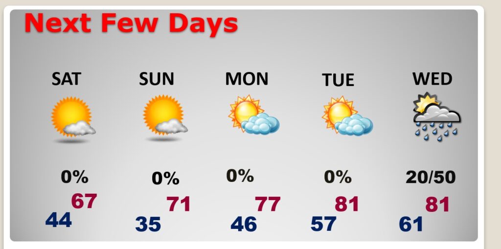
NEXT FEW DAYS: Dry weather returns for the weekend. The air behind the front is Pacific air, meaning we’re not expecting a big temperature drop this time. Highs will be in the 60’s Friday and Saturday, and back in the lower 70’s on Sunday. Expect an amazing warming trend next week, with upper 70’s by Monday. We could see our first 80+ degree day of 2024 by Tuesday. Meanwhile, we could see a much bigger deal storm system by mid week as February comes to an end, including a Severe Weather Threat. This will include a tornado threat.
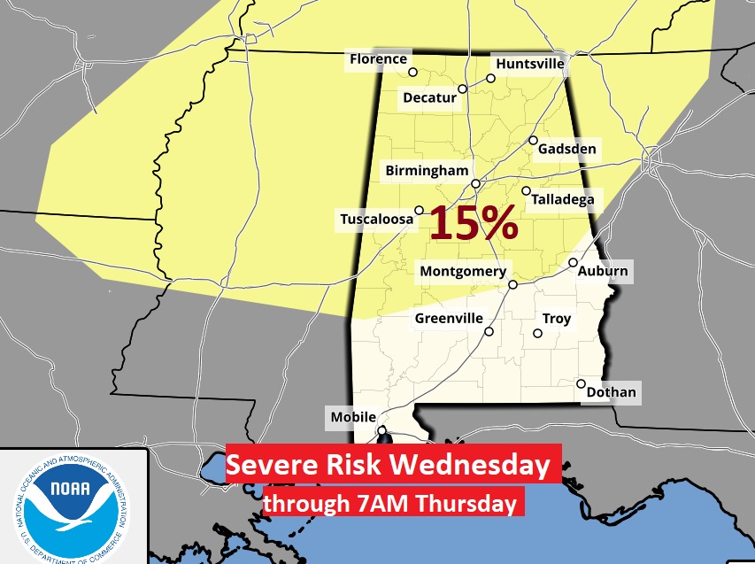
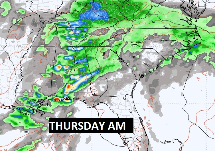
SEVERE RISK NEXT WEEK: The Storm Prediction Center has outlooked much of our state for a Severe Weather, including the risk of tornadoes, in their Day 6 outlook which continues through Wednesday night and through 7AM Thursday. As we get closer to this event, we’ll see if the scope of this threat expands, and whether they will include a Thursday threat as well. ‘Tis the season. Here’s the map area including their 15% threshold to issue an outlook beyond 3 days. 6 days out gets our attention for sure.
The long range models are NOT in agreement on timing of this system. The GFS is faster, but the EURO doesn’t bring the storm system more in the Thursday/Friday range.
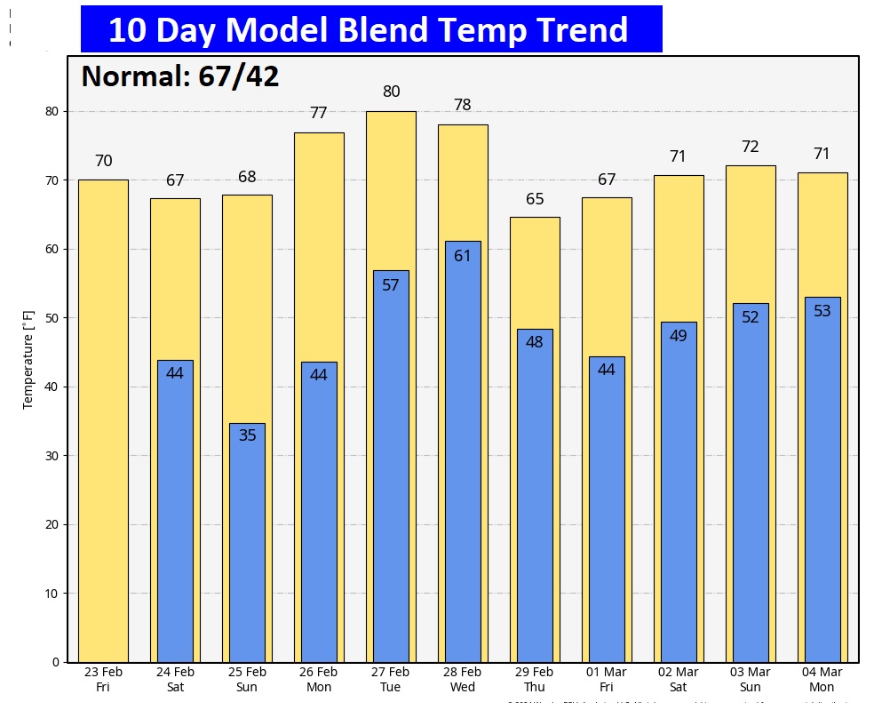
Here’s the 10 day temperature trend.
Thanks for reading the blog. There will be another complete Blog update and video forecast discussion tomorrow morning. This morning, everything is normal including LIVE on the Radio from 6 to 9AM on NewsTalk 93.1 – WACV. Have a great day.
–Rich
Thanks for reading the blog. There will be another complete Blog update and video forecast discussion tomorrow morning. This morning, everything is normal including LIVE on the Radio from 6 to 9AM on NewsTalk 93.1 – WACV. Have a great day.
–Rich